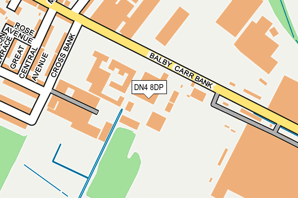
DN4 8DP is located in the Balby South electoral ward, within the metropolitan district of Doncaster and the English Parliamentary constituency of Doncaster Central. The Sub Integrated Care Board (ICB) Location is NHS South Yorkshire ICB - 02X and the police force is South Yorkshire. This postcode has been in use since October 2010.


GetTheData
Source: OS OpenMap – Local (Ordnance Survey)
Source: OS VectorMap District (Ordnance Survey)
Licence: Open Government Licence (requires attribution)
| Easting | 457094 |
| Northing | 401473 |
| Latitude | 53.506875 |
| Longitude | -1.140625 |
GetTheData
Source: Open Postcode Geo
Licence: Open Government Licence
| Country | England |
| Postcode District | DN4 |
➜ See where DN4 is on a map ➜ Where is Doncaster? | |
GetTheData
Source: Land Registry Price Paid Data
Licence: Open Government Licence
Elevation or altitude of DN4 8DP as distance above sea level:
| Metres | Feet | |
|---|---|---|
| Elevation | 10m | 33ft |
Elevation is measured from the approximate centre of the postcode, to the nearest point on an OS contour line from OS Terrain 50, which has contour spacing of ten vertical metres.
➜ How high above sea level am I? Find the elevation of your current position using your device's GPS.
GetTheData
Source: Open Postcode Elevation
Licence: Open Government Licence
| Ward | Balby South |
| Constituency | Doncaster Central |
GetTheData
Source: ONS Postcode Database
Licence: Open Government Licence
| Carr View Avenue (Balby Road) | Balby | 477m |
| Burton Avenue (Balby Road) | Balby | 500m |
| Alexandra Road (Balby Road) | Balby | 505m |
| Balby Road (Sandford Road) | Balby | 536m |
| Westfield Park (Balby Road) | Balby | 573m |
| Doncaster Station | 1.7km |
| Bentley (S Yorks) Station | 4.2km |
GetTheData
Source: NaPTAN
Licence: Open Government Licence
| Median download speed | 20.2Mbps |
| Average download speed | 38.7Mbps |
| Maximum download speed | 80.00Mbps |
| Median upload speed | 9.8Mbps |
| Average upload speed | 9.3Mbps |
| Maximum upload speed | 20.00Mbps |
GetTheData
Source: Ofcom
Licence: Ofcom Terms of Use (requires attribution)
GetTheData
Source: ONS Postcode Database
Licence: Open Government Licence


➜ Get more ratings from the Food Standards Agency
GetTheData
Source: Food Standards Agency
Licence: FSA terms & conditions
| Last Collection | |||
|---|---|---|---|
| Location | Mon-Fri | Sat | Distance |
| St Catherines Avenue | 17:15 | 11:15 | 287m |
| Balby Road P.o. | 17:00 | 11:15 | 438m |
| Florence Ave | 17:15 | 12:00 | 736m |
GetTheData
Source: Dracos
Licence: Creative Commons Attribution-ShareAlike
The below table lists the International Territorial Level (ITL) codes (formerly Nomenclature of Territorial Units for Statistics (NUTS) codes) and Local Administrative Units (LAU) codes for DN4 8DP:
| ITL 1 Code | Name |
|---|---|
| TLE | Yorkshire and The Humber |
| ITL 2 Code | Name |
| TLE3 | South Yorkshire |
| ITL 3 Code | Name |
| TLE31 | Barnsley, Doncaster and Rotherham |
| LAU 1 Code | Name |
| E08000017 | Doncaster |
GetTheData
Source: ONS Postcode Directory
Licence: Open Government Licence
The below table lists the Census Output Area (OA), Lower Layer Super Output Area (LSOA), and Middle Layer Super Output Area (MSOA) for DN4 8DP:
| Code | Name | |
|---|---|---|
| OA | E00037997 | |
| LSOA | E01007495 | Doncaster 028A |
| MSOA | E02001566 | Doncaster 028 |
GetTheData
Source: ONS Postcode Directory
Licence: Open Government Licence
| DN4 8BE | Cross Bank | 207m |
| DN4 8BL | Carr Hill | 239m |
| DN4 8BJ | Great Central Avenue | 240m |
| DN4 8AN | St Catherines Avenue | 259m |
| DN4 8BD | Coronation Road | 293m |
| DN4 8DG | Carr Hill | 298m |
| DN4 8AP | Mona Road | 302m |
| DN4 8BH | Rose Avenue | 310m |
| DN4 8AW | Scarth Avenue | 319m |
| DN4 8BP | Cookson Street | 321m |
GetTheData
Source: Open Postcode Geo; Land Registry Price Paid Data
Licence: Open Government Licence