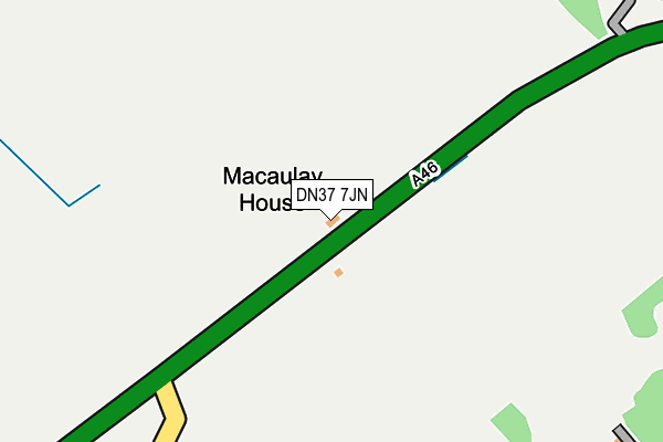
DN37 7JN is located in the Wolds electoral ward, within the unitary authority of North East Lincolnshire and the English Parliamentary constituency of Cleethorpes. The Sub Integrated Care Board (ICB) Location is NHS Humber and North Yorkshire ICB - 03H and the police force is Humberside. This postcode has been in use since January 1980.


GetTheData
Source: OS OpenMap – Local (Ordnance Survey)
Source: OS VectorMap District (Ordnance Survey)
Licence: Open Government Licence (requires attribution)
| Easting | 520325 |
| Northing | 405659 |
| Latitude | 53.533812 |
| Longitude | -0.186023 |
GetTheData
Source: Open Postcode Geo
Licence: Open Government Licence
| Country | England |
| Postcode District | DN37 |
➜ See where DN37 is on a map | |
GetTheData
Source: Land Registry Price Paid Data
Licence: Open Government Licence
Elevation or altitude of DN37 7JN as distance above sea level:
| Metres | Feet | |
|---|---|---|
| Elevation | 40m | 131ft |
Elevation is measured from the approximate centre of the postcode, to the nearest point on an OS contour line from OS Terrain 50, which has contour spacing of ten vertical metres.
➜ How high above sea level am I? Find the elevation of your current position using your device's GPS.
GetTheData
Source: Open Postcode Elevation
Licence: Open Government Licence
| Ward | Wolds |
| Constituency | Cleethorpes |
GetTheData
Source: ONS Postcode Database
Licence: Open Government Licence
| Old Main Road | Irby Upon Humber | 238m |
| Old Main Road | Irby Upon Humber | 246m |
| Grimsby Road A46 (A46) | Laceby | 506m |
| Grimsby Road A46 (A46) | Laceby | 635m |
| Caistor Road | Laceby | 1,045m |
| Great Coates Station | 6km |
GetTheData
Source: NaPTAN
Licence: Open Government Licence
| Percentage of properties with Next Generation Access | 100.0% |
| Percentage of properties with Superfast Broadband | 100.0% |
| Percentage of properties with Ultrafast Broadband | 0.0% |
| Percentage of properties with Full Fibre Broadband | 0.0% |
Superfast Broadband is between 30Mbps and 300Mbps
Ultrafast Broadband is > 300Mbps
| Percentage of properties unable to receive 2Mbps | 0.0% |
| Percentage of properties unable to receive 5Mbps | 0.0% |
| Percentage of properties unable to receive 10Mbps | 0.0% |
| Percentage of properties unable to receive 30Mbps | 0.0% |
GetTheData
Source: Ofcom
Licence: Ofcom Terms of Use (requires attribution)
GetTheData
Source: ONS Postcode Database
Licence: Open Government Licence


➜ Get more ratings from the Food Standards Agency
GetTheData
Source: Food Standards Agency
Licence: FSA terms & conditions
| Last Collection | |||
|---|---|---|---|
| Location | Mon-Fri | Sat | Distance |
| Caistor Road | 17:00 | 11:15 | 1,021m |
| Irby | 16:45 | 11:15 | 1,135m |
| Howerby Road | 17:00 | 11:15 | 1,595m |
GetTheData
Source: Dracos
Licence: Creative Commons Attribution-ShareAlike
The below table lists the International Territorial Level (ITL) codes (formerly Nomenclature of Territorial Units for Statistics (NUTS) codes) and Local Administrative Units (LAU) codes for DN37 7JN:
| ITL 1 Code | Name |
|---|---|
| TLE | Yorkshire and The Humber |
| ITL 2 Code | Name |
| TLE1 | East Yorkshire and Northern Lincolnshire |
| ITL 3 Code | Name |
| TLE13 | North and North East Lincolnshire |
| LAU 1 Code | Name |
| E06000012 | North East Lincolnshire |
GetTheData
Source: ONS Postcode Directory
Licence: Open Government Licence
The below table lists the Census Output Area (OA), Lower Layer Super Output Area (LSOA), and Middle Layer Super Output Area (MSOA) for DN37 7JN:
| Code | Name | |
|---|---|---|
| OA | E00173592 | |
| LSOA | E01013224 | North East Lincolnshire 007C |
| MSOA | E02002732 | North East Lincolnshire 007 |
GetTheData
Source: ONS Postcode Directory
Licence: Open Government Licence
| DN37 7LN | Barton Street | 424m |
| DN37 7LF | Barton Street | 479m |
| DN37 7JG | Caistor Road | 657m |
| DN37 7SW | Willow Close | 715m |
| DN37 7LL | Barton Street | 763m |
| DN37 7SU | Yews Lane | 800m |
| DN37 7ST | Elm Lane | 818m |
| DN37 7JJ | Breed Lane | 889m |
| DN37 7SS | Field Head Road | 898m |
| DN37 7JD | Caistor Road | 959m |
GetTheData
Source: Open Postcode Geo; Land Registry Price Paid Data
Licence: Open Government Licence