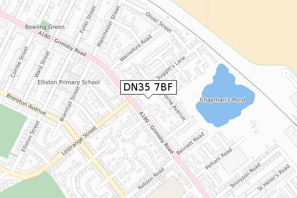
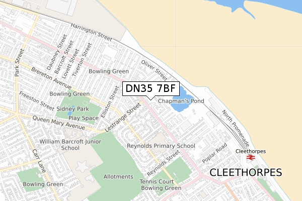
DN35 7BF is located in the Sidney Sussex electoral ward, within the unitary authority of North East Lincolnshire and the English Parliamentary constituency of Cleethorpes. The Sub Integrated Care Board (ICB) Location is NHS Humber and North Yorkshire ICB - 03H and the police force is Humberside. This postcode has been in use since September 2018.


GetTheData
Source: OS Open Zoomstack (Ordnance Survey)
Licence: Open Government Licence (requires attribution)
Attribution: Contains OS data © Crown copyright and database right 2024
Source: Open Postcode Geo
Licence: Open Government Licence (requires attribution)
Attribution: Contains OS data © Crown copyright and database right 2024; Contains Royal Mail data © Royal Mail copyright and database right 2024; Source: Office for National Statistics licensed under the Open Government Licence v.3.0
| Easting | 529769 |
| Northing | 409538 |
| Latitude | 53.566437 |
| Longitude | -0.042019 |
GetTheData
Source: Open Postcode Geo
Licence: Open Government Licence
| Country | England |
| Postcode District | DN35 |
| ➜ DN35 open data dashboard ➜ See where DN35 is on a map ➜ Where is Cleethorpes? | |
GetTheData
Source: Land Registry Price Paid Data
Licence: Open Government Licence
| Ward | Sidney Sussex |
| Constituency | Cleethorpes |
GetTheData
Source: ONS Postcode Database
Licence: Open Government Licence
| January 2024 | Violence and sexual offences | On or near Campden Crescent | 414m |
| December 2023 | Violence and sexual offences | On or near Campden Crescent | 414m |
| November 2023 | Violence and sexual offences | On or near Campden Crescent | 414m |
| ➜ Get more crime data in our Crime section | |||
GetTheData
Source: data.police.uk
Licence: Open Government Licence
| Suggitts Lane (Grimsby Road) | Cleethorpes | 12m |
| Suggitts Lane (Grimsby Road) | Cleethorpes | 80m |
| Lestrange Street (Brereton Avenue) | Cleethorpes | 245m |
| Fuller Street (Grimsby Road) | Cleethorpes | 246m |
| Pelham Road (Grimsby Road) | Cleethorpes | 266m |
| Cleethorpes Station | 1km |
| New Clee Station | 1.5km |
| Grimsby Docks Station | 2.4km |
GetTheData
Source: NaPTAN
Licence: Open Government Licence
| Percentage of properties with Next Generation Access | 100.0% |
| Percentage of properties with Superfast Broadband | 100.0% |
| Percentage of properties with Ultrafast Broadband | 66.7% |
| Percentage of properties with Full Fibre Broadband | 0.0% |
Superfast Broadband is between 30Mbps and 300Mbps
Ultrafast Broadband is > 300Mbps
| Percentage of properties unable to receive 2Mbps | 0.0% |
| Percentage of properties unable to receive 5Mbps | 0.0% |
| Percentage of properties unable to receive 10Mbps | 0.0% |
| Percentage of properties unable to receive 30Mbps | 0.0% |
GetTheData
Source: Ofcom
Licence: Ofcom Terms of Use (requires attribution)
GetTheData
Source: ONS Postcode Database
Licence: Open Government Licence


➜ Get more ratings from the Food Standards Agency
GetTheData
Source: Food Standards Agency
Licence: FSA terms & conditions
| Last Collection | |||
|---|---|---|---|
| Location | Mon-Fri | Sat | Distance |
| Suggitts Lane | 17:30 | 11:30 | 33m |
| Blundell Park P.o. | 17:30 | 12:15 | 282m |
| Robson Road | 17:30 | 11:30 | 320m |
GetTheData
Source: Dracos
Licence: Creative Commons Attribution-ShareAlike
| Facility | Distance |
|---|---|
| Reynolds Academy Machray Place, Cleethorpes Grass Pitches | 459m |
| Grimsby Town Fc (Blundell Park) Blundell Park, Cleethorpes Grass Pitches | 524m |
| Sidney Park Brereton Avenue, Cleethorpes Grass Pitches | 581m |
GetTheData
Source: Active Places
Licence: Open Government Licence
| School | Phase of Education | Distance |
|---|---|---|
| Elliston Primary Academy Elliston Street, Elliston Primary Academy, Cleethopres, DN35 7HT | Primary | 260m |
| Reynolds Primary Academy Machray Place, Cleethorpes, DN35 7LJ | Primary | 402m |
| Queen Mary Avenue Infant School Queen Mary Avenue, Cleethorpes, DN35 7SY | Primary | 661m |
GetTheData
Source: Edubase
Licence: Open Government Licence
| Risk of DN35 7BF flooding from rivers and sea | Low |
| ➜ DN35 7BF flood map | |
GetTheData
Source: Open Flood Risk by Postcode
Licence: Open Government Licence
The below table lists the International Territorial Level (ITL) codes (formerly Nomenclature of Territorial Units for Statistics (NUTS) codes) and Local Administrative Units (LAU) codes for DN35 7BF:
| ITL 1 Code | Name |
|---|---|
| TLE | Yorkshire and The Humber |
| ITL 2 Code | Name |
| TLE1 | East Yorkshire and Northern Lincolnshire |
| ITL 3 Code | Name |
| TLE13 | North and North East Lincolnshire |
| LAU 1 Code | Name |
| E06000012 | North East Lincolnshire |
GetTheData
Source: ONS Postcode Directory
Licence: Open Government Licence
The below table lists the Census Output Area (OA), Lower Layer Super Output Area (LSOA), and Middle Layer Super Output Area (MSOA) for DN35 7BF:
| Code | Name | |
|---|---|---|
| OA | E00066599 | |
| LSOA | E01013198 | North East Lincolnshire 010B |
| MSOA | E02002735 | North East Lincolnshire 010 |
GetTheData
Source: ONS Postcode Directory
Licence: Open Government Licence
| DN35 7JE | Suggitts Lane | 76m |
| DN35 7ET | Grimsby Road | 79m |
| DN35 7EU | Twyning Place | 91m |
| DN35 7ES | Grimsby Road | 103m |
| DN35 7JF | Kathleen Avenue | 117m |
| DN35 7JN | Hawthorne Avenue | 121m |
| DN35 7HF | Lestrange Street | 125m |
| DN35 7EY | Grimsby Road | 128m |
| DN35 7HG | Garnett Street | 130m |
| DN35 7HE | Grimsby Road | 130m |
GetTheData
Source: Open Postcode Geo; Land Registry Price Paid Data
Licence: Open Government Licence