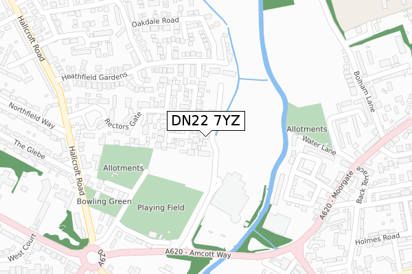
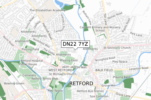
DN22 7YZ is located in the East Retford North electoral ward, within the local authority district of Bassetlaw and the English Parliamentary constituency of Bassetlaw. The Sub Integrated Care Board (ICB) Location is NHS Nottingham and Nottinghamshire ICB - 02Q and the police force is Nottinghamshire. This postcode has been in use since April 2018.


GetTheData
Source: OS Open Zoomstack (Ordnance Survey)
Licence: Open Government Licence (requires attribution)
Attribution: Contains OS data © Crown copyright and database right 2024
Source: Open Postcode Geo
Licence: Open Government Licence (requires attribution)
Attribution: Contains OS data © Crown copyright and database right 2024; Contains Royal Mail data © Royal Mail copyright and database right 2024; Source: Office for National Statistics licensed under the Open Government Licence v.3.0
| Easting | 470453 |
| Northing | 381761 |
| Latitude | 53.328107 |
| Longitude | -0.943631 |
GetTheData
Source: Open Postcode Geo
Licence: Open Government Licence
| Country | England |
| Postcode District | DN22 |
| ➜ DN22 open data dashboard ➜ See where DN22 is on a map ➜ Where is Retford? | |
GetTheData
Source: Land Registry Price Paid Data
Licence: Open Government Licence
| Ward | East Retford North |
| Constituency | Bassetlaw |
GetTheData
Source: ONS Postcode Database
Licence: Open Government Licence
23, IDLE VALLEY ROAD, RETFORD, DN22 7YZ 2021 29 OCT £595,000 |
13, IDLE VALLEY ROAD, RETFORD, DN22 7YZ 2021 29 JUN £570,000 |
21, IDLE VALLEY ROAD, RETFORD, DN22 7YZ 2021 22 JUN £587,500 |
15, IDLE VALLEY ROAD, RETFORD, DN22 7YZ 2021 26 FEB £560,000 |
17, IDLE VALLEY ROAD, RETFORD, DN22 7YZ 2021 29 JAN £570,000 |
11, IDLE VALLEY ROAD, RETFORD, DN22 7YZ 2020 14 FEB £485,000 |
3, IDLE VALLEY ROAD, RETFORD, DN22 7YZ 2019 16 APR £350,000 |
5, IDLE VALLEY ROAD, RETFORD, DN22 7YZ 2018 13 DEC £350,000 |
1, IDLE VALLEY ROAD, RETFORD, DN22 7YZ 2018 14 AUG £350,000 |
9, IDLE VALLEY ROAD, RETFORD, DN22 7YZ 2018 10 AUG £350,000 |
GetTheData
Source: HM Land Registry Price Paid Data
Licence: Contains HM Land Registry data © Crown copyright and database right 2024. This data is licensed under the Open Government Licence v3.0.
| December 2023 | Other theft | On or near Petrol Station | 342m |
| December 2023 | Other theft | On or near Petrol Station | 342m |
| November 2023 | Other theft | On or near Petrol Station | 342m |
| ➜ Get more crime data in our Crime section | |||
GetTheData
Source: data.police.uk
Licence: Open Government Licence
| Heathfield Gardens (Woodbeck Rise) | Hallcroft | 215m |
| Moorgate Park (Moorgate) | Retford | 398m |
| Moorgate Park (Moorgate) | Retford | 407m |
| Willand Court (Camborne Crescent) | Hallcroft | 424m |
| Bridgegate | Retford | 456m |
| Retford Station | 1.5km |
| Retford Low Level Station | 1.6km |
GetTheData
Source: NaPTAN
Licence: Open Government Licence
| Percentage of properties with Next Generation Access | 100.0% |
| Percentage of properties with Superfast Broadband | 100.0% |
| Percentage of properties with Ultrafast Broadband | 100.0% |
| Percentage of properties with Full Fibre Broadband | 100.0% |
Superfast Broadband is between 30Mbps and 300Mbps
Ultrafast Broadband is > 300Mbps
| Percentage of properties unable to receive 2Mbps | 0.0% |
| Percentage of properties unable to receive 5Mbps | 0.0% |
| Percentage of properties unable to receive 10Mbps | 0.0% |
| Percentage of properties unable to receive 30Mbps | 0.0% |
GetTheData
Source: Ofcom
Licence: Ofcom Terms of Use (requires attribution)
GetTheData
Source: ONS Postcode Database
Licence: Open Government Licence


➜ Get more ratings from the Food Standards Agency
GetTheData
Source: Food Standards Agency
Licence: FSA terms & conditions
| Last Collection | |||
|---|---|---|---|
| Location | Mon-Fri | Sat | Distance |
| Morrisons | 18:15 | 11:30 | 248m |
| Hallcroft Road | 17:15 | 12:00 | 456m |
| Cannon Square | 17:30 | 11:00 | 466m |
GetTheData
Source: Dracos
Licence: Creative Commons Attribution-ShareAlike
| Facility | Distance |
|---|---|
| Retford Cricket Club Cricket Field Lane, Retford Grass Pitches | 302m |
| Retford Lawn Tennis Club Hospital Road, Retford Outdoor Tennis Courts | 674m |
| Shapes Health & Fitness (Closed) Exchange Street, Retford Health and Fitness Gym, Studio | 690m |
GetTheData
Source: Active Places
Licence: Open Government Licence
| School | Phase of Education | Distance |
|---|---|---|
| Carr Hill Primary and Nursery School Tiln Lane, Retford, DN22 6SW | Primary | 582m |
| The Elizabethan Academy Hallcroft Road, Retford, DN22 7PY | Secondary | 630m |
| St Swithun's Church of England Primary Academy Grove Street, Retford, DN22 6LD | Primary | 764m |
GetTheData
Source: Edubase
Licence: Open Government Licence
| Risk of DN22 7YZ flooding from rivers and sea | Low |
| ➜ DN22 7YZ flood map | |
GetTheData
Source: Open Flood Risk by Postcode
Licence: Open Government Licence
The below table lists the International Territorial Level (ITL) codes (formerly Nomenclature of Territorial Units for Statistics (NUTS) codes) and Local Administrative Units (LAU) codes for DN22 7YZ:
| ITL 1 Code | Name |
|---|---|
| TLF | East Midlands (England) |
| ITL 2 Code | Name |
| TLF1 | Derbyshire and Nottinghamshire |
| ITL 3 Code | Name |
| TLF15 | North Nottinghamshire |
| LAU 1 Code | Name |
| E07000171 | Bassetlaw |
GetTheData
Source: ONS Postcode Directory
Licence: Open Government Licence
The below table lists the Census Output Area (OA), Lower Layer Super Output Area (LSOA), and Middle Layer Super Output Area (MSOA) for DN22 7YZ:
| Code | Name | |
|---|---|---|
| OA | E00142732 | |
| LSOA | E01028013 | Bassetlaw 005A |
| MSOA | E02005839 | Bassetlaw 005 |
GetTheData
Source: ONS Postcode Directory
Licence: Open Government Licence
| DN22 7ZD | Birchcroft Road | 130m |
| DN22 7TX | Rectors Gate | 194m |
| DN22 7GX | Oakdale Road | 256m |
| DN22 6RE | Waterfields | 261m |
| DN22 7LG | Heathfield Gardens | 270m |
| DN22 7JX | Woodbeck Rise | 272m |
| DN22 6RY | Waterfields | 274m |
| DN22 7TG | Crofters View | 325m |
| DN22 6SZ | Water Lane | 332m |
| DN22 7LB | Hallcroft Road | 339m |
GetTheData
Source: Open Postcode Geo; Land Registry Price Paid Data
Licence: Open Government Licence