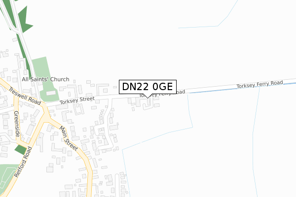
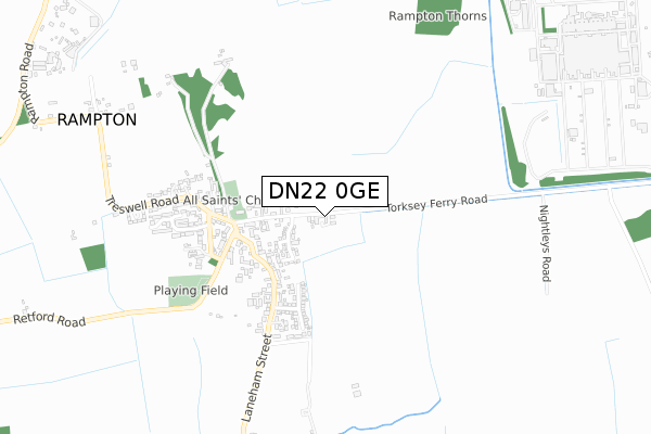
DN22 0GE is located in the Rampton electoral ward, within the local authority district of Bassetlaw and the English Parliamentary constituency of Newark. The Sub Integrated Care Board (ICB) Location is NHS Nottingham and Nottinghamshire ICB - 02Q and the police force is Nottinghamshire. This postcode has been in use since May 2018.


GetTheData
Source: OS Open Zoomstack (Ordnance Survey)
Licence: Open Government Licence (requires attribution)
Attribution: Contains OS data © Crown copyright and database right 2024
Source: Open Postcode Geo
Licence: Open Government Licence (requires attribution)
Attribution: Contains OS data © Crown copyright and database right 2024; Contains Royal Mail data © Royal Mail copyright and database right 2024; Source: Office for National Statistics licensed under the Open Government Licence v.3.0
| Easting | 480279 |
| Northing | 378561 |
| Latitude | 53.297953 |
| Longitude | -0.796940 |
GetTheData
Source: Open Postcode Geo
Licence: Open Government Licence
| Country | England |
| Postcode District | DN22 |
| ➜ DN22 open data dashboard ➜ See where DN22 is on a map ➜ Where is Rampton? | |
GetTheData
Source: Land Registry Price Paid Data
Licence: Open Government Licence
| Ward | Rampton |
| Constituency | Newark |
GetTheData
Source: ONS Postcode Database
Licence: Open Government Licence
1, EAST END COURT, RAMPTON, RETFORD, DN22 0GE 2018 16 NOV £283,000 |
3, EAST END COURT, RAMPTON, RETFORD, DN22 0GE 2018 18 MAY £290,000 |
GetTheData
Source: HM Land Registry Price Paid Data
Licence: Contains HM Land Registry data © Crown copyright and database right 2024. This data is licensed under the Open Government Licence v3.0.
| September 2023 | Other theft | On or near Petrol Station | 400m |
| June 2022 | Violence and sexual offences | On or near Petrol Station | 400m |
| May 2022 | Violence and sexual offences | On or near Petrol Station | 400m |
| ➜ Get more crime data in our Crime section | |||
GetTheData
Source: data.police.uk
Licence: Open Government Licence
| Orchard Drive (Laneham Street) | Rampton | 385m |
| Laneham Street (Retford Road) | Rampton | 385m |
| Laneham Street (Retford Road) | Rampton | 389m |
| Orchard Drive (Laneham Street) | Rampton | 395m |
| The Green (Treswell Road) | Rampton | 431m |
GetTheData
Source: NaPTAN
Licence: Open Government Licence
➜ Broadband speed and availability dashboard for DN22 0GE
| Percentage of properties with Next Generation Access | 100.0% |
| Percentage of properties with Superfast Broadband | 100.0% |
| Percentage of properties with Ultrafast Broadband | 0.0% |
| Percentage of properties with Full Fibre Broadband | 0.0% |
Superfast Broadband is between 30Mbps and 300Mbps
Ultrafast Broadband is > 300Mbps
| Median download speed | 55.0Mbps |
| Average download speed | 54.2Mbps |
| Maximum download speed | 75.86Mbps |
| Median upload speed | 10.0Mbps |
| Average upload speed | 11.8Mbps |
| Maximum upload speed | 19.41Mbps |
| Percentage of properties unable to receive 2Mbps | 0.0% |
| Percentage of properties unable to receive 5Mbps | 0.0% |
| Percentage of properties unable to receive 10Mbps | 0.0% |
| Percentage of properties unable to receive 30Mbps | 0.0% |
➜ Broadband speed and availability dashboard for DN22 0GE
GetTheData
Source: Ofcom
Licence: Ofcom Terms of Use (requires attribution)
GetTheData
Source: ONS Postcode Database
Licence: Open Government Licence


➜ Get more ratings from the Food Standards Agency
GetTheData
Source: Food Standards Agency
Licence: FSA terms & conditions
| Last Collection | |||
|---|---|---|---|
| Location | Mon-Fri | Sat | Distance |
| Rampton P.o. | 16:30 | 11:00 | 333m |
| Treswell | 17:00 | 10:45 | 2,024m |
| Church Laneham | 16:30 | 11:00 | 2,253m |
GetTheData
Source: Dracos
Licence: Creative Commons Attribution-ShareAlike
| Facility | Distance |
|---|---|
| Rampton Primary School Rampton, Retford Grass Pitches | 1.5km |
| Rampton Secure Hospital St Lukes Way, Retford Grass Pitches, Health and Fitness Gym, Sports Hall, Swimming Pool | 2.9km |
| The Orchard School South Leverton, Retford Outdoor Tennis Courts, Grass Pitches | 3.3km |
GetTheData
Source: Active Places
Licence: Open Government Licence
| School | Phase of Education | Distance |
|---|---|---|
| Rampton Primary School Retford Road, Rampton, Retford, DN22 0JB | Primary | 1.5km |
| Leverton Church of England Academy Main Street, North Leverton, Retford, DN22 0AD | Primary | 4km |
| Dunham-on-Trent CofE Primary School Laneham Road, Dunham-on-Trent, Newark, NG22 0UL | Primary | 4.2km |
GetTheData
Source: Edubase
Licence: Open Government Licence
| Risk of DN22 0GE flooding from rivers and sea | Medium |
| ➜ DN22 0GE flood map | |
GetTheData
Source: Open Flood Risk by Postcode
Licence: Open Government Licence
The below table lists the International Territorial Level (ITL) codes (formerly Nomenclature of Territorial Units for Statistics (NUTS) codes) and Local Administrative Units (LAU) codes for DN22 0GE:
| ITL 1 Code | Name |
|---|---|
| TLF | East Midlands (England) |
| ITL 2 Code | Name |
| TLF1 | Derbyshire and Nottinghamshire |
| ITL 3 Code | Name |
| TLF15 | North Nottinghamshire |
| LAU 1 Code | Name |
| E07000171 | Bassetlaw |
GetTheData
Source: ONS Postcode Directory
Licence: Open Government Licence
The below table lists the Census Output Area (OA), Lower Layer Super Output Area (LSOA), and Middle Layer Super Output Area (MSOA) for DN22 0GE:
| Code | Name | |
|---|---|---|
| OA | E00142828 | |
| LSOA | E01028033 | Bassetlaw 015C |
| MSOA | E02005849 | Bassetlaw 015 |
GetTheData
Source: ONS Postcode Directory
Licence: Open Government Licence
| DN22 0TD | The Pastures | 185m |
| DN22 0HT | Torksey Street | 205m |
| DN22 0HR | Main Street | 281m |
| DN22 0LS | Orchard Drive | 358m |
| DN22 0FG | Retford Road | 381m |
| DN22 0JX | Laneham Street | 418m |
| DN22 0LT | Golden Holme Lane | 469m |
| DN22 0HY | Greenside | 490m |
| DN22 0HU | Treswell Road | 551m |
| DN22 0JN | Greenside Avenue | 552m |
GetTheData
Source: Open Postcode Geo; Land Registry Price Paid Data
Licence: Open Government Licence