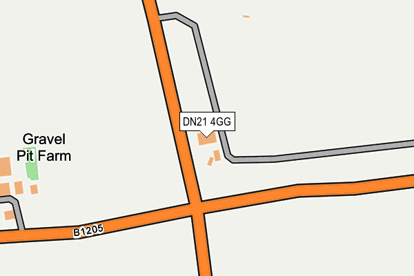
DN21 4GG is located in the Ridge electoral ward, within the unitary authority of North Lincolnshire and the English Parliamentary constituency of Scunthorpe. The Sub Integrated Care Board (ICB) Location is NHS Humber and North Yorkshire ICB - 03K and the police force is Humberside. This postcode has been in use since February 2007.


GetTheData
Source: OS OpenMap – Local (Ordnance Survey)
Source: OS VectorMap District (Ordnance Survey)
Licence: Open Government Licence (requires attribution)
| Easting | 494274 |
| Northing | 396627 |
| Latitude | 53.457968 |
| Longitude | -0.581637 |
GetTheData
Source: Open Postcode Geo
Licence: Open Government Licence
| Country | England |
| Postcode District | DN21 |
➜ See where DN21 is on a map | |
GetTheData
Source: Land Registry Price Paid Data
Licence: Open Government Licence
Elevation or altitude of DN21 4GG as distance above sea level:
| Metres | Feet | |
|---|---|---|
| Elevation | 60m | 197ft |
Elevation is measured from the approximate centre of the postcode, to the nearest point on an OS contour line from OS Terrain 50, which has contour spacing of ten vertical metres.
➜ How high above sea level am I? Find the elevation of your current position using your device's GPS.
GetTheData
Source: Open Postcode Elevation
Licence: Open Government Licence
| Ward | Ridge |
| Constituency | Scunthorpe |
GetTheData
Source: ONS Postcode Database
Licence: Open Government Licence
| Low Road (B1205) | Grayingham | 829m |
| Low Road (B1205) | Grayingham | 839m |
| School Lane (Low Road) | Grayingham | 931m |
| School Lane (Low Road) | Grayingham | 943m |
| Demand Responsive Area | Grayingham | 985m |
| Kirton Lindsey Station | 3.1km |
GetTheData
Source: NaPTAN
Licence: Open Government Licence
GetTheData
Source: ONS Postcode Database
Licence: Open Government Licence


➜ Get more ratings from the Food Standards Agency
GetTheData
Source: Food Standards Agency
Licence: FSA terms & conditions
| Last Collection | |||
|---|---|---|---|
| Location | Mon-Fri | Sat | Distance |
| Grayingham | 16:15 | 08:45 | 855m |
| Kirton Barracks | 16:30 | 11:30 | 1,214m |
| Dunstan Villas | 16:45 | 11:30 | 1,781m |
GetTheData
Source: Dracos
Licence: Creative Commons Attribution-ShareAlike
The below table lists the International Territorial Level (ITL) codes (formerly Nomenclature of Territorial Units for Statistics (NUTS) codes) and Local Administrative Units (LAU) codes for DN21 4GG:
| ITL 1 Code | Name |
|---|---|
| TLE | Yorkshire and The Humber |
| ITL 2 Code | Name |
| TLE1 | East Yorkshire and Northern Lincolnshire |
| ITL 3 Code | Name |
| TLE13 | North and North East Lincolnshire |
| LAU 1 Code | Name |
| E06000013 | North Lincolnshire |
GetTheData
Source: ONS Postcode Directory
Licence: Open Government Licence
The below table lists the Census Output Area (OA), Lower Layer Super Output Area (LSOA), and Middle Layer Super Output Area (MSOA) for DN21 4GG:
| Code | Name | |
|---|---|---|
| OA | E00172864 | |
| LSOA | E01013323 | North Lincolnshire 022B |
| MSOA | E02002770 | North Lincolnshire 022 |
GetTheData
Source: ONS Postcode Directory
Licence: Open Government Licence
| DN21 4ET | Church Lane | 813m |
| DN21 4GE | Meadow Court | 820m |
| DN21 4ES | Manor Lane | 938m |
| DN21 4ER | Low Road | 964m |
| DN21 4HX | South Cliff Road | 975m |
| DN21 4EX | Low Road | 1009m |
| DN21 4EU | School Lane | 1051m |
| DN21 4PY | Cranwell Close | 1322m |
| DN21 4PT | Bircham Crescent | 1350m |
| DN21 4EW | Grayingham Road | 1382m |
GetTheData
Source: Open Postcode Geo; Land Registry Price Paid Data
Licence: Open Government Licence