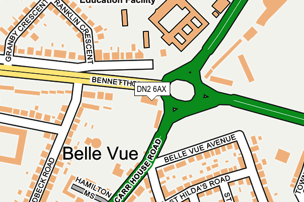
DN2 6AX is located in the Town electoral ward, within the metropolitan district of Doncaster and the English Parliamentary constituency of Doncaster Central. The Sub Integrated Care Board (ICB) Location is NHS South Yorkshire ICB - 02X and the police force is South Yorkshire. This postcode has been in use since January 1980.


GetTheData
Source: OS OpenMap – Local (Ordnance Survey)
Source: OS VectorMap District (Ordnance Survey)
Licence: Open Government Licence (requires attribution)
| Easting | 459113 |
| Northing | 402812 |
| Latitude | 53.518666 |
| Longitude | -1.109932 |
GetTheData
Source: Open Postcode Geo
Licence: Open Government Licence
| Country | England |
| Postcode District | DN2 |
➜ See where DN2 is on a map ➜ Where is Doncaster? | |
GetTheData
Source: Land Registry Price Paid Data
Licence: Open Government Licence
Elevation or altitude of DN2 6AX as distance above sea level:
| Metres | Feet | |
|---|---|---|
| Elevation | 10m | 33ft |
Elevation is measured from the approximate centre of the postcode, to the nearest point on an OS contour line from OS Terrain 50, which has contour spacing of ten vertical metres.
➜ How high above sea level am I? Find the elevation of your current position using your device's GPS.
GetTheData
Source: Open Postcode Elevation
Licence: Open Government Licence
| Ward | Town |
| Constituency | Doncaster Central |
GetTheData
Source: ONS Postcode Database
Licence: Open Government Licence
| Belle Vue Avenue (Carr House Road) | Belle Vue | 72m |
| Grand St Leger Hotel (Bennetthorpe) | Belle Vue | 72m |
| Leger Way (Bennetthorpe) | Belle Vue | 87m |
| St Helens Road (Carr House Road) | Belle Vue | 112m |
| Leger Way (Bawtry Road) | Belle Vue | 209m |
| Doncaster Station | 2km |
| Bentley (S Yorks) Station | 3.9km |
GetTheData
Source: NaPTAN
Licence: Open Government Licence
GetTheData
Source: ONS Postcode Database
Licence: Open Government Licence


➜ Get more ratings from the Food Standards Agency
GetTheData
Source: Food Standards Agency
Licence: FSA terms & conditions
| Last Collection | |||
|---|---|---|---|
| Location | Mon-Fri | Sat | Distance |
| Belle Vue Post Office | 18:30 | 12:00 | 190m |
| Manor Drive | 17:45 | 11:30 | 369m |
| Danum Road | 17:30 | 11:30 | 435m |
GetTheData
Source: Dracos
Licence: Creative Commons Attribution-ShareAlike
The below table lists the International Territorial Level (ITL) codes (formerly Nomenclature of Territorial Units for Statistics (NUTS) codes) and Local Administrative Units (LAU) codes for DN2 6AX:
| ITL 1 Code | Name |
|---|---|
| TLE | Yorkshire and The Humber |
| ITL 2 Code | Name |
| TLE3 | South Yorkshire |
| ITL 3 Code | Name |
| TLE31 | Barnsley, Doncaster and Rotherham |
| LAU 1 Code | Name |
| E08000017 | Doncaster |
GetTheData
Source: ONS Postcode Directory
Licence: Open Government Licence
The below table lists the Census Output Area (OA), Lower Layer Super Output Area (LSOA), and Middle Layer Super Output Area (MSOA) for DN2 6AX:
| Code | Name | |
|---|---|---|
| OA | E00038729 | |
| LSOA | E01007644 | Doncaster 019A |
| MSOA | E02001557 | Doncaster 019 |
GetTheData
Source: ONS Postcode Directory
Licence: Open Government Licence
| DN2 6AQ | Bennetthorpe | 107m |
| DN4 5DX | Belle Vue Avenue | 142m |
| DN2 6AH | Bennetthorpe | 172m |
| DN4 5EE | St Hildas Road | 211m |
| DN4 5DL | Hamilton Mews | 212m |
| DN4 5EU | Sandbeck Road | 219m |
| DN4 5DU | Carr House Road | 222m |
| DN4 5DY | St Annes Road | 228m |
| DN4 5EJ | St Hildas Road | 232m |
| DN4 5EX | Welbeck Road | 258m |
GetTheData
Source: Open Postcode Geo; Land Registry Price Paid Data
Licence: Open Government Licence