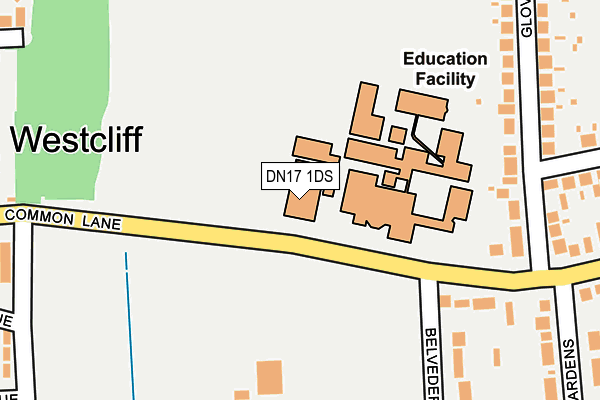
DN17 1DS is located in the Kingsway with Lincoln Gardens electoral ward, within the unitary authority of North Lincolnshire and the English Parliamentary constituency of Scunthorpe. The Sub Integrated Care Board (ICB) Location is NHS Humber and North Yorkshire ICB - 03K and the police force is Humberside. This postcode has been in use since January 1980.


GetTheData
Source: OS OpenMap – Local (Ordnance Survey)
Source: OS VectorMap District (Ordnance Survey)
Licence: Open Government Licence (requires attribution)
| Easting | 488257 |
| Northing | 409486 |
| Latitude | 53.574560 |
| Longitude | -0.668613 |
GetTheData
Source: Open Postcode Geo
Licence: Open Government Licence
| Country | England |
| Postcode District | DN17 |
➜ See where DN17 is on a map ➜ Where is Scunthorpe? | |
GetTheData
Source: Land Registry Price Paid Data
Licence: Open Government Licence
Elevation or altitude of DN17 1DS as distance above sea level:
| Metres | Feet | |
|---|---|---|
| Elevation | 40m | 131ft |
Elevation is measured from the approximate centre of the postcode, to the nearest point on an OS contour line from OS Terrain 50, which has contour spacing of ten vertical metres.
➜ How high above sea level am I? Find the elevation of your current position using your device's GPS.
GetTheData
Source: Open Postcode Elevation
Licence: Open Government Licence
| Ward | Kingsway With Lincoln Gardens |
| Constituency | Scunthorpe |
GetTheData
Source: ONS Postcode Database
Licence: Open Government Licence
| John Leggott College (West Common Lane) | Scunthorpe | 50m |
| John Leggott College (West Common Lane) | Scunthorpe | 95m |
| Peveril Avenue (Glover Road) | Scunthorpe | 237m |
| Peveril Avenue (Glover Road) | Scunthorpe | 245m |
| North Lindsey College (Glover Road) | Scunthorpe | 366m |
| Scunthorpe Station | 1.7km |
| Althorpe Station | 4.4km |
GetTheData
Source: NaPTAN
Licence: Open Government Licence
GetTheData
Source: ONS Postcode Database
Licence: Open Government Licence


➜ Get more ratings from the Food Standards Agency
GetTheData
Source: Food Standards Agency
Licence: FSA terms & conditions
| Last Collection | |||
|---|---|---|---|
| Location | Mon-Fri | Sat | Distance |
| West Common Lane | 17:30 | 12:45 | 524m |
| Lloyds Avenue | 17:45 | 12:45 | 637m |
| Westcliffe P.o. | 17:30 | 11:45 | 646m |
GetTheData
Source: Dracos
Licence: Creative Commons Attribution-ShareAlike
The below table lists the International Territorial Level (ITL) codes (formerly Nomenclature of Territorial Units for Statistics (NUTS) codes) and Local Administrative Units (LAU) codes for DN17 1DS:
| ITL 1 Code | Name |
|---|---|
| TLE | Yorkshire and The Humber |
| ITL 2 Code | Name |
| TLE1 | East Yorkshire and Northern Lincolnshire |
| ITL 3 Code | Name |
| TLE13 | North and North East Lincolnshire |
| LAU 1 Code | Name |
| E06000013 | North Lincolnshire |
GetTheData
Source: ONS Postcode Directory
Licence: Open Government Licence
The below table lists the Census Output Area (OA), Lower Layer Super Output Area (LSOA), and Middle Layer Super Output Area (MSOA) for DN17 1DS:
| Code | Name | |
|---|---|---|
| OA | E00067200 | |
| LSOA | E01013316 | North Lincolnshire 012C |
| MSOA | E02002760 | North Lincolnshire 012 |
GetTheData
Source: ONS Postcode Directory
Licence: Open Government Licence
| DN17 1DZ | Belvedere Drive | 291m |
| DN17 1AS | Glover Road | 309m |
| DN17 1AU | Glover Road | 309m |
| DN17 1NN | Herrick Road | 323m |
| DN17 1DT | Westcliff Gardens | 326m |
| DN17 1PD | West Common Lane | 360m |
| DN17 1BG | Peveril Avenue | 374m |
| DN17 1BB | Hamilton Road | 375m |
| DN17 1TF | Staniwell Rise | 379m |
| DN17 1PB | Cowper Avenue | 386m |
GetTheData
Source: Open Postcode Geo; Land Registry Price Paid Data
Licence: Open Government Licence