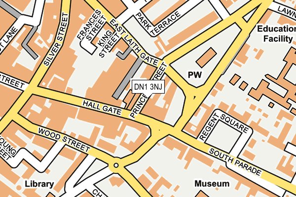
DN1 3NJ is located in the Town electoral ward, within the metropolitan district of Doncaster and the English Parliamentary constituency of Doncaster Central. The Sub Integrated Care Board (ICB) Location is NHS South Yorkshire ICB - 02X and the police force is South Yorkshire. This postcode has been in use since January 1980.


GetTheData
Source: OS OpenMap – Local (Ordnance Survey)
Source: OS VectorMap District (Ordnance Survey)
Licence: Open Government Licence (requires attribution)
| Easting | 457860 |
| Northing | 403225 |
| Latitude | 53.522517 |
| Longitude | -1.128751 |
GetTheData
Source: Open Postcode Geo
Licence: Open Government Licence
| Country | England |
| Postcode District | DN1 |
➜ See where DN1 is on a map ➜ Where is Doncaster? | |
GetTheData
Source: Land Registry Price Paid Data
Licence: Open Government Licence
Elevation or altitude of DN1 3NJ as distance above sea level:
| Metres | Feet | |
|---|---|---|
| Elevation | 20m | 66ft |
Elevation is measured from the approximate centre of the postcode, to the nearest point on an OS contour line from OS Terrain 50, which has contour spacing of ten vertical metres.
➜ How high above sea level am I? Find the elevation of your current position using your device's GPS.
GetTheData
Source: Open Postcode Elevation
Licence: Open Government Licence
| Ward | Town |
| Constituency | Doncaster Central |
GetTheData
Source: ONS Postcode Database
Licence: Open Government Licence
| Princes Street | Doncaster Town Centre | 21m |
| Princes Street (Hall Gate) | Doncaster Town Centre | 49m |
| King Street (East Laith Gate) | Doncaster Town Centre | 137m |
| Regent Square (South Parade) | Doncaster Town Centre | 156m |
| Hall Gate | Doncaster Town Centre | 162m |
| Doncaster Station | 0.7km |
| Bentley (S Yorks) Station | 2.8km |
| Kirk Sandall Station | 5.9km |
GetTheData
Source: NaPTAN
Licence: Open Government Licence
GetTheData
Source: ONS Postcode Database
Licence: Open Government Licence


➜ Get more ratings from the Food Standards Agency
GetTheData
Source: Food Standards Agency
Licence: FSA terms & conditions
| Last Collection | |||
|---|---|---|---|
| Location | Mon-Fri | Sat | Distance |
| Bradford Row | 18:30 | 11:45 | 107m |
| Hallgate | 18:30 | 11:30 | 150m |
| Hallcross | 18:15 | 11:30 | 206m |
GetTheData
Source: Dracos
Licence: Creative Commons Attribution-ShareAlike
The below table lists the International Territorial Level (ITL) codes (formerly Nomenclature of Territorial Units for Statistics (NUTS) codes) and Local Administrative Units (LAU) codes for DN1 3NJ:
| ITL 1 Code | Name |
|---|---|
| TLE | Yorkshire and The Humber |
| ITL 2 Code | Name |
| TLE3 | South Yorkshire |
| ITL 3 Code | Name |
| TLE31 | Barnsley, Doncaster and Rotherham |
| LAU 1 Code | Name |
| E08000017 | Doncaster |
GetTheData
Source: ONS Postcode Directory
Licence: Open Government Licence
The below table lists the Census Output Area (OA), Lower Layer Super Output Area (LSOA), and Middle Layer Super Output Area (MSOA) for DN1 3NJ:
| Code | Name | |
|---|---|---|
| OA | E00038726 | |
| LSOA | E01007645 | Doncaster 022E |
| MSOA | E02001560 | Doncaster 022 |
GetTheData
Source: ONS Postcode Directory
Licence: Open Government Licence
| DN1 1JE | East Laith Gate | 84m |
| DN1 3NA | Hall Gate | 99m |
| DN1 2HJ | Thorne Road | 100m |
| DN1 3NX | Hall Gate | 113m |
| DN1 1JD | East Laith Gate | 127m |
| DN1 2HS | Thorne Road | 134m |
| DN1 2HG | Thorne Road | 140m |
| DN1 2DR | South Parade | 157m |
| DN1 2AA | Chequer Road | 176m |
| DN1 2QQ | Park Terrace | 177m |
GetTheData
Source: Open Postcode Geo; Land Registry Price Paid Data
Licence: Open Government Licence