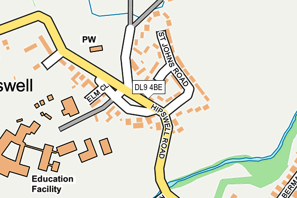
DL9 4BE is in Hipswell, Catterick Garrison. DL9 4BE is located in the Hipswell & Colburn electoral ward, within the unitary authority of North Yorkshire and the English Parliamentary constituency of Richmond (Yorks). The Sub Integrated Care Board (ICB) Location is NHS Humber and North Yorkshire ICB - 42D and the police force is North Yorkshire. This postcode has been in use since January 1980.


GetTheData
Source: OS OpenMap – Local (Ordnance Survey)
Source: OS VectorMap District (Ordnance Survey)
Licence: Open Government Licence (requires attribution)
| Easting | 418929 |
| Northing | 498151 |
| Latitude | 54.378521 |
| Longitude | -1.710097 |
GetTheData
Source: Open Postcode Geo
Licence: Open Government Licence
| Locality | Hipswell |
| Town/City | Catterick Garrison |
| Country | England |
| Postcode District | DL9 |
➜ See where DL9 is on a map ➜ Where is Catterick Garrison? | |
GetTheData
Source: Land Registry Price Paid Data
Licence: Open Government Licence
Elevation or altitude of DL9 4BE as distance above sea level:
| Metres | Feet | |
|---|---|---|
| Elevation | 120m | 394ft |
Elevation is measured from the approximate centre of the postcode, to the nearest point on an OS contour line from OS Terrain 50, which has contour spacing of ten vertical metres.
➜ How high above sea level am I? Find the elevation of your current position using your device's GPS.
GetTheData
Source: Open Postcode Elevation
Licence: Open Government Licence
| Ward | Hipswell & Colburn |
| Constituency | Richmond (Yorks) |
GetTheData
Source: ONS Postcode Database
Licence: Open Government Licence
| Hipswell Road | Hipswell | 155m |
| Hipswell Village (Hipswell Road) | Hipswell | 192m |
| Hipswell Village (Hipswell Road) | Hipswell | 193m |
| Albermarle Drive (Byng Road) | Hipswell | 231m |
| Albermarle Drive (Byng Road) | Hipswell | 232m |
GetTheData
Source: NaPTAN
Licence: Open Government Licence
| Percentage of properties with Next Generation Access | 100.0% |
| Percentage of properties with Superfast Broadband | 100.0% |
| Percentage of properties with Ultrafast Broadband | 0.0% |
| Percentage of properties with Full Fibre Broadband | 0.0% |
Superfast Broadband is between 30Mbps and 300Mbps
Ultrafast Broadband is > 300Mbps
| Percentage of properties unable to receive 2Mbps | 0.0% |
| Percentage of properties unable to receive 5Mbps | 0.0% |
| Percentage of properties unable to receive 10Mbps | 0.0% |
| Percentage of properties unable to receive 30Mbps | 0.0% |
GetTheData
Source: Ofcom
Licence: Ofcom Terms of Use (requires attribution)
GetTheData
Source: ONS Postcode Database
Licence: Open Government Licence


➜ Get more ratings from the Food Standards Agency
GetTheData
Source: Food Standards Agency
Licence: FSA terms & conditions
| Last Collection | |||
|---|---|---|---|
| Location | Mon-Fri | Sat | Distance |
| Hilyard Row, Catterick Garrison | 17:00 | 11:00 | 368m |
| Hipswell Road West, Catterick G | 16:00 | 11:00 | 570m |
| Vimy Barracks, Catterick Garris | 17:00 | 11:15 | 953m |
GetTheData
Source: Dracos
Licence: Creative Commons Attribution-ShareAlike
The below table lists the International Territorial Level (ITL) codes (formerly Nomenclature of Territorial Units for Statistics (NUTS) codes) and Local Administrative Units (LAU) codes for DL9 4BE:
| ITL 1 Code | Name |
|---|---|
| TLE | Yorkshire and The Humber |
| ITL 2 Code | Name |
| TLE2 | North Yorkshire |
| ITL 3 Code | Name |
| TLE22 | North Yorkshire CC |
| LAU 1 Code | Name |
| E07000166 | Richmondshire |
GetTheData
Source: ONS Postcode Directory
Licence: Open Government Licence
The below table lists the Census Output Area (OA), Lower Layer Super Output Area (LSOA), and Middle Layer Super Output Area (MSOA) for DL9 4BE:
| Code | Name | |
|---|---|---|
| OA | E00141346 | |
| LSOA | E01027754 | Richmondshire 004C |
| MSOA | E02005785 | Richmondshire 004 |
GetTheData
Source: ONS Postcode Directory
Licence: Open Government Licence
| DL9 4BH | Wandesford Grove | 113m |
| DL9 4BJ | St Johns Road | 113m |
| DL9 4BB | 121m | |
| DL9 4BG | 143m | |
| DL9 4BQ | St Johns Road | 147m |
| DL9 4AG | Church View | 178m |
| DL9 4DR | Byng Road | 193m |
| DL9 4DS | Westridge Crescent | 216m |
| DL9 4AZ | Hipswell Road | 223m |
| DL9 4DP | Kingfisher Drive | 240m |
GetTheData
Source: Open Postcode Geo; Land Registry Price Paid Data
Licence: Open Government Licence