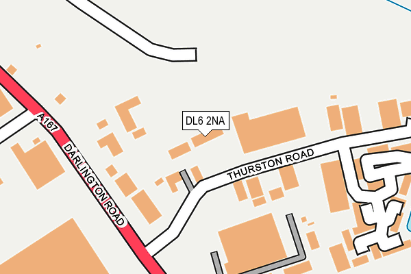
DL6 2NA is located in the Northallerton North & Brompton electoral ward, within the unitary authority of North Yorkshire and the English Parliamentary constituency of Richmond (Yorks). The Sub Integrated Care Board (ICB) Location is NHS Humber and North Yorkshire ICB - 42D and the police force is North Yorkshire. This postcode has been in use since August 2004.


GetTheData
Source: OS OpenMap – Local (Ordnance Survey)
Source: OS VectorMap District (Ordnance Survey)
Licence: Open Government Licence (requires attribution)
| Easting | 436337 |
| Northing | 495122 |
| Latitude | 54.350361 |
| Longitude | -1.442479 |
GetTheData
Source: Open Postcode Geo
Licence: Open Government Licence
| Country | England |
| Postcode District | DL6 |
➜ See where DL6 is on a map ➜ Where is Northallerton? | |
GetTheData
Source: Land Registry Price Paid Data
Licence: Open Government Licence
Elevation or altitude of DL6 2NA as distance above sea level:
| Metres | Feet | |
|---|---|---|
| Elevation | 50m | 164ft |
Elevation is measured from the approximate centre of the postcode, to the nearest point on an OS contour line from OS Terrain 50, which has contour spacing of ten vertical metres.
➜ How high above sea level am I? Find the elevation of your current position using your device's GPS.
GetTheData
Source: Open Postcode Elevation
Licence: Open Government Licence
| Ward | Northallerton North & Brompton |
| Constituency | Richmond (Yorks) |
GetTheData
Source: ONS Postcode Database
Licence: Open Government Licence
| Thurston Road (Darlington Road) | Northallerton | 131m |
| Standard Way | Northallerton | 546m |
| Stone Cross (Northallerton Road) | Northallerton | 673m |
| Stone Cross (Northallerton Road) | Northallerton | 688m |
| High Street (A167) | Northallerton | 710m |
| Northallerton Station | 1.9km |
GetTheData
Source: NaPTAN
Licence: Open Government Licence
GetTheData
Source: ONS Postcode Database
Licence: Open Government Licence


➜ Get more ratings from the Food Standards Agency
GetTheData
Source: Food Standards Agency
Licence: FSA terms & conditions
| Last Collection | |||
|---|---|---|---|
| Location | Mon-Fri | Sat | Distance |
| Thurston Road | 107m | ||
| Thurston Road | 111m | ||
| Standard Way | 506m | ||
GetTheData
Source: Dracos
Licence: Creative Commons Attribution-ShareAlike
The below table lists the International Territorial Level (ITL) codes (formerly Nomenclature of Territorial Units for Statistics (NUTS) codes) and Local Administrative Units (LAU) codes for DL6 2NA:
| ITL 1 Code | Name |
|---|---|
| TLE | Yorkshire and The Humber |
| ITL 2 Code | Name |
| TLE2 | North Yorkshire |
| ITL 3 Code | Name |
| TLE22 | North Yorkshire CC |
| LAU 1 Code | Name |
| E07000164 | Hambleton |
GetTheData
Source: ONS Postcode Directory
Licence: Open Government Licence
The below table lists the Census Output Area (OA), Lower Layer Super Output Area (LSOA), and Middle Layer Super Output Area (MSOA) for DL6 2NA:
| Code | Name | |
|---|---|---|
| OA | E00140585 | |
| LSOA | E01027611 | Hambleton 004F |
| MSOA | E02005753 | Hambleton 004 |
GetTheData
Source: ONS Postcode Directory
Licence: Open Government Licence
| DL6 2NQ | County Business Park | 205m |
| DL6 2NJ | Omega Business Village | 267m |
| DL6 2NG | Northallerton Business Park | 294m |
| DL6 2NN | Darlington Road | 311m |
| DL6 2XF | 313m | |
| DL6 2XA | Standard Way | 362m |
| DL6 2NH | Darlington Road | 366m |
| DL6 2XQ | Thornfield Business Park | 596m |
| DL6 2NP | The Bungalows | 604m |
| DL7 8WA | Ben Hyde Way | 604m |
GetTheData
Source: Open Postcode Geo; Land Registry Price Paid Data
Licence: Open Government Licence