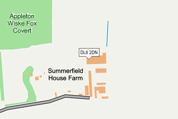
DL6 2DN is located in the Morton-on-Swale & Appleton Wiske electoral ward, within the unitary authority of North Yorkshire and the English Parliamentary constituency of Richmond (Yorks). The Sub Integrated Care Board (ICB) Location is NHS Humber and North Yorkshire ICB - 42D and the police force is North Yorkshire. This postcode has been in use since January 1980.


GetTheData
Source: OS OpenMap – Local (Ordnance Survey)
Source: OS VectorMap District (Ordnance Survey)
Licence: Open Government Licence (requires attribution)
| Easting | 438937 |
| Northing | 503178 |
| Latitude | 54.422554 |
| Longitude | -1.401419 |
GetTheData
Source: Open Postcode Geo
Licence: Open Government Licence
| Country | England |
| Postcode District | DL6 |
➜ See where DL6 is on a map | |
GetTheData
Source: Land Registry Price Paid Data
Licence: Open Government Licence
Elevation or altitude of DL6 2DN as distance above sea level:
| Metres | Feet | |
|---|---|---|
| Elevation | 70m | 230ft |
Elevation is measured from the approximate centre of the postcode, to the nearest point on an OS contour line from OS Terrain 50, which has contour spacing of ten vertical metres.
➜ How high above sea level am I? Find the elevation of your current position using your device's GPS.
GetTheData
Source: Open Postcode Elevation
Licence: Open Government Licence
| Ward | Morton-on-swale & Appleton Wiske |
| Constituency | Richmond (Yorks) |
GetTheData
Source: ONS Postcode Database
Licence: Open Government Licence
| Oak Tree Cottages (Tofts Lane) | Welbury | 1,261m |
GetTheData
Source: NaPTAN
Licence: Open Government Licence
GetTheData
Source: ONS Postcode Database
Licence: Open Government Licence


➜ Get more ratings from the Food Standards Agency
GetTheData
Source: Food Standards Agency
Licence: FSA terms & conditions
| Last Collection | |||
|---|---|---|---|
| Location | Mon-Fri | Sat | Distance |
| Welbury | 16:00 | 10:00 | 1,148m |
| North Deighton | 16:30 | 11:00 | 1,714m |
| East Harlsey | 16:15 | 11:00 | 4,833m |
GetTheData
Source: Dracos
Licence: Creative Commons Attribution-ShareAlike
The below table lists the International Territorial Level (ITL) codes (formerly Nomenclature of Territorial Units for Statistics (NUTS) codes) and Local Administrative Units (LAU) codes for DL6 2DN:
| ITL 1 Code | Name |
|---|---|
| TLE | Yorkshire and The Humber |
| ITL 2 Code | Name |
| TLE2 | North Yorkshire |
| ITL 3 Code | Name |
| TLE22 | North Yorkshire CC |
| LAU 1 Code | Name |
| E07000164 | Hambleton |
GetTheData
Source: ONS Postcode Directory
Licence: Open Government Licence
The below table lists the Census Output Area (OA), Lower Layer Super Output Area (LSOA), and Middle Layer Super Output Area (MSOA) for DL6 2DN:
| Code | Name | |
|---|---|---|
| OA | E00140604 | |
| LSOA | E01027613 | Hambleton 003C |
| MSOA | E02005752 | Hambleton 003 |
GetTheData
Source: ONS Postcode Directory
Licence: Open Government Licence
| DL6 2SL | Summerfield House Farm Cottages | 122m |
| DL6 2SR | 928m | |
| DL6 2SF | 946m | |
| DL6 2SG | 1095m | |
| DL6 2SQ | Spring Hill | 1129m |
| DL6 2SE | 1361m | |
| DL6 2SS | Shire Garth | 1398m |
| DL6 2AB | Front Street | 1431m |
| DL6 2BD | Hunters Ride | 1463m |
| DL6 2BE | The Paddock | 1466m |
GetTheData
Source: Open Postcode Geo; Land Registry Price Paid Data
Licence: Open Government Licence