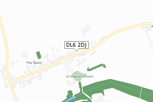
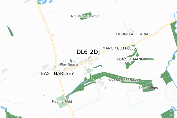
DL6 2DJ lies on The Beeches in East Harlsey, Northallerton. DL6 2DJ is located in the Hutton Rudby & Osmotherley electoral ward, within the unitary authority of North Yorkshire and the English Parliamentary constituency of Richmond (Yorks). The Sub Integrated Care Board (ICB) Location is NHS Humber and North Yorkshire ICB - 42D and the police force is North Yorkshire. This postcode has been in use since January 1993.


GetTheData
Source: OS Open Zoomstack (Ordnance Survey)
Licence: Open Government Licence (requires attribution)
Attribution: Contains OS data © Crown copyright and database right 2025
Source: Open Postcode Geo
Licence: Open Government Licence (requires attribution)
Attribution: Contains OS data © Crown copyright and database right 2025; Contains Royal Mail data © Royal Mail copyright and database right 2025; Source: Office for National Statistics licensed under the Open Government Licence v.3.0
| Easting | 442608 |
| Northing | 499913 |
| Latitude | 54.392920 |
| Longitude | -1.345314 |
GetTheData
Source: Open Postcode Geo
Licence: Open Government Licence
| Street | The Beeches |
| Locality | East Harlsey |
| Town/City | Northallerton |
| Country | England |
| Postcode District | DL6 |
➜ See where DL6 is on a map ➜ Where is East Harlsey? | |
GetTheData
Source: Land Registry Price Paid Data
Licence: Open Government Licence
Elevation or altitude of DL6 2DJ as distance above sea level:
| Metres | Feet | |
|---|---|---|
| Elevation | 110m | 361ft |
Elevation is measured from the approximate centre of the postcode, to the nearest point on an OS contour line from OS Terrain 50, which has contour spacing of ten vertical metres.
➜ How high above sea level am I? Find the elevation of your current position using your device's GPS.
GetTheData
Source: Open Postcode Elevation
Licence: Open Government Licence
| Ward | Hutton Rudby & Osmotherley |
| Constituency | Richmond (Yorks) |
GetTheData
Source: ONS Postcode Database
Licence: Open Government Licence
| Percentage of properties with Next Generation Access | 100.0% |
| Percentage of properties with Superfast Broadband | 100.0% |
| Percentage of properties with Ultrafast Broadband | 0.0% |
| Percentage of properties with Full Fibre Broadband | 0.0% |
Superfast Broadband is between 30Mbps and 300Mbps
Ultrafast Broadband is > 300Mbps
| Median download speed | 52.3Mbps |
| Average download speed | 46.8Mbps |
| Maximum download speed | 59.58Mbps |
| Median upload speed | 15.0Mbps |
| Average upload speed | 11.9Mbps |
| Maximum upload speed | 17.16Mbps |
| Percentage of properties unable to receive 2Mbps | 0.0% |
| Percentage of properties unable to receive 5Mbps | 0.0% |
| Percentage of properties unable to receive 10Mbps | 0.0% |
| Percentage of properties unable to receive 30Mbps | 0.0% |
GetTheData
Source: Ofcom
Licence: Ofcom Terms of Use (requires attribution)
Estimated total energy consumption in DL6 2DJ by fuel type, 2015.
| Consumption (kWh) | 21,725 |
|---|---|
| Meter count | 8 |
| Mean (kWh/meter) | 2,716 |
| Median (kWh/meter) | 2,527 |
GetTheData
Source: Postcode level gas estimates: 2015 (experimental)
Source: Postcode level electricity estimates: 2015 (experimental)
Licence: Open Government Licence
GetTheData
Source: ONS Postcode Database
Licence: Open Government Licence
| Last Collection | |||
|---|---|---|---|
| Location | Mon-Fri | Sat | Distance |
| East Harlsey | 16:15 | 11:00 | 268m |
| Ellerbeck | 16:30 | 11:00 | 3,230m |
| Clack Bank, Osmotherley | 16:30 | 11:00 | 3,590m |
GetTheData
Source: Dracos
Licence: Creative Commons Attribution-ShareAlike
The below table lists the International Territorial Level (ITL) codes (formerly Nomenclature of Territorial Units for Statistics (NUTS) codes) and Local Administrative Units (LAU) codes for DL6 2DJ:
| ITL 1 Code | Name |
|---|---|
| TLE | Yorkshire and The Humber |
| ITL 2 Code | Name |
| TLE2 | North Yorkshire |
| ITL 3 Code | Name |
| TLE22 | North Yorkshire CC |
| LAU 1 Code | Name |
| E07000164 | Hambleton |
GetTheData
Source: ONS Postcode Directory
Licence: Open Government Licence
The below table lists the Census Output Area (OA), Lower Layer Super Output Area (LSOA), and Middle Layer Super Output Area (MSOA) for DL6 2DJ:
| Code | Name | |
|---|---|---|
| OA | E00140598 | |
| LSOA | E01027613 | Hambleton 003C |
| MSOA | E02005752 | Hambleton 003 |
GetTheData
Source: ONS Postcode Directory
Licence: Open Government Licence
| DL6 2BP | Hall Cottages | 76m |
| DL6 2ED | Wye Carr | 112m |
| DL6 2DF | 115m | |
| DL6 2BW | 131m | |
| DL6 2DE | Hambleton Cottages | 136m |
| DL6 2DD | Carlton Cottages | 218m |
| DL6 2DB | 232m | |
| DL6 2BL | 238m | |
| DL6 2DH | 492m | |
| DL6 2DW | 504m |
GetTheData
Source: Open Postcode Geo; Land Registry Price Paid Data
Licence: Open Government Licence