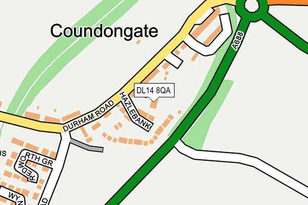
DL14 8QA lies on Potters Close in Coundon Gate, Bishop Auckland. DL14 8QA is located in the Coundon electoral ward, within the unitary authority of County Durham and the English Parliamentary constituency of Bishop Auckland. The Sub Integrated Care Board (ICB) Location is NHS North East and North Cumbria ICB - 84H and the police force is Durham. This postcode has been in use since July 2006.


GetTheData
Source: OS OpenMap – Local (Ordnance Survey)
Source: OS VectorMap District (Ordnance Survey)
Licence: Open Government Licence (requires attribution)
| Easting | 422609 |
| Northing | 529585 |
| Latitude | 54.660849 |
| Longitude | -1.651038 |
GetTheData
Source: Open Postcode Geo
Licence: Open Government Licence
| Street | Potters Close |
| Locality | Coundon Gate |
| Town/City | Bishop Auckland |
| Country | England |
| Postcode District | DL14 |
➜ See where DL14 is on a map ➜ Where is Coundongate? | |
GetTheData
Source: Land Registry Price Paid Data
Licence: Open Government Licence
Elevation or altitude of DL14 8QA as distance above sea level:
| Metres | Feet | |
|---|---|---|
| Elevation | 140m | 459ft |
Elevation is measured from the approximate centre of the postcode, to the nearest point on an OS contour line from OS Terrain 50, which has contour spacing of ten vertical metres.
➜ How high above sea level am I? Find the elevation of your current position using your device's GPS.
GetTheData
Source: Open Postcode Elevation
Licence: Open Government Licence
| Ward | Coundon |
| Constituency | Bishop Auckland |
GetTheData
Source: ONS Postcode Database
Licence: Open Government Licence
| The Sportsman (Durham Road) | Canney Hill | 85m |
| The Sportsman (Durham Road) | Canney Hill | 117m |
| Durham Road | Canney Hill | 311m |
| Clydesdale Lodge (B6287) | Coundon Gate | 321m |
| Clydesdale Lodge (B6287) | Coundon Gate | 327m |
| Bishop Auckland Station | 1.8km |
| Shildon Station | 4km |
GetTheData
Source: NaPTAN
Licence: Open Government Licence
| Percentage of properties with Next Generation Access | 100.0% |
| Percentage of properties with Superfast Broadband | 100.0% |
| Percentage of properties with Ultrafast Broadband | 0.0% |
| Percentage of properties with Full Fibre Broadband | 0.0% |
Superfast Broadband is between 30Mbps and 300Mbps
Ultrafast Broadband is > 300Mbps
| Percentage of properties unable to receive 2Mbps | 0.0% |
| Percentage of properties unable to receive 5Mbps | 0.0% |
| Percentage of properties unable to receive 10Mbps | 0.0% |
| Percentage of properties unable to receive 30Mbps | 0.0% |
GetTheData
Source: Ofcom
Licence: Ofcom Terms of Use (requires attribution)
GetTheData
Source: ONS Postcode Database
Licence: Open Government Licence


➜ Get more ratings from the Food Standards Agency
GetTheData
Source: Food Standards Agency
Licence: FSA terms & conditions
| Last Collection | |||
|---|---|---|---|
| Location | Mon-Fri | Sat | Distance |
| Coundon Gate | 16:30 | 07:45 | 112m |
| Durham Road | 17:30 | 11:00 | 556m |
| Auckland Park, Douglas Crescent | 16:00 | 11:30 | 682m |
GetTheData
Source: Dracos
Licence: Creative Commons Attribution-ShareAlike
The below table lists the International Territorial Level (ITL) codes (formerly Nomenclature of Territorial Units for Statistics (NUTS) codes) and Local Administrative Units (LAU) codes for DL14 8QA:
| ITL 1 Code | Name |
|---|---|
| TLC | North East (England) |
| ITL 2 Code | Name |
| TLC1 | Tees Valley and Durham |
| ITL 3 Code | Name |
| TLC14 | Durham |
| LAU 1 Code | Name |
| E06000047 | County Durham |
GetTheData
Source: ONS Postcode Directory
Licence: Open Government Licence
The below table lists the Census Output Area (OA), Lower Layer Super Output Area (LSOA), and Middle Layer Super Output Area (MSOA) for DL14 8QA:
| Code | Name | |
|---|---|---|
| OA | E00105949 | |
| LSOA | E01020875 | County Durham 051B |
| MSOA | E02004351 | County Durham 051 |
GetTheData
Source: ONS Postcode Directory
Licence: Open Government Licence
| DL14 8QL | Hazelbank | 31m |
| DL14 8QN | Canney Hill | 65m |
| DL14 8QJ | Grange View | 171m |
| DL14 8QH | Park Avenue | 184m |
| DL14 8QW | Durham Road | 191m |
| DL14 8QP | Redworth Grove | 272m |
| DL14 8RF | Wynyard Grove | 350m |
| DL14 8QQ | Spring Terrace | 371m |
| DL14 7GE | Neile Court | 381m |
| DL14 7GA | Walcher Gardens | 393m |
GetTheData
Source: Open Postcode Geo; Land Registry Price Paid Data
Licence: Open Government Licence