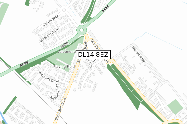
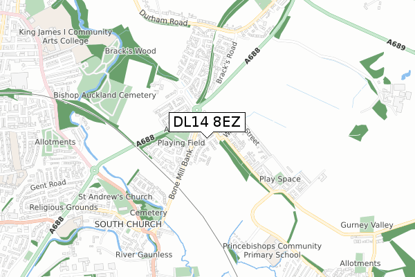
DL14 8EZ is located in the Shildon and Dene Valley electoral ward, within the unitary authority of County Durham and the English Parliamentary constituency of Bishop Auckland. The Sub Integrated Care Board (ICB) Location is NHS North East and North Cumbria ICB - 84H and the police force is Durham. This postcode has been in use since September 2019.


GetTheData
Source: OS Open Zoomstack (Ordnance Survey)
Licence: Open Government Licence (requires attribution)
Attribution: Contains OS data © Crown copyright and database right 2024
Source: Open Postcode Geo
Licence: Open Government Licence (requires attribution)
Attribution: Contains OS data © Crown copyright and database right 2024; Contains Royal Mail data © Royal Mail copyright and database right 2024; Source: Office for National Statistics licensed under the Open Government Licence v.3.0
| Easting | 422276 |
| Northing | 528872 |
| Latitude | 54.654466 |
| Longitude | -1.656265 |
GetTheData
Source: Open Postcode Geo
Licence: Open Government Licence
| Country | England |
| Postcode District | DL14 |
| ➜ DL14 open data dashboard ➜ See where DL14 is on a map ➜ Where is Bishop Auckland? | |
GetTheData
Source: Land Registry Price Paid Data
Licence: Open Government Licence
| Ward | Shildon And Dene Valley |
| Constituency | Bishop Auckland |
GetTheData
Source: ONS Postcode Database
Licence: Open Government Licence
34, MARSH WAY, AUCKLAND PARK, BISHOP AUCKLAND, DL14 8EZ 2021 26 FEB £213,495 |
8, MARSH WAY, AUCKLAND PARK, BISHOP AUCKLAND, DL14 8EZ 2020 12 MAR £199,995 |
6, MARSH WAY, AUCKLAND PARK, BISHOP AUCKLAND, DL14 8EZ 2019 28 NOV £194,995 |
16, MARSH WAY, AUCKLAND PARK, BISHOP AUCKLAND, DL14 8EZ 2019 22 NOV £205,995 |
3, MARSH WAY, AUCKLAND PARK, BISHOP AUCKLAND, DL14 8EZ 2019 21 NOV £189,995 |
10, MARSH WAY, AUCKLAND PARK, BISHOP AUCKLAND, DL14 8EZ 2019 31 OCT £189,950 |
5, MARSH WAY, AUCKLAND PARK, BISHOP AUCKLAND, DL14 8EZ 2019 27 SEP £179,950 |
1, MARSH WAY, AUCKLAND PARK, BISHOP AUCKLAND, DL14 8EZ 2019 27 SEP £214,995 |
➜ Bishop Auckland house prices
GetTheData
Source: HM Land Registry Price Paid Data
Licence: Contains HM Land Registry data © Crown copyright and database right 2024. This data is licensed under the Open Government Licence v3.0.
| July 2022 | Anti-social behaviour | On or near Kirkham Way | 244m |
| June 2022 | Violence and sexual offences | On or near Douglas Crescent | 90m |
| June 2022 | Violence and sexual offences | On or near Douglas Crescent | 90m |
| ➜ Get more crime data in our Crime section | |||
GetTheData
Source: data.police.uk
Licence: Open Government Licence
| Grange Avenue (Bone Mill Bank) | Auckland Park | 111m |
| Grange Avenue (Bone Mill Bank) | Auckland Park | 119m |
| Pilkington Way (Unclassified Road) | Auckland Park | 129m |
| Pilkington Way (Unclassified Road) | Auckland Park | 142m |
| By-pass (A688) | Auckland Park | 182m |
| Bishop Auckland Station | 1.4km |
| Shildon Station | 3.4km |
| Newton Aycliffe Station | 6.2km |
GetTheData
Source: NaPTAN
Licence: Open Government Licence
GetTheData
Source: ONS Postcode Database
Licence: Open Government Licence


➜ Get more ratings from the Food Standards Agency
GetTheData
Source: Food Standards Agency
Licence: FSA terms & conditions
| Last Collection | |||
|---|---|---|---|
| Location | Mon-Fri | Sat | Distance |
| Auckland Park, Douglas Crescent | 16:00 | 11:30 | 117m |
| South Church | 17:30 | 11:15 | 623m |
| South Church Post Office | 17:30 | 11:15 | 726m |
GetTheData
Source: Dracos
Licence: Creative Commons Attribution-ShareAlike
| Facility | Distance |
|---|---|
| Auckland Park Methodist Church Douglas Crescent, Auckland Park Sports Hall | 72m |
| Coundon Grange Recreation Ground Randolph Street, Coundon Grange Grass Pitches | 1.1km |
| King James I Academy South Church Road, Bishop Auckland Grass Pitches, Studio, Artificial Grass Pitch, Sports Hall | 1.1km |
GetTheData
Source: Active Places
Licence: Open Government Licence
| School | Phase of Education | Distance |
|---|---|---|
| Prince Bishops Community Primary School Gibson Street, Coundon Grange, Bishop Auckland, DL14 8DY | Primary | 741m |
| St Andrew's Primary School St Andrew's Road, Bishop Auckland, DL14 6RY | Primary | 933m |
| King James I Academy Bishop Auckland South Church Road, Bishop Auckland, DL14 7JZ | Secondary | 1.1km |
GetTheData
Source: Edubase
Licence: Open Government Licence
The below table lists the International Territorial Level (ITL) codes (formerly Nomenclature of Territorial Units for Statistics (NUTS) codes) and Local Administrative Units (LAU) codes for DL14 8EZ:
| ITL 1 Code | Name |
|---|---|
| TLC | North East (England) |
| ITL 2 Code | Name |
| TLC1 | Tees Valley and Durham |
| ITL 3 Code | Name |
| TLC14 | Durham |
| LAU 1 Code | Name |
| E06000047 | County Durham |
GetTheData
Source: ONS Postcode Directory
Licence: Open Government Licence
The below table lists the Census Output Area (OA), Lower Layer Super Output Area (LSOA), and Middle Layer Super Output Area (MSOA) for DL14 8EZ:
| Code | Name | |
|---|---|---|
| OA | E00105988 | |
| LSOA | E01020881 | County Durham 055E |
| MSOA | E02004352 | County Durham 055 |
GetTheData
Source: ONS Postcode Directory
Licence: Open Government Licence
| DL14 8RD | Grange Avenue | 113m |
| DL14 8RG | Douglas Crescent | 120m |
| DL14 8YN | Pilkington Way | 150m |
| DL14 8RB | Grange Avenue | 153m |
| DL14 8SF | Maltby Close | 191m |
| DL14 8YW | Morton Close | 265m |
| DL14 8SG | Westcott Drive | 272m |
| DL14 8SQ | Kirkham Way | 277m |
| DL14 8YP | Talbot Court | 280m |
| DL14 8RJ | William Street | 285m |
GetTheData
Source: Open Postcode Geo; Land Registry Price Paid Data
Licence: Open Government Licence