Coundon Grange Recreation Ground
Coundon Grange Recreation Ground is located in Coundon Grange (DL14).
| Address | COUNDON GRANGE RECREATION GROUND, Randolph Street, Coundon Grange, DL14 8XH |
| Management Type | Local Authority (in house) |
| Management Group | Local Authority |
| Owner Type | Local Authority |
| Owner Group | Local Authority |
| Education Phase | Not applicable |
Facilities
| Accessibility | Free Public Access |
| Management Type | Local Authority (in house) |
| Year Built | 1918 |
| Changing Rooms | No |
| Date Record Checked | 23rd Aug 2022 |
| Opening Times | Dawn To Dusk |
Facility specifics
Contact
Where is Coundon Grange Recreation Ground?
| Sub Building Name | |
| Building Name | COUNDON GRANGE RECREATION GROUND |
| Building Number | 0 |
| Dependent Thoroughfare | |
| Thoroughfare Name | RANDOLPH STREET |
| Double Dependent Locality | |
| Dependent Locality | |
| PostTown | COUNDON GRANGE |
| Postcode | DL14 8XH |
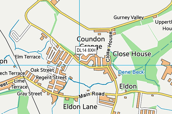
Coundon Grange Recreation Ground on a map

Coundon Grange Recreation Ground geodata
| Easting | 422960.67 |
| Northing | 527985.48 |
| Latitude | 54.646459 |
| Longitude | -1.645712 |
| Local Authority Name | County Durham |
| Local Authority Code | E06000047 |
| Parliamentary Constituency Name | Bishop Auckland |
| Parliamentary Constituency Code | E14000569 |
| Region Name | North East |
| Region Code | E15000001 |
| Ward Name | Shildon and Dene Valley |
| Ward Code | E05009080 |
| Output Area Code | E00105990 |
About this data
This data is open data sourced from Active Places Power and licenced under the Active Places Open Data Licence.
| toid | osgb1000000074258764 |
| Created On | 22nd Aug 2007 |
| Audited On | 23rd Aug 2022 |
| Checked On | 23rd Aug 2022 |
