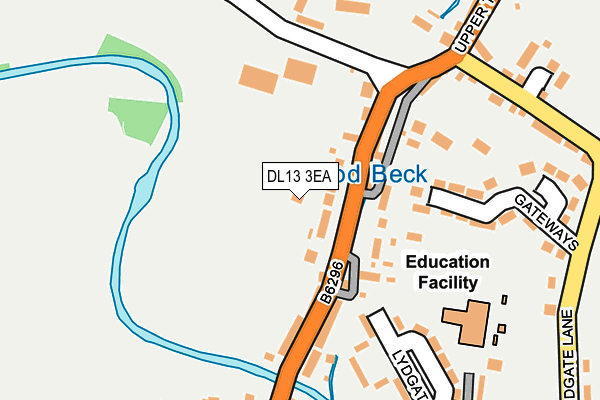
DL13 3EA is located in the Weardale electoral ward, within the unitary authority of County Durham and the English Parliamentary constituency of North West Durham. The Sub Integrated Care Board (ICB) Location is NHS North East and North Cumbria ICB - 84H and the police force is Durham. This postcode has been in use since October 2014.


GetTheData
Source: OS OpenMap – Local (Ordnance Survey)
Source: OS VectorMap District (Ordnance Survey)
Licence: Open Government Licence (requires attribution)
| Easting | 407688 |
| Northing | 537657 |
| Latitude | 54.733842 |
| Longitude | -1.882139 |
GetTheData
Source: Open Postcode Geo
Licence: Open Government Licence
| Country | England |
| Postcode District | DL13 |
➜ See where DL13 is on a map ➜ Where is Wolsingham? | |
GetTheData
Source: Land Registry Price Paid Data
Licence: Open Government Licence
Elevation or altitude of DL13 3EA as distance above sea level:
| Metres | Feet | |
|---|---|---|
| Elevation | 150m | 492ft |
Elevation is measured from the approximate centre of the postcode, to the nearest point on an OS contour line from OS Terrain 50, which has contour spacing of ten vertical metres.
➜ How high above sea level am I? Find the elevation of your current position using your device's GPS.
GetTheData
Source: Open Postcode Elevation
Licence: Open Government Licence
| Ward | Weardale |
| Constituency | North West Durham |
GetTheData
Source: ONS Postcode Database
Licence: Open Government Licence
1, CHAPEL WALLS, WOLSINGHAM, BISHOP AUCKLAND, DL13 3EA 2021 17 SEP £580,000 |
GetTheData
Source: HM Land Registry Price Paid Data
Licence: Contains HM Land Registry data © Crown copyright and database right 2025. This data is licensed under the Open Government Licence v3.0.
| Upper Town (B6296 Upper Town) | Wolsingham | 82m |
| Upper Town (B6296 Upper Town) | Wolsingham | 83m |
| Market Place (B6296) | Wolsingham | 418m |
| Market Place (A689 Front Street) | Wolsingham | 428m |
| Market Place (A689 Front Street) | Wolsingham | 449m |
| Wolsingham Station | 0.8km |
GetTheData
Source: NaPTAN
Licence: Open Government Licence
| Percentage of properties with Next Generation Access | 100.0% |
| Percentage of properties with Superfast Broadband | 100.0% |
| Percentage of properties with Ultrafast Broadband | 0.0% |
| Percentage of properties with Full Fibre Broadband | 0.0% |
Superfast Broadband is between 30Mbps and 300Mbps
Ultrafast Broadband is > 300Mbps
| Percentage of properties unable to receive 2Mbps | 0.0% |
| Percentage of properties unable to receive 5Mbps | 0.0% |
| Percentage of properties unable to receive 10Mbps | 0.0% |
| Percentage of properties unable to receive 30Mbps | 0.0% |
GetTheData
Source: Ofcom
Licence: Ofcom Terms of Use (requires attribution)
GetTheData
Source: ONS Postcode Database
Licence: Open Government Licence


➜ Get more ratings from the Food Standards Agency
GetTheData
Source: Food Standards Agency
Licence: FSA terms & conditions
| Last Collection | |||
|---|---|---|---|
| Location | Mon-Fri | Sat | Distance |
| Upper Town | 16:30 | 10:00 | 132m |
| Lydgate | 16:00 | 10:30 | 381m |
| Wolsingham Post Office | 17:00 | 11:30 | 408m |
GetTheData
Source: Dracos
Licence: Creative Commons Attribution-ShareAlike
The below table lists the International Territorial Level (ITL) codes (formerly Nomenclature of Territorial Units for Statistics (NUTS) codes) and Local Administrative Units (LAU) codes for DL13 3EA:
| ITL 1 Code | Name |
|---|---|
| TLC | North East (England) |
| ITL 2 Code | Name |
| TLC1 | Tees Valley and Durham |
| ITL 3 Code | Name |
| TLC14 | Durham |
| LAU 1 Code | Name |
| E06000047 | County Durham |
GetTheData
Source: ONS Postcode Directory
Licence: Open Government Licence
The below table lists the Census Output Area (OA), Lower Layer Super Output Area (LSOA), and Middle Layer Super Output Area (MSOA) for DL13 3EA:
| Code | Name | |
|---|---|---|
| OA | E00106109 | |
| LSOA | E01020905 | County Durham 042D |
| MSOA | E02004348 | County Durham 042 |
GetTheData
Source: ONS Postcode Directory
Licence: Open Government Licence
| DL13 3ES | Uppertown | 32m |
| DL13 3ET | Uppertown | 92m |
| DL13 3DB | Convent Gardens | 181m |
| DL13 3HW | Gateways | 189m |
| DL13 3ER | Cooperative Terrace | 192m |
| DL13 3DG | St Annes Drive | 216m |
| DL13 3EP | Angate Square | 218m |
| DL13 3LJ | Lydgate Avenue | 245m |
| DL13 3EY | Grosvenor Terrace | 254m |
| DL13 3EL | Meadhope Street | 271m |
GetTheData
Source: Open Postcode Geo; Land Registry Price Paid Data
Licence: Open Government Licence