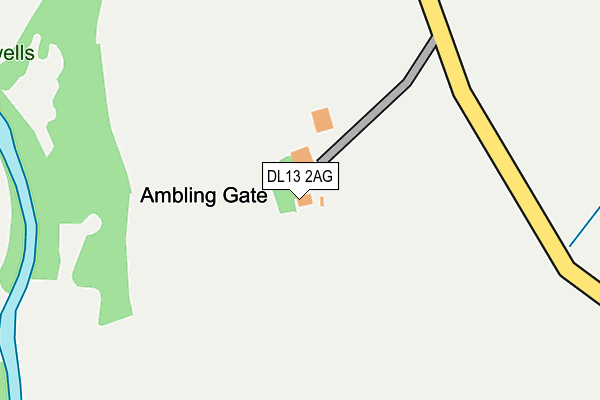
DL13 2AG is located in the Weardale electoral ward, within the unitary authority of County Durham and the English Parliamentary constituency of North West Durham. The Sub Integrated Care Board (ICB) Location is NHS North East and North Cumbria ICB - 84H and the police force is Durham. This postcode has been in use since January 1980.


GetTheData
Source: OS OpenMap – Local (Ordnance Survey)
Source: OS VectorMap District (Ordnance Survey)
Licence: Open Government Licence (requires attribution)
| Easting | 394987 |
| Northing | 540615 |
| Latitude | 54.760447 |
| Longitude | -2.079423 |
GetTheData
Source: Open Postcode Geo
Licence: Open Government Licence
| Country | England |
| Postcode District | DL13 |
➜ See where DL13 is on a map | |
GetTheData
Source: Land Registry Price Paid Data
Licence: Open Government Licence
Elevation or altitude of DL13 2AG as distance above sea level:
| Metres | Feet | |
|---|---|---|
| Elevation | 350m | 1,148ft |
Elevation is measured from the approximate centre of the postcode, to the nearest point on an OS contour line from OS Terrain 50, which has contour spacing of ten vertical metres.
➜ How high above sea level am I? Find the elevation of your current position using your device's GPS.
GetTheData
Source: Open Postcode Elevation
Licence: Open Government Licence
| Ward | Weardale |
| Constituency | North West Durham |
GetTheData
Source: ONS Postcode Database
Licence: Open Government Licence
| Dents Gate (Unclassified Road Eastgate To Rookhope) | Eastgate | 895m |
| Dents Gate (Unclassified Road Eastgate To Rookhope) | Eastgate | 901m |
| Lane End (Unclassified Road Eastgate To Rookhope) | Rookhope | 1,133m |
| Lane End (Unclassified Road Eastgate-rookhope) | Rookhope | 1,134m |
| Bog (Unclassified Road Eastgate-rookhope) | Rookhope | 1,483m |
| Stanhope Station | 5.3km |
GetTheData
Source: NaPTAN
Licence: Open Government Licence
GetTheData
Source: ONS Postcode Database
Licence: Open Government Licence

➜ Get more ratings from the Food Standards Agency
GetTheData
Source: Food Standards Agency
Licence: FSA terms & conditions
| Last Collection | |||
|---|---|---|---|
| Location | Mon-Fri | Sat | Distance |
| Stotsfield Burn | 16:00 | 10:15 | 1,843m |
| Eastgate | 16:30 | 11:00 | 1,900m |
| Rookhope | 16:00 | 10:15 | 2,526m |
GetTheData
Source: Dracos
Licence: Creative Commons Attribution-ShareAlike
The below table lists the International Territorial Level (ITL) codes (formerly Nomenclature of Territorial Units for Statistics (NUTS) codes) and Local Administrative Units (LAU) codes for DL13 2AG:
| ITL 1 Code | Name |
|---|---|
| TLC | North East (England) |
| ITL 2 Code | Name |
| TLC1 | Tees Valley and Durham |
| ITL 3 Code | Name |
| TLC14 | Durham |
| LAU 1 Code | Name |
| E06000047 | County Durham |
GetTheData
Source: ONS Postcode Directory
Licence: Open Government Licence
The below table lists the Census Output Area (OA), Lower Layer Super Output Area (LSOA), and Middle Layer Super Output Area (MSOA) for DL13 2AG:
| Code | Name | |
|---|---|---|
| OA | E00106034 | |
| LSOA | E01020891 | County Durham 042C |
| MSOA | E02004348 | County Durham 042 |
GetTheData
Source: ONS Postcode Directory
Licence: Open Government Licence
| DL13 2AB | 720m | |
| DL13 2AF | 852m | |
| DL13 2HX | 921m | |
| DL13 2HY | 1149m | |
| DL13 2HU | 1753m | |
| DL13 2HJ | Cragside Cottages | 1755m |
| DL13 2HS | 1850m | |
| DL13 2HN | Crag Villas | 1880m |
| DL13 2HW | 1884m | |
| DL13 2HR | 1908m |
GetTheData
Source: Open Postcode Geo; Land Registry Price Paid Data
Licence: Open Government Licence