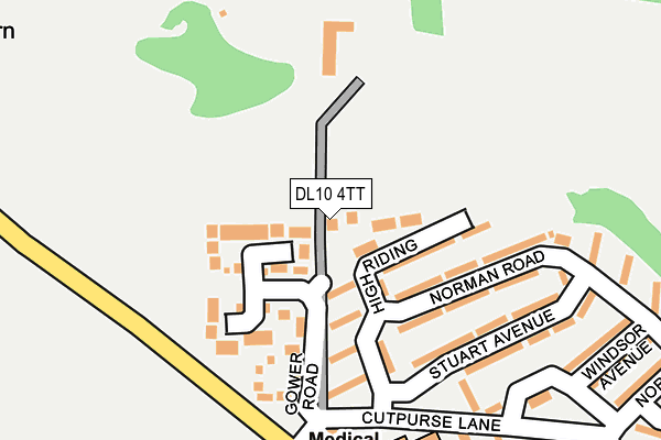
DL10 4TT lies on Magnolia Drive in Richmond. DL10 4TT is located in the Richmond electoral ward, within the unitary authority of North Yorkshire and the English Parliamentary constituency of Richmond (Yorks). The Sub Integrated Care Board (ICB) Location is NHS Humber and North Yorkshire ICB - 42D and the police force is North Yorkshire. This postcode has been in use since December 2001.


GetTheData
Source: OS OpenMap – Local (Ordnance Survey)
Source: OS VectorMap District (Ordnance Survey)
Licence: Open Government Licence (requires attribution)
| Easting | 417396 |
| Northing | 502034 |
| Latitude | 54.413471 |
| Longitude | -1.733471 |
GetTheData
Source: Open Postcode Geo
Licence: Open Government Licence
| Street | Magnolia Drive |
| Town/City | Richmond |
| Country | England |
| Postcode District | DL10 |
➜ See where DL10 is on a map ➜ Where is Richmond? | |
GetTheData
Source: Land Registry Price Paid Data
Licence: Open Government Licence
Elevation or altitude of DL10 4TT as distance above sea level:
| Metres | Feet | |
|---|---|---|
| Elevation | 210m | 689ft |
Elevation is measured from the approximate centre of the postcode, to the nearest point on an OS contour line from OS Terrain 50, which has contour spacing of ten vertical metres.
➜ How high above sea level am I? Find the elevation of your current position using your device's GPS.
GetTheData
Source: Open Postcode Elevation
Licence: Open Government Licence
| Ward | Richmond |
| Constituency | Richmond (Yorks) |
GetTheData
Source: ONS Postcode Database
Licence: Open Government Licence
2, MAGNOLIA DRIVE, RICHMOND, DL10 4TT 2016 6 MAY £305,000 |
1, MAGNOLIA DRIVE, RICHMOND, DL10 4TT 2001 21 MAY £35,000 |
GetTheData
Source: HM Land Registry Price Paid Data
Licence: Contains HM Land Registry data © Crown copyright and database right 2025. This data is licensed under the Open Government Licence v3.0.
| Norman Road | Hurgill | 156m |
| Cutpurse Estate (High Riding) | Hurgill | 165m |
| Cutpurse Green (Cutpurse Lane) | Hurgill | 195m |
| Norman Square | Hurgill | 334m |
| Conan Drive | Hurgill | 430m |
GetTheData
Source: NaPTAN
Licence: Open Government Licence
| Percentage of properties with Next Generation Access | 100.0% |
| Percentage of properties with Superfast Broadband | 100.0% |
| Percentage of properties with Ultrafast Broadband | 0.0% |
| Percentage of properties with Full Fibre Broadband | 0.0% |
Superfast Broadband is between 30Mbps and 300Mbps
Ultrafast Broadband is > 300Mbps
| Percentage of properties unable to receive 2Mbps | 0.0% |
| Percentage of properties unable to receive 5Mbps | 0.0% |
| Percentage of properties unable to receive 10Mbps | 0.0% |
| Percentage of properties unable to receive 30Mbps | 0.0% |
GetTheData
Source: Ofcom
Licence: Ofcom Terms of Use (requires attribution)
GetTheData
Source: ONS Postcode Database
Licence: Open Government Licence


➜ Get more ratings from the Food Standards Agency
GetTheData
Source: Food Standards Agency
Licence: FSA terms & conditions
| Last Collection | |||
|---|---|---|---|
| Location | Mon-Fri | Sat | Distance |
| Cutpurse Lane | 17:00 | 11:15 | 241m |
| Beechfield Road | 17:00 | 11:15 | 421m |
| Alma Place | 17:30 | 11:15 | 546m |
GetTheData
Source: Dracos
Licence: Creative Commons Attribution-ShareAlike
The below table lists the International Territorial Level (ITL) codes (formerly Nomenclature of Territorial Units for Statistics (NUTS) codes) and Local Administrative Units (LAU) codes for DL10 4TT:
| ITL 1 Code | Name |
|---|---|
| TLE | Yorkshire and The Humber |
| ITL 2 Code | Name |
| TLE2 | North Yorkshire |
| ITL 3 Code | Name |
| TLE22 | North Yorkshire CC |
| LAU 1 Code | Name |
| E07000166 | Richmondshire |
GetTheData
Source: ONS Postcode Directory
Licence: Open Government Licence
The below table lists the Census Output Area (OA), Lower Layer Super Output Area (LSOA), and Middle Layer Super Output Area (MSOA) for DL10 4TT:
| Code | Name | |
|---|---|---|
| OA | E00141402 | |
| LSOA | E01027765 | Richmondshire 002A |
| MSOA | E02005783 | Richmondshire 002 |
GetTheData
Source: ONS Postcode Directory
Licence: Open Government Licence
| DL10 4NX | High Riding | 80m |
| DL10 4TZ | Gower Road | 97m |
| DL10 4TY | Tate Road | 167m |
| DL10 4PG | Stuart Avenue | 179m |
| DL10 4PA | Norman Road | 185m |
| DL10 4NU | Chestnut Close | 203m |
| DL10 4PF | Cutpurse Lane | 226m |
| DL10 4UB | Seagram Crescent | 266m |
| DL10 4YY | Bolton Way | 267m |
| DL10 4YZ | Gillingwood Close | 273m |
GetTheData
Source: Open Postcode Geo; Land Registry Price Paid Data
Licence: Open Government Licence