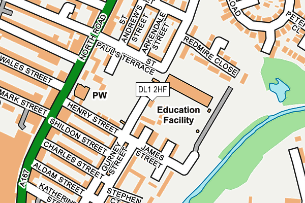
DL1 2HF lies on Pendleton Road South in Darlington. DL1 2HF is located in the North Road electoral ward, within the unitary authority of Darlington and the English Parliamentary constituency of Darlington. The Sub Integrated Care Board (ICB) Location is NHS North East and North Cumbria ICB - 16C and the police force is Durham. This postcode has been in use since January 1980.


GetTheData
Source: OS OpenMap – Local (Ordnance Survey)
Source: OS VectorMap District (Ordnance Survey)
Licence: Open Government Licence (requires attribution)
| Easting | 429303 |
| Northing | 516080 |
| Latitude | 54.539144 |
| Longitude | -1.548616 |
GetTheData
Source: Open Postcode Geo
Licence: Open Government Licence
| Street | Pendleton Road South |
| Town/City | Darlington |
| Country | England |
| Postcode District | DL1 |
➜ See where DL1 is on a map ➜ Where is Darlington? | |
GetTheData
Source: Land Registry Price Paid Data
Licence: Open Government Licence
Elevation or altitude of DL1 2HF as distance above sea level:
| Metres | Feet | |
|---|---|---|
| Elevation | 50m | 164ft |
Elevation is measured from the approximate centre of the postcode, to the nearest point on an OS contour line from OS Terrain 50, which has contour spacing of ten vertical metres.
➜ How high above sea level am I? Find the elevation of your current position using your device's GPS.
GetTheData
Source: Open Postcode Elevation
Licence: Open Government Licence
| Ward | North Road |
| Constituency | Darlington |
GetTheData
Source: ONS Postcode Database
Licence: Open Government Licence
| Gurney Street (Henry Street) | North Road | 103m |
| Westmoreland Street (North Road) | North Road | 158m |
| Westmoreland Street (North Road) | North Road | 169m |
| Charles Street (Gurney Street) | North Road | 192m |
| North Road (Westmoreland Street) | North Road | 205m |
| North Road Station | 0.5km |
| Darlington Station | 2.1km |
GetTheData
Source: NaPTAN
Licence: Open Government Licence
| Percentage of properties with Next Generation Access | 100.0% |
| Percentage of properties with Superfast Broadband | 100.0% |
| Percentage of properties with Ultrafast Broadband | 100.0% |
| Percentage of properties with Full Fibre Broadband | 0.0% |
Superfast Broadband is between 30Mbps and 300Mbps
Ultrafast Broadband is > 300Mbps
| Percentage of properties unable to receive 2Mbps | 0.0% |
| Percentage of properties unable to receive 5Mbps | 0.0% |
| Percentage of properties unable to receive 10Mbps | 0.0% |
| Percentage of properties unable to receive 30Mbps | 0.0% |
GetTheData
Source: Ofcom
Licence: Ofcom Terms of Use (requires attribution)
GetTheData
Source: ONS Postcode Database
Licence: Open Government Licence


➜ Get more ratings from the Food Standards Agency
GetTheData
Source: Food Standards Agency
Licence: FSA terms & conditions
| Last Collection | |||
|---|---|---|---|
| Location | Mon-Fri | Sat | Distance |
| Zetland Street | 17:30 | 10:45 | 237m |
| Albert Road P.o. | 17:30 | 12:15 | 348m |
| Morrisons, North Road | 17:30 | 11:45 | 362m |
GetTheData
Source: Dracos
Licence: Creative Commons Attribution-ShareAlike
The below table lists the International Territorial Level (ITL) codes (formerly Nomenclature of Territorial Units for Statistics (NUTS) codes) and Local Administrative Units (LAU) codes for DL1 2HF:
| ITL 1 Code | Name |
|---|---|
| TLC | North East (England) |
| ITL 2 Code | Name |
| TLC1 | Tees Valley and Durham |
| ITL 3 Code | Name |
| TLC13 | Darlington |
| LAU 1 Code | Name |
| E06000005 | Darlington |
GetTheData
Source: ONS Postcode Directory
Licence: Open Government Licence
The below table lists the Census Output Area (OA), Lower Layer Super Output Area (LSOA), and Middle Layer Super Output Area (MSOA) for DL1 2HF:
| Code | Name | |
|---|---|---|
| OA | E00062301 | |
| LSOA | E01012350 | Darlington 004B |
| MSOA | E02002562 | Darlington 004 |
GetTheData
Source: ONS Postcode Directory
Licence: Open Government Licence
| DL1 2HH | Close Street | 67m |
| DL1 2HE | St Pauls Terrace | 96m |
| DL1 2HJ | Grass Street | 104m |
| DL1 2JL | James Street | 113m |
| DL1 2HN | Gurney Street | 114m |
| DL1 2HG | Henry Street | 120m |
| DL1 2HB | Arkendale Street | 127m |
| DL1 2HA | Pendleton Road South | 132m |
| DL1 2GL | Redmire Close | 161m |
| DL1 2HW | Gurney Street | 162m |
GetTheData
Source: Open Postcode Geo; Land Registry Price Paid Data
Licence: Open Government Licence