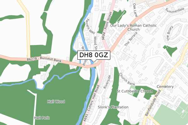
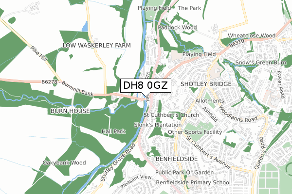
DH8 0GZ is located in the Benfieldside electoral ward, within the unitary authority of County Durham and the English Parliamentary constituency of North West Durham. The Sub Integrated Care Board (ICB) Location is NHS North East and North Cumbria ICB - 84H and the police force is Durham. This postcode has been in use since March 2019.


GetTheData
Source: OS Open Zoomstack (Ordnance Survey)
Licence: Open Government Licence (requires attribution)
Attribution: Contains OS data © Crown copyright and database right 2024
Source: Open Postcode Geo
Licence: Open Government Licence (requires attribution)
Attribution: Contains OS data © Crown copyright and database right 2024; Contains Royal Mail data © Royal Mail copyright and database right 2024; Source: Office for National Statistics licensed under the Open Government Licence v.3.0
| Easting | 409089 |
| Northing | 552760 |
| Latitude | 54.869540 |
| Longitude | -1.859915 |
GetTheData
Source: Open Postcode Geo
Licence: Open Government Licence
| Country | England |
| Postcode District | DH8 |
| ➜ DH8 open data dashboard ➜ See where DH8 is on a map ➜ Where is Consett? | |
GetTheData
Source: Land Registry Price Paid Data
Licence: Open Government Licence
| Ward | Benfieldside |
| Constituency | North West Durham |
GetTheData
Source: ONS Postcode Database
Licence: Open Government Licence
| June 2022 | Violence and sexual offences | On or near The Crescent | 254m |
| June 2022 | Anti-social behaviour | On or near Briary Gardens | 374m |
| May 2022 | Anti-social behaviour | On or near The Crescent | 254m |
| ➜ Get more crime data in our Crime section | |||
GetTheData
Source: data.police.uk
Licence: Open Government Licence
| Kings Head (A691 - Cutlers Hall Road) | Shotley Bridge | 44m |
| Derwent Dene Lodge (B6278) | Shotley Bridge | 49m |
| Derwent Dene Lodge (B6278) | Shotley Bridge | 56m |
| Kings Head (A691 - Cutlers Hall Road) | Shotley Bridge | 67m |
| Catholic Church (Snows Green Road) | Shotley Bridge | 171m |
GetTheData
Source: NaPTAN
Licence: Open Government Licence
| Percentage of properties with Next Generation Access | 100.0% |
| Percentage of properties with Superfast Broadband | 100.0% |
| Percentage of properties with Ultrafast Broadband | 0.0% |
| Percentage of properties with Full Fibre Broadband | 0.0% |
Superfast Broadband is between 30Mbps and 300Mbps
Ultrafast Broadband is > 300Mbps
| Percentage of properties unable to receive 2Mbps | 0.0% |
| Percentage of properties unable to receive 5Mbps | 0.0% |
| Percentage of properties unable to receive 10Mbps | 0.0% |
| Percentage of properties unable to receive 30Mbps | 0.0% |
GetTheData
Source: Ofcom
Licence: Ofcom Terms of Use (requires attribution)
GetTheData
Source: ONS Postcode Database
Licence: Open Government Licence


➜ Get more ratings from the Food Standards Agency
GetTheData
Source: Food Standards Agency
Licence: FSA terms & conditions
| Last Collection | |||
|---|---|---|---|
| Location | Mon-Fri | Sat | Distance |
| Shotley Bridge Post Office | 16:00 | 12:00 | 117m |
| St Cuthberts, Benfieldside Road | 16:15 | 12:00 | 400m |
| Snows Greenroad | 16:00 | 12:00 | 785m |
GetTheData
Source: Dracos
Licence: Creative Commons Attribution-ShareAlike
| Facility | Distance |
|---|---|
| Shotley And Benfieldside Tennis Club Benfield Close, Consett Outdoor Tennis Courts, Indoor Tennis Centre | 542m |
| Shotley Bridge Cricket Club The Spa Gardens, Consett Grass Pitches | 693m |
| Benfieldside Primary School Moorlands, Consett Grass Pitches | 858m |
GetTheData
Source: Active Places
Licence: Open Government Licence
| School | Phase of Education | Distance |
|---|---|---|
| Shotley Bridge Primary School Benfieldside Road, Shotley Bridge, Consett, DH8 0SQ | Primary | 647m |
| Benfieldside Primary School Moorlands, Blackhill, Consett, DH8 0JX | Primary | 878m |
| St Mary's Catholic Primary School, Blackhill Pemberton Road, Blackhill, Consett, DH8 8JD | Primary | 1.3km |
GetTheData
Source: Edubase
Licence: Open Government Licence
| Risk of DH8 0GZ flooding from rivers and sea | Medium |
| ➜ DH8 0GZ flood map | |
GetTheData
Source: Open Flood Risk by Postcode
Licence: Open Government Licence
The below table lists the International Territorial Level (ITL) codes (formerly Nomenclature of Territorial Units for Statistics (NUTS) codes) and Local Administrative Units (LAU) codes for DH8 0GZ:
| ITL 1 Code | Name |
|---|---|
| TLC | North East (England) |
| ITL 2 Code | Name |
| TLC1 | Tees Valley and Durham |
| ITL 3 Code | Name |
| TLC14 | Durham |
| LAU 1 Code | Name |
| E06000047 | County Durham |
GetTheData
Source: ONS Postcode Directory
Licence: Open Government Licence
The below table lists the Census Output Area (OA), Lower Layer Super Output Area (LSOA), and Middle Layer Super Output Area (MSOA) for DH8 0GZ:
| Code | Name | |
|---|---|---|
| OA | E00104665 | |
| LSOA | E01020628 | County Durham 003B |
| MSOA | E02004298 | County Durham 003 |
GetTheData
Source: ONS Postcode Directory
Licence: Open Government Licence
| DH8 0HJ | Messenger Mews | 52m |
| DH8 0LZ | Swordmakers Terrace | 62m |
| DH8 0LD | Swordsmiths Lane | 90m |
| DH8 0HT | Messenger Bank | 92m |
| DH8 9TB | Bridge Island | 94m |
| DH8 0HH | Front Street | 102m |
| DH8 0NP | Church Bank | 105m |
| DH8 0HY | Riverside | 114m |
| DH8 0JE | Wood Street | 131m |
| DH8 0NE | Farriers Way | 132m |
GetTheData
Source: Open Postcode Geo; Land Registry Price Paid Data
Licence: Open Government Licence