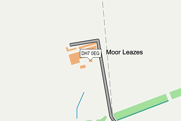
DH7 0EG is located in the Lanchester electoral ward, within the unitary authority of County Durham and the English Parliamentary constituency of North West Durham. The Sub Integrated Care Board (ICB) Location is NHS North East and North Cumbria ICB - 84H and the police force is Durham. This postcode has been in use since January 1980.


GetTheData
Source: OS OpenMap – Local (Ordnance Survey)
Source: OS VectorMap District (Ordnance Survey)
Licence: Open Government Licence (requires attribution)
| Easting | 417524 |
| Northing | 548233 |
| Latitude | 54.828630 |
| Longitude | -1.728747 |
GetTheData
Source: Open Postcode Geo
Licence: Open Government Licence
| Country | England |
| Postcode District | DH7 |
➜ See where DH7 is on a map | |
GetTheData
Source: Land Registry Price Paid Data
Licence: Open Government Licence
Elevation or altitude of DH7 0EG as distance above sea level:
| Metres | Feet | |
|---|---|---|
| Elevation | 210m | 689ft |
Elevation is measured from the approximate centre of the postcode, to the nearest point on an OS contour line from OS Terrain 50, which has contour spacing of ten vertical metres.
➜ How high above sea level am I? Find the elevation of your current position using your device's GPS.
GetTheData
Source: Open Postcode Elevation
Licence: Open Government Licence
| Ward | Lanchester |
| Constituency | North West Durham |
GetTheData
Source: ONS Postcode Database
Licence: Open Government Licence
| Care Homes (Howden Bank) | Maiden Law | 872m |
| Holmside Lane End (Edge Lane) | Burnhope | 889m |
| Holmside Lane End (Edge Lane) | Burnhope | 894m |
| Hospital (A6076) | Maiden Law | 966m |
| Hospital (A6076) | Maiden Law | 967m |
GetTheData
Source: NaPTAN
Licence: Open Government Licence
GetTheData
Source: ONS Postcode Database
Licence: Open Government Licence


➜ Get more ratings from the Food Standards Agency
GetTheData
Source: Food Standards Agency
Licence: FSA terms & conditions
| Last Collection | |||
|---|---|---|---|
| Location | Mon-Fri | Sat | Distance |
| Deneside, Lanchester | 16:30 | 07:15 | 1,118m |
| Durham Road, Lanchester | 16:30 | 09:30 | 1,206m |
| Ford Road, Lanchester | 16:00 | 09:45 | 1,461m |
GetTheData
Source: Dracos
Licence: Creative Commons Attribution-ShareAlike
The below table lists the International Territorial Level (ITL) codes (formerly Nomenclature of Territorial Units for Statistics (NUTS) codes) and Local Administrative Units (LAU) codes for DH7 0EG:
| ITL 1 Code | Name |
|---|---|
| TLC | North East (England) |
| ITL 2 Code | Name |
| TLC1 | Tees Valley and Durham |
| ITL 3 Code | Name |
| TLC14 | Durham |
| LAU 1 Code | Name |
| E06000047 | County Durham |
GetTheData
Source: ONS Postcode Directory
Licence: Open Government Licence
The below table lists the Census Output Area (OA), Lower Layer Super Output Area (LSOA), and Middle Layer Super Output Area (MSOA) for DH7 0EG:
| Code | Name | |
|---|---|---|
| OA | E00104856 | |
| LSOA | E01020664 | County Durham 020B |
| MSOA | E02004306 | County Durham 020 |
GetTheData
Source: ONS Postcode Directory
Licence: Open Government Licence
| DH7 0NQ | Peth Bank | 788m |
| DH7 0NJ | Deanery View | 852m |
| DH7 0QR | Howden Bank | 908m |
| DH7 0QL | Ornsby Hill | 918m |
| DH7 0QW | Howden Bank | 921m |
| DH7 0NH | Deanery View | 958m |
| DH7 0ND | Burnhopeside Avenue | 965m |
| DH7 0LG | 981m | |
| DH7 0QJ | Crow Hall | 1007m |
| DH7 0NB | Holmside Avenue | 1017m |
GetTheData
Source: Open Postcode Geo; Land Registry Price Paid Data
Licence: Open Government Licence