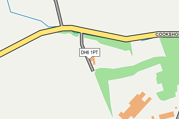
DH6 1PT is located in the Sherburn electoral ward, within the unitary authority of County Durham and the English Parliamentary constituency of City of Durham. The Sub Integrated Care Board (ICB) Location is NHS North East and North Cumbria ICB - 84H and the police force is Durham. This postcode has been in use since January 1980.


GetTheData
Source: OS OpenMap – Local (Ordnance Survey)
Source: OS VectorMap District (Ordnance Survey)
Licence: Open Government Licence (requires attribution)
| Easting | 433405 |
| Northing | 542783 |
| Latitude | 54.778862 |
| Longitude | -1.482191 |
GetTheData
Source: Open Postcode Geo
Licence: Open Government Licence
| Country | England |
| Postcode District | DH6 |
➜ See where DH6 is on a map | |
GetTheData
Source: Land Registry Price Paid Data
Licence: Open Government Licence
Elevation or altitude of DH6 1PT as distance above sea level:
| Metres | Feet | |
|---|---|---|
| Elevation | 100m | 328ft |
Elevation is measured from the approximate centre of the postcode, to the nearest point on an OS contour line from OS Terrain 50, which has contour spacing of ten vertical metres.
➜ How high above sea level am I? Find the elevation of your current position using your device's GPS.
GetTheData
Source: Open Postcode Elevation
Licence: Open Government Licence
| Ward | Sherburn |
| Constituency | City Of Durham |
GetTheData
Source: ONS Postcode Database
Licence: Open Government Licence
| Jubilee Crescent (Littletown Lane) | Sherburn Hill | 572m |
| Jubilee Crescent (Littletown Lane) | Sherburn Hill | 626m |
| Aged Miners Homes (B1283 Local Avenue) | Sherburn Hill | 635m |
| Moor Edge (Front Street) | Sherburn Hill | 653m |
| Aged Miners Homes (B1283 Local Avenue) | Sherburn Hill | 661m |
GetTheData
Source: NaPTAN
Licence: Open Government Licence
GetTheData
Source: ONS Postcode Database
Licence: Open Government Licence

➜ Get more ratings from the Food Standards Agency
GetTheData
Source: Food Standards Agency
Licence: FSA terms & conditions
| Last Collection | |||
|---|---|---|---|
| Location | Mon-Fri | Sat | Distance |
| East View, Sherburn Hill | 16:30 | 09:45 | 519m |
| Front Street | 16:00 | 10:30 | 687m |
| Littletown | 16:00 | 10:30 | 903m |
GetTheData
Source: Dracos
Licence: Creative Commons Attribution-ShareAlike
The below table lists the International Territorial Level (ITL) codes (formerly Nomenclature of Territorial Units for Statistics (NUTS) codes) and Local Administrative Units (LAU) codes for DH6 1PT:
| ITL 1 Code | Name |
|---|---|
| TLC | North East (England) |
| ITL 2 Code | Name |
| TLC1 | Tees Valley and Durham |
| ITL 3 Code | Name |
| TLC14 | Durham |
| LAU 1 Code | Name |
| E06000047 | County Durham |
GetTheData
Source: ONS Postcode Directory
Licence: Open Government Licence
The below table lists the Census Output Area (OA), Lower Layer Super Output Area (LSOA), and Middle Layer Super Output Area (MSOA) for DH6 1PT:
| Code | Name | |
|---|---|---|
| OA | E00105199 | |
| LSOA | E01020731 | County Durham 027F |
| MSOA | E02004311 | County Durham 027 |
GetTheData
Source: ONS Postcode Directory
Licence: Open Government Licence
| DH6 1PP | Kell Crescent | 377m |
| DH6 1PN | North View | 514m |
| DH6 1PW | South View | 530m |
| DH6 1PH | Jubilee Crescent | 551m |
| DH6 1HG | Local Avenue | 589m |
| DH6 1HH | West View | 593m |
| DH6 1PL | East View | 593m |
| DH6 1HJ | Bannerman Terrace | 596m |
| DH6 1PU | Littletown Lane | 617m |
| DH6 1HQ | Local Avenue | 633m |
GetTheData
Source: Open Postcode Geo; Land Registry Price Paid Data
Licence: Open Government Licence