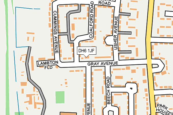
DH6 1JF is located in the Sherburn electoral ward, within the unitary authority of County Durham and the English Parliamentary constituency of City of Durham. The Sub Integrated Care Board (ICB) Location is NHS North East and North Cumbria ICB - 84H and the police force is Durham. This postcode has been in use since January 1980.


GetTheData
Source: OS OpenMap – Local (Ordnance Survey)
Source: OS VectorMap District (Ordnance Survey)
Licence: Open Government Licence (requires attribution)
| Easting | 431692 |
| Northing | 542730 |
| Latitude | 54.778486 |
| Longitude | -1.508815 |
GetTheData
Source: Open Postcode Geo
Licence: Open Government Licence
| Country | England |
| Postcode District | DH6 |
➜ See where DH6 is on a map ➜ Where is Sherburn? | |
GetTheData
Source: Land Registry Price Paid Data
Licence: Open Government Licence
Elevation or altitude of DH6 1JF as distance above sea level:
| Metres | Feet | |
|---|---|---|
| Elevation | 80m | 262ft |
Elevation is measured from the approximate centre of the postcode, to the nearest point on an OS contour line from OS Terrain 50, which has contour spacing of ten vertical metres.
➜ How high above sea level am I? Find the elevation of your current position using your device's GPS.
GetTheData
Source: Open Postcode Elevation
Licence: Open Government Licence
| Ward | Sherburn |
| Constituency | City Of Durham |
GetTheData
Source: ONS Postcode Database
Licence: Open Government Licence
| Gray Avenue | Sherburn | 18m |
| Gray Avenue | Sherburn | 40m |
| Park House (Gray Avenue) | Sherburn | 154m |
| Park House (Park House Gardens) | Sherburn | 210m |
| Park House (Park House Gardens) | Sherburn | 227m |
| Durham Station | 4.7km |
GetTheData
Source: NaPTAN
Licence: Open Government Licence
GetTheData
Source: ONS Postcode Database
Licence: Open Government Licence

➜ Get more ratings from the Food Standards Agency
GetTheData
Source: Food Standards Agency
Licence: FSA terms & conditions
| Last Collection | |||
|---|---|---|---|
| Location | Mon-Fri | Sat | Distance |
| Gray Avenue, Sherburn | 17:30 | 10:00 | 109m |
| Sherburn Post Office | 17:30 | 12:00 | 440m |
| Cornwall Walk | 17:15 | 11:30 | 1,032m |
GetTheData
Source: Dracos
Licence: Creative Commons Attribution-ShareAlike
The below table lists the International Territorial Level (ITL) codes (formerly Nomenclature of Territorial Units for Statistics (NUTS) codes) and Local Administrative Units (LAU) codes for DH6 1JF:
| ITL 1 Code | Name |
|---|---|
| TLC | North East (England) |
| ITL 2 Code | Name |
| TLC1 | Tees Valley and Durham |
| ITL 3 Code | Name |
| TLC14 | Durham |
| LAU 1 Code | Name |
| E06000047 | County Durham |
GetTheData
Source: ONS Postcode Directory
Licence: Open Government Licence
The below table lists the Census Output Area (OA), Lower Layer Super Output Area (LSOA), and Middle Layer Super Output Area (MSOA) for DH6 1JF:
| Code | Name | |
|---|---|---|
| OA | E00105203 | |
| LSOA | E01020730 | County Durham 027E |
| MSOA | E02004311 | County Durham 027 |
GetTheData
Source: ONS Postcode Directory
Licence: Open Government Licence
| DH6 1JE | Gray Avenue | 51m |
| DH6 1JL | Coalford Road | 56m |
| DH6 1JN | Attlee Square | 93m |
| DH6 1JB | Beech Road | 116m |
| DH6 1JG | Usher Avenue | 135m |
| DH6 1JW | Cummings Avenue | 157m |
| DH6 1NX | Lambton Field | 160m |
| DH6 1JR | Kidd Avenue | 170m |
| DH6 1JH | Dowsey Road | 181m |
| DH6 1JP | Kidd Avenue | 187m |
GetTheData
Source: Open Postcode Geo; Land Registry Price Paid Data
Licence: Open Government Licence