DH5 8EA maps, stats, and open data
DH5 8EA lies on Seaham Road in Houghton Le Spring. DH5 8EA is located in the Copt Hill electoral ward, within the metropolitan district of Sunderland and the English Parliamentary constituency of Houghton and Sunderland South. The Sub Integrated Care Board (ICB) Location is NHS North East and North Cumbria ICB - 00P and the police force is Northumbria. This postcode has been in use since January 1980.
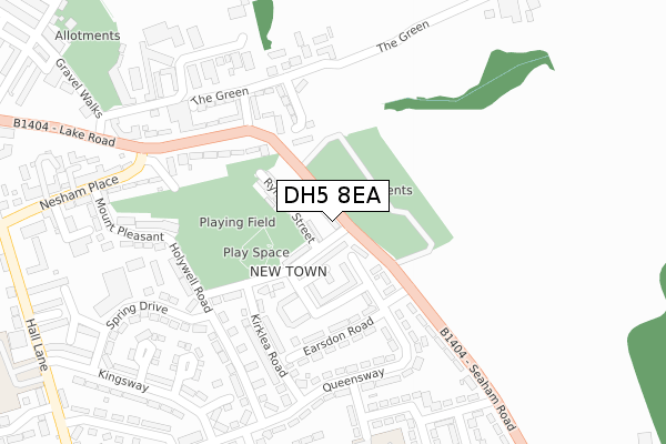
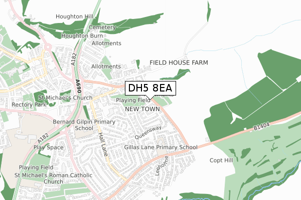
DH5 8EA maps


Licence: Open Government Licence (requires attribution)
Attribution: Contains OS data © Crown copyright and database right 2025
Source: Open Postcode Geo
Licence: Open Government Licence (requires attribution)
Attribution: Contains OS data © Crown copyright and database right 2025; Contains Royal Mail data © Royal Mail copyright and database right 2025; Source: Office for National Statistics licensed under the Open Government Licence v.3.0
DH5 8EA geodata
| Easting | 434897 |
| Northing | 549827 |
| Latitude | 54.842049 |
| Longitude | -1.458138 |
Where is DH5 8EA?
| Street | Seaham Road |
| Town/City | Houghton Le Spring |
| Country | England |
| Postcode District | DH5 |
DH5 8EA Elevation
Elevation or altitude of DH5 8EA as distance above sea level:
| Metres | Feet | |
|---|---|---|
| Elevation | 90m | 295ft |
Elevation is measured from the approximate centre of the postcode, to the nearest point on an OS contour line from OS Terrain 50, which has contour spacing of ten vertical metres.
➜ How high above sea level am I? Find the elevation of your current position using your device's GPS.
Politics
| Ward | Copt Hill |
|---|---|
| Constituency | Houghton And Sunderland South |
Transport
Nearest bus stops to DH5 8EA
| Hall Lane Estate (Seaham Road) | Houghton-le-spring | 43m |
| Seaham Road-market Place (Seaham Road) | Houghton-le-spring | 109m |
| Hall Lane Estate (Seaham Road) | Houghton-le-spring | 133m |
| Seaham Road-market Place (Seaham Road) | Houghton-le-spring | 145m |
| Hall Lane Estate (Queensway) | Houghton-le-spring | 172m |
Broadband
Broadband access in DH5 8EA (2020 data)
| Percentage of properties with Next Generation Access | 100.0% |
| Percentage of properties with Superfast Broadband | 100.0% |
| Percentage of properties with Ultrafast Broadband | 0.0% |
| Percentage of properties with Full Fibre Broadband | 0.0% |
Superfast Broadband is between 30Mbps and 300Mbps
Ultrafast Broadband is > 300Mbps
Broadband speed in DH5 8EA (2019 data)
Download
| Median download speed | 12.7Mbps |
| Average download speed | 25.7Mbps |
| Maximum download speed | 62.03Mbps |
Upload
| Median upload speed | 1.2Mbps |
| Average upload speed | 5.2Mbps |
| Maximum upload speed | 12.47Mbps |
Broadband limitations in DH5 8EA (2020 data)
| Percentage of properties unable to receive 2Mbps | 0.0% |
| Percentage of properties unable to receive 5Mbps | 0.0% |
| Percentage of properties unable to receive 10Mbps | 0.0% |
| Percentage of properties unable to receive 30Mbps | 0.0% |
DH5 8EA gas and electricity consumption
Estimated total energy consumption in DH5 8EA by fuel type, 2015.
Gas
| Consumption (kWh) | 175,718 |
|---|---|
| Meter count | 12 |
| Mean (kWh/meter) | 14,643 |
| Median (kWh/meter) | 13,385 |
Electricity
| Consumption (kWh) | 36,267 |
|---|---|
| Meter count | 13 |
| Mean (kWh/meter) | 2,790 |
| Median (kWh/meter) | 2,538 |
- Consumption: The estimated total energy consumption, in kWh, across all meters in DH5 8EA, for 2015.
- Meter count: The total number of meters in DH5 8EA.
- Mean: The mean average consumption per meter, in kWh.
- Median: The median average consumption per meter, in kWh.
Source: Postcode level electricity estimates: 2015 (experimental)
Licence: Open Government Licence
Deprivation
93.6% of English postcodes are less deprived than DH5 8EA:Food Standards Agency
Three nearest food hygiene ratings to DH5 8EA (metres)


➜ Get more ratings from the Food Standards Agency
Nearest post box to DH5 8EA
| Last Collection | |||
|---|---|---|---|
| Location | Mon-Fri | Sat | Distance |
| Hetton Road Hetton Le Hole | 17:15 | 12:15 | 1,191m |
| Dunelm Drive | 17:30 | 12:15 | 1,530m |
| Humbledon Park | 17:00 | 11:30 | 1,714m |
DH5 8EA ITL and DH5 8EA LAU
The below table lists the International Territorial Level (ITL) codes (formerly Nomenclature of Territorial Units for Statistics (NUTS) codes) and Local Administrative Units (LAU) codes for DH5 8EA:
| ITL 1 Code | Name |
|---|---|
| TLC | North East (England) |
| ITL 2 Code | Name |
| TLC2 | Northumberland, and Tyne and Wear |
| ITL 3 Code | Name |
| TLC23 | Sunderland |
| LAU 1 Code | Name |
| E08000024 | Sunderland |
DH5 8EA census areas
The below table lists the Census Output Area (OA), Lower Layer Super Output Area (LSOA), and Middle Layer Super Output Area (MSOA) for DH5 8EA:
| Code | Name | |
|---|---|---|
| OA | E00044244 | |
| LSOA | E01008714 | Sunderland 034A |
| MSOA | E02001824 | Sunderland 034 |
Nearest postcodes to DH5 8EA
| DH5 8DU | John Street | 69m |
| DH5 8DY | Aged Miners Homes | 103m |
| DH5 8ER | Earsdon Road | 160m |
| DH5 8DX | John Street | 178m |
| DH5 8EB | Seaham Road | 203m |
| DH5 8AL | The Green | 212m |
| DH5 8EW | Queensway | 221m |
| DH5 8DP | Kirklea Road | 230m |
| DH5 8AH | Market Place | 236m |
| DH5 8EP | Queensway | 242m |