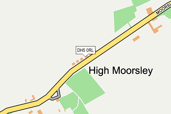
DH5 0RL lies on Valley View in Hetton Le Hole, Houghton Le Spring. DH5 0RL is located in the Hetton electoral ward, within the metropolitan district of Sunderland and the English Parliamentary constituency of Houghton and Sunderland South. The Sub Integrated Care Board (ICB) Location is NHS North East and North Cumbria ICB - 00P and the police force is Northumbria. This postcode has been in use since January 1980.


GetTheData
Source: OS OpenMap – Local (Ordnance Survey)
Source: OS VectorMap District (Ordnance Survey)
Licence: Open Government Licence (requires attribution)
| Easting | 433835 |
| Northing | 546006 |
| Latitude | 54.807786 |
| Longitude | -1.475119 |
GetTheData
Source: Open Postcode Geo
Licence: Open Government Licence
| Street | Valley View |
| Locality | Hetton Le Hole |
| Town/City | Houghton Le Spring |
| Country | England |
| Postcode District | DH5 |
➜ See where DH5 is on a map ➜ Where is Hetton-le-Hole? | |
GetTheData
Source: Land Registry Price Paid Data
Licence: Open Government Licence
Elevation or altitude of DH5 0RL as distance above sea level:
| Metres | Feet | |
|---|---|---|
| Elevation | 130m | 427ft |
Elevation is measured from the approximate centre of the postcode, to the nearest point on an OS contour line from OS Terrain 50, which has contour spacing of ten vertical metres.
➜ How high above sea level am I? Find the elevation of your current position using your device's GPS.
GetTheData
Source: Open Postcode Elevation
Licence: Open Government Licence
| Ward | Hetton |
| Constituency | Houghton And Sunderland South |
GetTheData
Source: ONS Postcode Database
Licence: Open Government Licence
| Moorsley Road-valley View (Moorsley Road) | Low Moorsley | 28m |
| Moorsley Road-valley View (Moorsley Road) | Low Moorsley | 66m |
| Moorsley Road - York Street (Front Street) | Low Moorsley | 426m |
| Moorsley Road - York Street (Front Street) | Low Moorsley | 427m |
| York Street | Low Moorsley | 494m |
GetTheData
Source: NaPTAN
Licence: Open Government Licence
| Percentage of properties with Next Generation Access | 100.0% |
| Percentage of properties with Superfast Broadband | 0.0% |
| Percentage of properties with Ultrafast Broadband | 0.0% |
| Percentage of properties with Full Fibre Broadband | 0.0% |
Superfast Broadband is between 30Mbps and 300Mbps
Ultrafast Broadband is > 300Mbps
| Median download speed | 21.4Mbps |
| Average download speed | 20.1Mbps |
| Maximum download speed | 56.98Mbps |
| Median upload speed | 1.2Mbps |
| Average upload speed | 3.5Mbps |
| Maximum upload speed | 16.46Mbps |
| Percentage of properties unable to receive 2Mbps | 0.0% |
| Percentage of properties unable to receive 5Mbps | 0.0% |
| Percentage of properties unable to receive 10Mbps | 0.0% |
| Percentage of properties unable to receive 30Mbps | 100.0% |
GetTheData
Source: Ofcom
Licence: Ofcom Terms of Use (requires attribution)
Estimated total energy consumption in DH5 0RL by fuel type, 2015.
| Consumption (kWh) | 114,779 |
|---|---|
| Meter count | 12 |
| Mean (kWh/meter) | 9,565 |
| Median (kWh/meter) | 8,273 |
| Consumption (kWh) | 22,414 |
|---|---|
| Meter count | 12 |
| Mean (kWh/meter) | 1,868 |
| Median (kWh/meter) | 1,837 |
GetTheData
Source: Postcode level gas estimates: 2015 (experimental)
Source: Postcode level electricity estimates: 2015 (experimental)
Licence: Open Government Licence
GetTheData
Source: ONS Postcode Database
Licence: Open Government Licence


➜ Get more ratings from the Food Standards Agency
GetTheData
Source: Food Standards Agency
Licence: FSA terms & conditions
| Last Collection | |||
|---|---|---|---|
| Location | Mon-Fri | Sat | Distance |
| High Moorsley, Hetton Le Hole | 16:00 | 11:45 | 60m |
| Low Pittington | 16:45 | 09:45 | 1,642m |
| Pittington Post Office | 17:00 | 12:00 | 1,913m |
GetTheData
Source: Dracos
Licence: Creative Commons Attribution-ShareAlike
The below table lists the International Territorial Level (ITL) codes (formerly Nomenclature of Territorial Units for Statistics (NUTS) codes) and Local Administrative Units (LAU) codes for DH5 0RL:
| ITL 1 Code | Name |
|---|---|
| TLC | North East (England) |
| ITL 2 Code | Name |
| TLC2 | Northumberland, and Tyne and Wear |
| ITL 3 Code | Name |
| TLC23 | Sunderland |
| LAU 1 Code | Name |
| E08000024 | Sunderland |
GetTheData
Source: ONS Postcode Directory
Licence: Open Government Licence
The below table lists the Census Output Area (OA), Lower Layer Super Output Area (LSOA), and Middle Layer Super Output Area (MSOA) for DH5 0RL:
| Code | Name | |
|---|---|---|
| OA | E00044416 | |
| LSOA | E01008744 | Sunderland 036B |
| MSOA | E02001826 | Sunderland 036 |
GetTheData
Source: ONS Postcode Directory
Licence: Open Government Licence
| DH5 0RJ | 180m | |
| DH5 0EA | Rosedale Street | 612m |
| DH5 0ED | Moorsley Road | 687m |
| DH5 0DZ | Weardale Street | 711m |
| DH5 0DY | Swaledale Close | 753m |
| DH5 0DU | Tynedale Street | 786m |
| DH5 9RQ | 878m | |
| DH5 0DT | Ennerdale Street | 920m |
| DH5 0DS | Kirkdale Street | 949m |
| DH5 0DR | Moorsley Road | 950m |
GetTheData
Source: Open Postcode Geo; Land Registry Price Paid Data
Licence: Open Government Licence