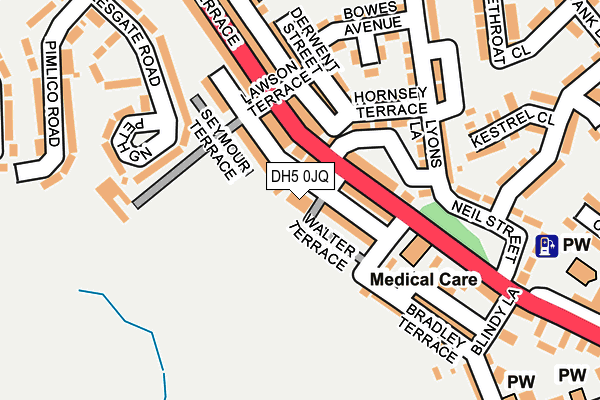
DH5 0JQ is located in the Hetton electoral ward, within the metropolitan district of Sunderland and the English Parliamentary constituency of Houghton and Sunderland South. The Sub Integrated Care Board (ICB) Location is NHS North East and North Cumbria ICB - 00P and the police force is Northumbria. This postcode has been in use since January 1980.


GetTheData
Source: OS OpenMap – Local (Ordnance Survey)
Source: OS VectorMap District (Ordnance Survey)
Licence: Open Government Licence (requires attribution)
| Easting | 435876 |
| Northing | 546315 |
| Latitude | 54.810421 |
| Longitude | -1.443329 |
GetTheData
Source: Open Postcode Geo
Licence: Open Government Licence
| Country | England |
| Postcode District | DH5 |
➜ See where DH5 is on a map ➜ Where is Easington Lane? | |
GetTheData
Source: Land Registry Price Paid Data
Licence: Open Government Licence
Elevation or altitude of DH5 0JQ as distance above sea level:
| Metres | Feet | |
|---|---|---|
| Elevation | 110m | 361ft |
Elevation is measured from the approximate centre of the postcode, to the nearest point on an OS contour line from OS Terrain 50, which has contour spacing of ten vertical metres.
➜ How high above sea level am I? Find the elevation of your current position using your device's GPS.
GetTheData
Source: Open Postcode Elevation
Licence: Open Government Licence
| Ward | Hetton |
| Constituency | Houghton And Sunderland South |
GetTheData
Source: ONS Postcode Database
Licence: Open Government Licence
| Pemberton Bank-smiths Terrace (Pemberton Bank) | Easington Lane | 50m |
| Lilywhite Terrace-lawson Terrace (Lilywhile Terrrace) | Easington Lane | 125m |
| Pemberton Bank-blindy Lane (Pemberton Bank) | Easington Lane | 232m |
| Pemberton Bank-st Michaels Church (Pemberton Bank) | Easington Lane | 306m |
| Lilywhite Tce-white Gates Dr (Lilywhite Terrace) | Hetton-le-hole | 319m |
GetTheData
Source: NaPTAN
Licence: Open Government Licence
GetTheData
Source: ONS Postcode Database
Licence: Open Government Licence


➜ Get more ratings from the Food Standards Agency
GetTheData
Source: Food Standards Agency
Licence: FSA terms & conditions
| Last Collection | |||
|---|---|---|---|
| Location | Mon-Fri | Sat | Distance |
| Easington Lane | 17:15 | 11:45 | 413m |
| High Moorsley, Hetton Le Hole | 16:00 | 11:45 | 2,114m |
| Boundary Houses, Shiney Row | 17:00 | 12:00 | 2,384m |
GetTheData
Source: Dracos
Licence: Creative Commons Attribution-ShareAlike
The below table lists the International Territorial Level (ITL) codes (formerly Nomenclature of Territorial Units for Statistics (NUTS) codes) and Local Administrative Units (LAU) codes for DH5 0JQ:
| ITL 1 Code | Name |
|---|---|
| TLC | North East (England) |
| ITL 2 Code | Name |
| TLC2 | Northumberland, and Tyne and Wear |
| ITL 3 Code | Name |
| TLC23 | Sunderland |
| LAU 1 Code | Name |
| E08000024 | Sunderland |
GetTheData
Source: ONS Postcode Directory
Licence: Open Government Licence
The below table lists the Census Output Area (OA), Lower Layer Super Output Area (LSOA), and Middle Layer Super Output Area (MSOA) for DH5 0JQ:
| Code | Name | |
|---|---|---|
| OA | E00044385 | |
| LSOA | E01008744 | Sunderland 036B |
| MSOA | E02001826 | Sunderland 036 |
GetTheData
Source: ONS Postcode Directory
Licence: Open Government Licence
| DH5 0JJ | Walter Terrace | 55m |
| DH5 0JH | Smiths Terrace | 58m |
| DH5 0JL | Campbell Terrace | 66m |
| DH5 0HN | Pemberton Bank | 74m |
| DH5 0HJ | Frederick Terrace | 80m |
| DH5 0JE | Seymour Terrace | 93m |
| DH5 0HH | Hornsey Crescent | 120m |
| DH5 0HP | Lyons Lane | 149m |
| DH5 0JX | Girven Terrace West | 164m |
| DH5 0HG | Derwent Street | 178m |
GetTheData
Source: Open Postcode Geo; Land Registry Price Paid Data
Licence: Open Government Licence