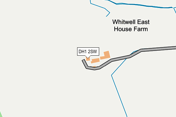
DH1 2SW is located in the Durham South electoral ward, within the unitary authority of County Durham and the English Parliamentary constituency of City of Durham. The Sub Integrated Care Board (ICB) Location is NHS North East and North Cumbria ICB - 84H and the police force is Durham. This postcode has been in use since January 1980.


GetTheData
Source: OS OpenMap – Local (Ordnance Survey)
Source: OS VectorMap District (Ordnance Survey)
Licence: Open Government Licence (requires attribution)
| Easting | 431540 |
| Northing | 540026 |
| Latitude | 54.754197 |
| Longitude | -1.511471 |
GetTheData
Source: Open Postcode Geo
Licence: Open Government Licence
| Country | England |
| Postcode District | DH1 |
➜ See where DH1 is on a map | |
GetTheData
Source: Land Registry Price Paid Data
Licence: Open Government Licence
Elevation or altitude of DH1 2SW as distance above sea level:
| Metres | Feet | |
|---|---|---|
| Elevation | 90m | 295ft |
Elevation is measured from the approximate centre of the postcode, to the nearest point on an OS contour line from OS Terrain 50, which has contour spacing of ten vertical metres.
➜ How high above sea level am I? Find the elevation of your current position using your device's GPS.
GetTheData
Source: Open Postcode Elevation
Licence: Open Government Licence
| Ward | Durham South |
| Constituency | City Of Durham |
GetTheData
Source: ONS Postcode Database
Licence: Open Government Licence
| Chapman Bridge (Un-named Road Byers Garth-cassop Moor) | Byers Garth | 549m |
| Chapman Bridge (Un-named Road Byers Garth-cassop Moor) | Byers Garth | 559m |
| Cassop Moor (Un-named Road Cassop Moor-bowburn) | Bowburn | 831m |
| Cassop Moor (Un-named Road Cassop Moor - Bowburn) | Bowburn | 840m |
| Cottages - West (A181) | Byers Garth | 952m |
| Durham Station | 5.3km |
GetTheData
Source: NaPTAN
Licence: Open Government Licence
GetTheData
Source: ONS Postcode Database
Licence: Open Government Licence


➜ Get more ratings from the Food Standards Agency
GetTheData
Source: Food Standards Agency
Licence: FSA terms & conditions
| Last Collection | |||
|---|---|---|---|
| Location | Mon-Fri | Sat | Distance |
| Hallgarth Estate | 17:00 | 08:30 | 1,476m |
| Philip Avenue | 17:00 | 09:00 | 1,604m |
| Heathways, High Shincliffe | 17:00 | 09:15 | 1,611m |
GetTheData
Source: Dracos
Licence: Creative Commons Attribution-ShareAlike
The below table lists the International Territorial Level (ITL) codes (formerly Nomenclature of Territorial Units for Statistics (NUTS) codes) and Local Administrative Units (LAU) codes for DH1 2SW:
| ITL 1 Code | Name |
|---|---|
| TLC | North East (England) |
| ITL 2 Code | Name |
| TLC1 | Tees Valley and Durham |
| ITL 3 Code | Name |
| TLC14 | Durham |
| LAU 1 Code | Name |
| E06000047 | County Durham |
GetTheData
Source: ONS Postcode Directory
Licence: Open Government Licence
The below table lists the Census Output Area (OA), Lower Layer Super Output Area (LSOA), and Middle Layer Super Output Area (MSOA) for DH1 2SW:
| Code | Name | |
|---|---|---|
| OA | E00171823 | |
| LSOA | E01020732 | County Durham 041D |
| MSOA | E02004318 | County Durham 041 |
GetTheData
Source: ONS Postcode Directory
Licence: Open Government Licence
| DH1 2SN | 992m | |
| DH1 2SJ | 1297m | |
| DH6 5FE | Cavell Drive | 1470m |
| DH1 2TY | Apperley Avenue | 1479m |
| DH1 2SF | Beech View | 1487m |
| DH6 5EN | Henry Avenue | 1489m |
| DH6 5EL | Henry Avenue | 1505m |
| DH6 1EN | Grand View | 1505m |
| DH6 5DD | Leyland Close | 1520m |
| DH6 5EG | Robert Terrace | 1535m |
GetTheData
Source: Open Postcode Geo; Land Registry Price Paid Data
Licence: Open Government Licence