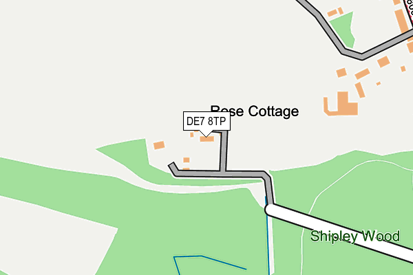
DE7 8TP lies on Shipley Wood in Ilkeston. DE7 8TP is located in the Smalley, Shipley & Horsley Woodhouse electoral ward, within the local authority district of Amber Valley and the English Parliamentary constituency of Amber Valley. The Sub Integrated Care Board (ICB) Location is NHS Derby and Derbyshire ICB - 15M and the police force is Derbyshire. This postcode has been in use since January 1980.


GetTheData
Source: OS OpenMap – Local (Ordnance Survey)
Source: OS VectorMap District (Ordnance Survey)
Licence: Open Government Licence (requires attribution)
| Easting | 445287 |
| Northing | 344080 |
| Latitude | 52.992163 |
| Longitude | -1.326769 |
GetTheData
Source: Open Postcode Geo
Licence: Open Government Licence
| Street | Shipley Wood |
| Town/City | Ilkeston |
| Country | England |
| Postcode District | DE7 |
➜ See where DE7 is on a map | |
GetTheData
Source: Land Registry Price Paid Data
Licence: Open Government Licence
Elevation or altitude of DE7 8TP as distance above sea level:
| Metres | Feet | |
|---|---|---|
| Elevation | 100m | 328ft |
Elevation is measured from the approximate centre of the postcode, to the nearest point on an OS contour line from OS Terrain 50, which has contour spacing of ten vertical metres.
➜ How high above sea level am I? Find the elevation of your current position using your device's GPS.
GetTheData
Source: Open Postcode Elevation
Licence: Open Government Licence
| Ward | Smalley, Shipley & Horsley Woodhouse |
| Constituency | Amber Valley |
GetTheData
Source: ONS Postcode Database
Licence: Open Government Licence
| Mallard Public House (Heanor Road) | Cotmanhay | 367m |
| The Copse (Hassock Lane South) | Shipley | 371m |
| Mallard Public House (Hassock Lane South) | Cotmanhay | 372m |
| The Copse (Hassock Lane South) | Shipley | 402m |
| Church Street End (Heanor Road) | Cotmanhay | 475m |
| Ilkeston Station | 2.6km |
| Langley Mill Station | 2.9km |
GetTheData
Source: NaPTAN
Licence: Open Government Licence
| Percentage of properties with Next Generation Access | 100.0% |
| Percentage of properties with Superfast Broadband | 100.0% |
| Percentage of properties with Ultrafast Broadband | 20.0% |
| Percentage of properties with Full Fibre Broadband | 0.0% |
Superfast Broadband is between 30Mbps and 300Mbps
Ultrafast Broadband is > 300Mbps
| Median download speed | 25.0Mbps |
| Average download speed | 59.2Mbps |
| Maximum download speed | 200.00Mbps |
| Median upload speed | 6.4Mbps |
| Average upload speed | 6.5Mbps |
| Maximum upload speed | 7.05Mbps |
| Percentage of properties unable to receive 2Mbps | 0.0% |
| Percentage of properties unable to receive 5Mbps | 0.0% |
| Percentage of properties unable to receive 10Mbps | 0.0% |
| Percentage of properties unable to receive 30Mbps | 0.0% |
GetTheData
Source: Ofcom
Licence: Ofcom Terms of Use (requires attribution)
GetTheData
Source: ONS Postcode Database
Licence: Open Government Licence


➜ Get more ratings from the Food Standards Agency
GetTheData
Source: Food Standards Agency
Licence: FSA terms & conditions
| Last Collection | |||
|---|---|---|---|
| Location | Mon-Fri | Sat | Distance |
| Heanor Road | 17:30 | 10:00 | 376m |
| Shipley Common Lane | 17:30 | 07:15 | 659m |
| Church Street | 17:30 | 07:15 | 708m |
GetTheData
Source: Dracos
Licence: Creative Commons Attribution-ShareAlike
The below table lists the International Territorial Level (ITL) codes (formerly Nomenclature of Territorial Units for Statistics (NUTS) codes) and Local Administrative Units (LAU) codes for DE7 8TP:
| ITL 1 Code | Name |
|---|---|
| TLF | East Midlands (England) |
| ITL 2 Code | Name |
| TLF1 | Derbyshire and Nottinghamshire |
| ITL 3 Code | Name |
| TLF13 | South and West Derbyshire |
| LAU 1 Code | Name |
| E07000032 | Amber Valley |
GetTheData
Source: ONS Postcode Directory
Licence: Open Government Licence
The below table lists the Census Output Area (OA), Lower Layer Super Output Area (LSOA), and Middle Layer Super Output Area (MSOA) for DE7 8TP:
| Code | Name | |
|---|---|---|
| OA | E00165840 | |
| LSOA | E01032613 | Amber Valley 017E |
| MSOA | E02006827 | Amber Valley 017 |
GetTheData
Source: ONS Postcode Directory
Licence: Open Government Licence
| DE7 8LP | Heanor Road | 243m |
| DE7 8TN | Heanor Road | 362m |
| DE7 8TJ | Heanor Road | 363m |
| DE7 8TT | The Copse | 437m |
| DE75 7JE | Hassock Lane South | 446m |
| DE7 8TY | Woodside Crescent | 465m |
| DE7 8QB | Church Drive | 468m |
| DE7 8TH | Heanor Road | 474m |
| DE7 8TR | Shipley Common Lane | 478m |
| DE7 8QA | Woodland Avenue | 489m |
GetTheData
Source: Open Postcode Geo; Land Registry Price Paid Data
Licence: Open Government Licence