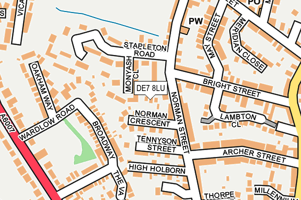
DE7 8LU lies on Joseph Court in Ilkeston. DE7 8LU is located in the Awsworth Road electoral ward, within the local authority district of Erewash and the English Parliamentary constituency of Erewash. The Sub Integrated Care Board (ICB) Location is NHS Derby and Derbyshire ICB - 15M and the police force is Derbyshire. This postcode has been in use since June 1999.


GetTheData
Source: OS OpenMap – Local (Ordnance Survey)
Source: OS VectorMap District (Ordnance Survey)
Licence: Open Government Licence (requires attribution)
| Easting | 446223 |
| Northing | 343410 |
| Latitude | 52.986042 |
| Longitude | -1.312925 |
GetTheData
Source: Open Postcode Geo
Licence: Open Government Licence
| Street | Joseph Court |
| Town/City | Ilkeston |
| Country | England |
| Postcode District | DE7 |
➜ See where DE7 is on a map ➜ Where is Ilkeston? | |
GetTheData
Source: Land Registry Price Paid Data
Licence: Open Government Licence
Elevation or altitude of DE7 8LU as distance above sea level:
| Metres | Feet | |
|---|---|---|
| Elevation | 80m | 262ft |
Elevation is measured from the approximate centre of the postcode, to the nearest point on an OS contour line from OS Terrain 50, which has contour spacing of ten vertical metres.
➜ How high above sea level am I? Find the elevation of your current position using your device's GPS.
GetTheData
Source: Open Postcode Elevation
Licence: Open Government Licence
| Ward | Awsworth Road |
| Constituency | Erewash |
GetTheData
Source: ONS Postcode Database
Licence: Open Government Licence
2015 12 MAR £124,995 |
3, JOSEPH COURT, ILKESTON, DE7 8LU 2014 25 JUL £122,500 |
2004 18 NOV £155,000 |
2000 28 JAN £55,000 |
1, JOSEPH COURT, ILKESTON, DE7 8LU 1999 2 JUL £35,000 |
3, JOSEPH COURT, ILKESTON, DE7 8LU 1999 26 MAR £54,000 |
4, JOSEPH COURT, ILKESTON, DE7 8LU 1998 24 FEB £60,000 |
GetTheData
Source: HM Land Registry Price Paid Data
Licence: Contains HM Land Registry data © Crown copyright and database right 2025. This data is licensed under the Open Government Licence v3.0.
| Broadway (Heanor Road) | Shipley View | 266m |
| Broadway (Heanor Road) | Shipley View | 272m |
| Ash Street (Cotmanhay Road) | Cotmanhay | 296m |
| Ash Street (Cotmanhay Road) | Cotmanhay | 310m |
| Ebenezer Church (Charlotte Street) | Ilkeston | 348m |
| Ilkeston Station | 1.4km |
| Langley Mill Station | 3.8km |
GetTheData
Source: NaPTAN
Licence: Open Government Licence
| Percentage of properties with Next Generation Access | 100.0% |
| Percentage of properties with Superfast Broadband | 100.0% |
| Percentage of properties with Ultrafast Broadband | 75.0% |
| Percentage of properties with Full Fibre Broadband | 0.0% |
Superfast Broadband is between 30Mbps and 300Mbps
Ultrafast Broadband is > 300Mbps
| Percentage of properties unable to receive 2Mbps | 0.0% |
| Percentage of properties unable to receive 5Mbps | 0.0% |
| Percentage of properties unable to receive 10Mbps | 0.0% |
| Percentage of properties unable to receive 30Mbps | 0.0% |
GetTheData
Source: Ofcom
Licence: Ofcom Terms of Use (requires attribution)
GetTheData
Source: ONS Postcode Database
Licence: Open Government Licence


➜ Get more ratings from the Food Standards Agency
GetTheData
Source: Food Standards Agency
Licence: FSA terms & conditions
| Last Collection | |||
|---|---|---|---|
| Location | Mon-Fri | Sat | Distance |
| Norman Street | 17:30 | 07:15 | 52m |
| Cotmanhay Post Office | 17:30 | 11:15 | 270m |
| Duke Street | 17:30 | 07:30 | 347m |
GetTheData
Source: Dracos
Licence: Creative Commons Attribution-ShareAlike
The below table lists the International Territorial Level (ITL) codes (formerly Nomenclature of Territorial Units for Statistics (NUTS) codes) and Local Administrative Units (LAU) codes for DE7 8LU:
| ITL 1 Code | Name |
|---|---|
| TLF | East Midlands (England) |
| ITL 2 Code | Name |
| TLF1 | Derbyshire and Nottinghamshire |
| ITL 3 Code | Name |
| TLF13 | South and West Derbyshire |
| LAU 1 Code | Name |
| E07000036 | Erewash |
GetTheData
Source: ONS Postcode Directory
Licence: Open Government Licence
The below table lists the Census Output Area (OA), Lower Layer Super Output Area (LSOA), and Middle Layer Super Output Area (MSOA) for DE7 8LU:
| Code | Name | |
|---|---|---|
| OA | E00099389 | |
| LSOA | E01019645 | Erewash 016D |
| MSOA | E02006828 | Erewash 016 |
GetTheData
Source: ONS Postcode Directory
Licence: Open Government Licence
| DE7 8NN | Norman Crescent | 32m |
| DE7 8NP | Norman Street | 49m |
| DE7 8NL | Norman Street | 75m |
| DE7 8JY | Tennyson Street | 82m |
| DE7 8PQ | Stapleton Road | 124m |
| DE7 8TD | Broadway | 144m |
| DE7 8NH | Bright Street | 148m |
| DE7 8LA | High Holborn | 149m |
| DE7 8US | Wardlow Road | 151m |
| DE7 8NR | Norman Street | 168m |
GetTheData
Source: Open Postcode Geo; Land Registry Price Paid Data
Licence: Open Government Licence