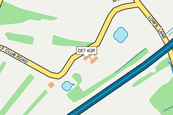
DE7 4QR is located in the Kirk Hallam & Stanton-by-Dale electoral ward, within the local authority district of Erewash and the English Parliamentary constituency of Erewash. The Sub Integrated Care Board (ICB) Location is NHS Derby and Derbyshire ICB - 15M and the police force is Derbyshire. This postcode has been in use since January 1980.


GetTheData
Source: OS OpenMap – Local (Ordnance Survey)
Source: OS VectorMap District (Ordnance Survey)
Licence: Open Government Licence (requires attribution)
| Easting | 447729 |
| Northing | 338111 |
| Latitude | 52.938280 |
| Longitude | -1.291273 |
GetTheData
Source: Open Postcode Geo
Licence: Open Government Licence
| Country | England |
| Postcode District | DE7 |
➜ See where DE7 is on a map | |
GetTheData
Source: Land Registry Price Paid Data
Licence: Open Government Licence
Elevation or altitude of DE7 4QR as distance above sea level:
| Metres | Feet | |
|---|---|---|
| Elevation | 50m | 164ft |
Elevation is measured from the approximate centre of the postcode, to the nearest point on an OS contour line from OS Terrain 50, which has contour spacing of ten vertical metres.
➜ How high above sea level am I? Find the elevation of your current position using your device's GPS.
GetTheData
Source: Open Postcode Elevation
Licence: Open Government Licence
| Ward | Kirk Hallam & Stanton-by-dale |
| Constituency | Erewash |
GetTheData
Source: ONS Postcode Database
Licence: Open Government Licence
| Beech Avenue North End (Beech Avenue) | Sandiacre | 801m |
| Maple Avenue (Coronation Avenue) | Sandiacre | 816m |
| Coronation Avenue | Sandiacre | 911m |
| The Orchard (Quarry Hill) | Stanton By Dale | 968m |
| The Orchard (Quarry Hill) | Stanton By Dale | 970m |
| Ilkeston Station | 4.6km |
| Attenborough Station | 5.4km |
GetTheData
Source: NaPTAN
Licence: Open Government Licence
| Percentage of properties with Next Generation Access | 100.0% |
| Percentage of properties with Superfast Broadband | 100.0% |
| Percentage of properties with Ultrafast Broadband | 0.0% |
| Percentage of properties with Full Fibre Broadband | 0.0% |
Superfast Broadband is between 30Mbps and 300Mbps
Ultrafast Broadband is > 300Mbps
| Percentage of properties unable to receive 2Mbps | 0.0% |
| Percentage of properties unable to receive 5Mbps | 0.0% |
| Percentage of properties unable to receive 10Mbps | 0.0% |
| Percentage of properties unable to receive 30Mbps | 0.0% |
GetTheData
Source: Ofcom
Licence: Ofcom Terms of Use (requires attribution)
GetTheData
Source: ONS Postcode Database
Licence: Open Government Licence


➜ Get more ratings from the Food Standards Agency
GetTheData
Source: Food Standards Agency
Licence: FSA terms & conditions
| Last Collection | |||
|---|---|---|---|
| Location | Mon-Fri | Sat | Distance |
| Coronation Avenue | 17:00 | 12:00 | 909m |
| Stanton Road | 17:00 | 12:00 | 1,052m |
| Church Street | 17:00 | 12:00 | 1,075m |
GetTheData
Source: Dracos
Licence: Creative Commons Attribution-ShareAlike
The below table lists the International Territorial Level (ITL) codes (formerly Nomenclature of Territorial Units for Statistics (NUTS) codes) and Local Administrative Units (LAU) codes for DE7 4QR:
| ITL 1 Code | Name |
|---|---|
| TLF | East Midlands (England) |
| ITL 2 Code | Name |
| TLF1 | Derbyshire and Nottinghamshire |
| ITL 3 Code | Name |
| TLF13 | South and West Derbyshire |
| LAU 1 Code | Name |
| E07000036 | Erewash |
GetTheData
Source: ONS Postcode Directory
Licence: Open Government Licence
The below table lists the Census Output Area (OA), Lower Layer Super Output Area (LSOA), and Middle Layer Super Output Area (MSOA) for DE7 4QR:
| Code | Name | |
|---|---|---|
| OA | E00099450 | |
| LSOA | E01019656 | Erewash 008A |
| MSOA | E02004085 | Erewash 008 |
GetTheData
Source: ONS Postcode Directory
Licence: Open Government Licence
| DE7 4RJ | Lows Lane | 348m |
| DE7 4QS | Stanton Gate | 503m |
| DE7 4QU | Lows Lane | 504m |
| NG10 5FD | Larch Drive | 658m |
| NG10 5FB | Cloudside Road | 711m |
| NG10 5EF | Maple Avenue | 736m |
| NG10 5FA | Laburnum Close | 737m |
| NG10 5EE | Church Drive | 782m |
| NG10 5EZ | Chestnut Grove | 833m |
| NG9 8GT | Moorbridge Lane | 841m |
GetTheData
Source: Open Postcode Geo; Land Registry Price Paid Data
Licence: Open Government Licence