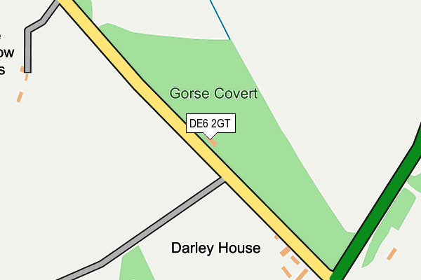
DE6 2GT is located in the Norbury electoral ward, within the local authority district of Derbyshire Dales and the English Parliamentary constituency of Derbyshire Dales. The Sub Integrated Care Board (ICB) Location is NHS Derby and Derbyshire ICB - 15M and the police force is Derbyshire. This postcode has been in use since September 2013.


GetTheData
Source: OS OpenMap – Local (Ordnance Survey)
Source: OS VectorMap District (Ordnance Survey)
Licence: Open Government Licence (requires attribution)
| Easting | 416668 |
| Northing | 342698 |
| Latitude | 52.981370 |
| Longitude | -1.753195 |
GetTheData
Source: Open Postcode Geo
Licence: Open Government Licence
| Country | England |
| Postcode District | DE6 |
➜ See where DE6 is on a map | |
GetTheData
Source: Land Registry Price Paid Data
Licence: Open Government Licence
Elevation or altitude of DE6 2GT as distance above sea level:
| Metres | Feet | |
|---|---|---|
| Elevation | 170m | 558ft |
Elevation is measured from the approximate centre of the postcode, to the nearest point on an OS contour line from OS Terrain 50, which has contour spacing of ten vertical metres.
➜ How high above sea level am I? Find the elevation of your current position using your device's GPS.
GetTheData
Source: Open Postcode Elevation
Licence: Open Government Licence
| Ward | Norbury |
| Constituency | Derbyshire Dales |
GetTheData
Source: ONS Postcode Database
Licence: Open Government Licence
| Windmill Farm (Windmill Lane) | Snelston | 679m |
| Windmill Farm (Windmill Lane) | Snelston | 683m |
| Church (Edlaston Lane) | Edlaston | 1,461m |
| Church (Edlaston Lane) | Edlaston | 1,462m |
| Parkfield Lane (Church Road) | Snelston | 1,505m |
GetTheData
Source: NaPTAN
Licence: Open Government Licence
GetTheData
Source: ONS Postcode Database
Licence: Open Government Licence


➜ Get more ratings from the Food Standards Agency
GetTheData
Source: Food Standards Agency
Licence: FSA terms & conditions
| Last Collection | |||
|---|---|---|---|
| Location | Mon-Fri | Sat | Distance |
| Darley Moor | 16:00 | 07:15 | 1,322m |
| Edlaston | 16:15 | 09:00 | 1,419m |
| Snelston | 16:15 | 08:15 | 1,647m |
GetTheData
Source: Dracos
Licence: Creative Commons Attribution-ShareAlike
The below table lists the International Territorial Level (ITL) codes (formerly Nomenclature of Territorial Units for Statistics (NUTS) codes) and Local Administrative Units (LAU) codes for DE6 2GT:
| ITL 1 Code | Name |
|---|---|
| TLF | East Midlands (England) |
| ITL 2 Code | Name |
| TLF1 | Derbyshire and Nottinghamshire |
| ITL 3 Code | Name |
| TLF13 | South and West Derbyshire |
| LAU 1 Code | Name |
| E07000035 | Derbyshire Dales |
GetTheData
Source: ONS Postcode Directory
Licence: Open Government Licence
The below table lists the Census Output Area (OA), Lower Layer Super Output Area (LSOA), and Middle Layer Super Output Area (MSOA) for DE6 2GT:
| Code | Name | |
|---|---|---|
| OA | E00099182 | |
| LSOA | E01019607 | Derbyshire Dales 010B |
| MSOA | E02004077 | Derbyshire Dales 010 |
GetTheData
Source: ONS Postcode Directory
Licence: Open Government Licence
| DE6 2GP | 787m | |
| DE6 2DQ | 1147m | |
| DE6 2GN | 1157m | |
| DE6 2GH | Long View Lane | 1248m |
| DE6 2DN | Anacre Cottages | 1523m |
| DE6 2ET | 1542m | |
| DE6 2DP | Cocks Head Lane | 1553m |
| DE6 2EP | 1564m | |
| DE6 2DL | 1720m | |
| DE6 2DS | Hales Green | 1916m |
GetTheData
Source: Open Postcode Geo; Land Registry Price Paid Data
Licence: Open Government Licence