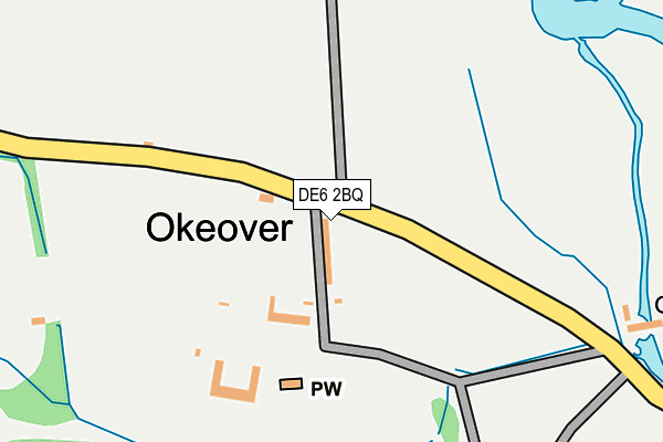
DE6 2BQ is located in the Stramshall & Weaver electoral ward, within the local authority district of East Staffordshire and the English Parliamentary constituency of Burton. The Sub Integrated Care Board (ICB) Location is NHS Staffordshire and Stoke-on-Trent ICB - 05D and the police force is Staffordshire. This postcode has been in use since January 1980.


GetTheData
Source: OS OpenMap – Local (Ordnance Survey)
Source: OS VectorMap District (Ordnance Survey)
Licence: Open Government Licence (requires attribution)
| Easting | 415879 |
| Northing | 348272 |
| Latitude | 53.031517 |
| Longitude | -1.764670 |
GetTheData
Source: Open Postcode Geo
Licence: Open Government Licence
| Country | England |
| Postcode District | DE6 |
➜ See where DE6 is on a map ➜ Where is Okeover? | |
GetTheData
Source: Land Registry Price Paid Data
Licence: Open Government Licence
Elevation or altitude of DE6 2BQ as distance above sea level:
| Metres | Feet | |
|---|---|---|
| Elevation | 130m | 427ft |
Elevation is measured from the approximate centre of the postcode, to the nearest point on an OS contour line from OS Terrain 50, which has contour spacing of ten vertical metres.
➜ How high above sea level am I? Find the elevation of your current position using your device's GPS.
GetTheData
Source: Open Postcode Elevation
Licence: Open Government Licence
| Ward | Stramshall & Weaver |
| Constituency | Burton |
GetTheData
Source: ONS Postcode Database
Licence: Open Government Licence
| Church (Mapleton Road) | Mapleton | 712m |
| Church (Main Road) | Mapleton | 717m |
| Okeover Arms (Car Park) | Mapleton | 736m |
| Manor House (Mapleton Road) | Mapleton | 856m |
| Main Road No1 (Main Road) | Mapleton | 928m |
GetTheData
Source: NaPTAN
Licence: Open Government Licence
| Percentage of properties with Next Generation Access | 0.0% |
| Percentage of properties with Superfast Broadband | 0.0% |
| Percentage of properties with Ultrafast Broadband | 0.0% |
| Percentage of properties with Full Fibre Broadband | 0.0% |
Superfast Broadband is between 30Mbps and 300Mbps
Ultrafast Broadband is > 300Mbps
| Median download speed | 6.5Mbps |
| Average download speed | 6.2Mbps |
| Maximum download speed | 7.50Mbps |
| Median upload speed | 0.8Mbps |
| Average upload speed | 0.8Mbps |
| Maximum upload speed | 1.10Mbps |
| Percentage of properties unable to receive 2Mbps | 0.0% |
| Percentage of properties unable to receive 5Mbps | 0.0% |
| Percentage of properties unable to receive 10Mbps | 20.0% |
| Percentage of properties unable to receive 30Mbps | 100.0% |
GetTheData
Source: Ofcom
Licence: Ofcom Terms of Use (requires attribution)
GetTheData
Source: ONS Postcode Database
Licence: Open Government Licence


➜ Get more ratings from the Food Standards Agency
GetTheData
Source: Food Standards Agency
Licence: FSA terms & conditions
| Last Collection | |||
|---|---|---|---|
| Location | Mon-Fri | Sat | Distance |
| Mappleton Post Office | 16:45 | 08:30 | 741m |
| Thorpe Green | 16:00 | 08:00 | 1,953m |
| Thorpe | 16:00 | 07:45 | 2,207m |
GetTheData
Source: Dracos
Licence: Creative Commons Attribution-ShareAlike
The below table lists the International Territorial Level (ITL) codes (formerly Nomenclature of Territorial Units for Statistics (NUTS) codes) and Local Administrative Units (LAU) codes for DE6 2BQ:
| ITL 1 Code | Name |
|---|---|
| TLG | West Midlands (England) |
| ITL 2 Code | Name |
| TLG2 | Shropshire and Staffordshire |
| ITL 3 Code | Name |
| TLG24 | Staffordshire CC |
| LAU 1 Code | Name |
| E07000193 | East Staffordshire |
GetTheData
Source: ONS Postcode Directory
Licence: Open Government Licence
The below table lists the Census Output Area (OA), Lower Layer Super Output Area (LSOA), and Middle Layer Super Output Area (MSOA) for DE6 2BQ:
| Code | Name | |
|---|---|---|
| OA | E00150135 | |
| LSOA | E01029467 | East Staffordshire 001E |
| MSOA | E02006131 | East Staffordshire 001 |
GetTheData
Source: ONS Postcode Directory
Licence: Open Government Licence
| DE6 2AB | 778m | |
| DE6 2AR | Spend Lane | 1495m |
| DE6 2AS | Spend Lane | 1905m |
| DE6 2AP | Woodland Close | 1916m |
| DE6 2HR | Leek Road | 1935m |
| DE6 2AW | 1983m | |
| DE6 2AQ | Sandybrook | 2029m |
| DE6 2AA | Mapleton Road | 2062m |
| DE6 1LA | 2171m | |
| DE6 2HQ | 2222m |
GetTheData
Source: Open Postcode Geo; Land Registry Price Paid Data
Licence: Open Government Licence