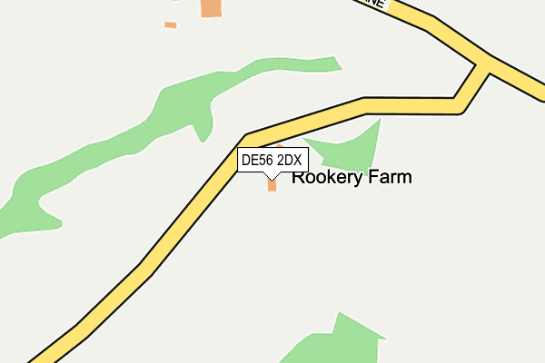
DE56 2DX is located in the Alport & South West Parishes electoral ward, within the local authority district of Amber Valley and the English Parliamentary constituency of Derbyshire Dales. The Sub Integrated Care Board (ICB) Location is NHS Derby and Derbyshire ICB - 15M and the police force is Derbyshire. This postcode has been in use since August 1992.


GetTheData
Source: OS OpenMap – Local (Ordnance Survey)
Source: OS VectorMap District (Ordnance Survey)
Licence: Open Government Licence (requires attribution)
| Easting | 429597 |
| Northing | 349289 |
| Latitude | 53.040079 |
| Longitude | -1.560031 |
GetTheData
Source: Open Postcode Geo
Licence: Open Government Licence
| Country | England |
| Postcode District | DE56 |
➜ See where DE56 is on a map | |
GetTheData
Source: Land Registry Price Paid Data
Licence: Open Government Licence
Elevation or altitude of DE56 2DX as distance above sea level:
| Metres | Feet | |
|---|---|---|
| Elevation | 150m | 492ft |
Elevation is measured from the approximate centre of the postcode, to the nearest point on an OS contour line from OS Terrain 50, which has contour spacing of ten vertical metres.
➜ How high above sea level am I? Find the elevation of your current position using your device's GPS.
GetTheData
Source: Open Postcode Elevation
Licence: Open Government Licence
| Ward | Alport & South West Parishes |
| Constituency | Derbyshire Dales |
GetTheData
Source: ONS Postcode Database
Licence: Open Government Licence
| The Black Swan (Wirksworth Road) | Idridgehay | 966m |
| The Black Swan (Wirksworth Road) | Idridgehay | 974m |
| Ecclesbourne Lane (Wirksworth Road) | Idridgehay | 1,006m |
| Ecclesbourne Lane (Wirksworth Road) | Idridgehay | 1,023m |
| Church (Wirksworth Road) | Idridgehay | 1,050m |
| Idridgehay (Ecclesbourne Valley Railway) | Idridgehay | 772m |
| Whatstandwell Station | 6.1km |
GetTheData
Source: NaPTAN
Licence: Open Government Licence
| Percentage of properties with Next Generation Access | 0.0% |
| Percentage of properties with Superfast Broadband | 0.0% |
| Percentage of properties with Ultrafast Broadband | 0.0% |
| Percentage of properties with Full Fibre Broadband | 0.0% |
Superfast Broadband is between 30Mbps and 300Mbps
Ultrafast Broadband is > 300Mbps
| Percentage of properties unable to receive 2Mbps | 0.0% |
| Percentage of properties unable to receive 5Mbps | 0.0% |
| Percentage of properties unable to receive 10Mbps | 100.0% |
| Percentage of properties unable to receive 30Mbps | 100.0% |
GetTheData
Source: Ofcom
Licence: Ofcom Terms of Use (requires attribution)
GetTheData
Source: ONS Postcode Database
Licence: Open Government Licence


➜ Get more ratings from the Food Standards Agency
GetTheData
Source: Food Standards Agency
Licence: FSA terms & conditions
| Last Collection | |||
|---|---|---|---|
| Location | Mon-Fri | Sat | Distance |
| Old Idridgehay Post Office | 16:00 | 09:15 | 986m |
| Idrigehay Green | 16:00 | 07:30 | 1,237m |
| Hillcliffe Lane | 16:00 | 08:45 | 1,946m |
GetTheData
Source: Dracos
Licence: Creative Commons Attribution-ShareAlike
The below table lists the International Territorial Level (ITL) codes (formerly Nomenclature of Territorial Units for Statistics (NUTS) codes) and Local Administrative Units (LAU) codes for DE56 2DX:
| ITL 1 Code | Name |
|---|---|
| TLF | East Midlands (England) |
| ITL 2 Code | Name |
| TLF1 | Derbyshire and Nottinghamshire |
| ITL 3 Code | Name |
| TLF13 | South and West Derbyshire |
| LAU 1 Code | Name |
| E07000032 | Amber Valley |
GetTheData
Source: ONS Postcode Directory
Licence: Open Government Licence
The below table lists the Census Output Area (OA), Lower Layer Super Output Area (LSOA), and Middle Layer Super Output Area (MSOA) for DE56 2DX:
| Code | Name | |
|---|---|---|
| OA | E00098147 | |
| LSOA | E01019405 | Amber Valley 007A |
| MSOA | E02004035 | Amber Valley 007 |
GetTheData
Source: ONS Postcode Directory
Licence: Open Government Licence
| DE56 2SS | Rood Lane | 619m |
| DE56 2SF | 715m | |
| DE56 2SG | Wirksworth Road | 948m |
| DE56 2SB | 1054m | |
| DE56 2SJ | Cliffash Lane | 1230m |
| DE56 2SL | Windley Lane | 1315m |
| DE56 2SE | Cliffash Lane | 1548m |
| DE56 2DS | 1598m | |
| DE4 4AH | Ashleyhay | 1785m |
| DE56 2DR | 1883m |
GetTheData
Source: Open Postcode Geo; Land Registry Price Paid Data
Licence: Open Government Licence