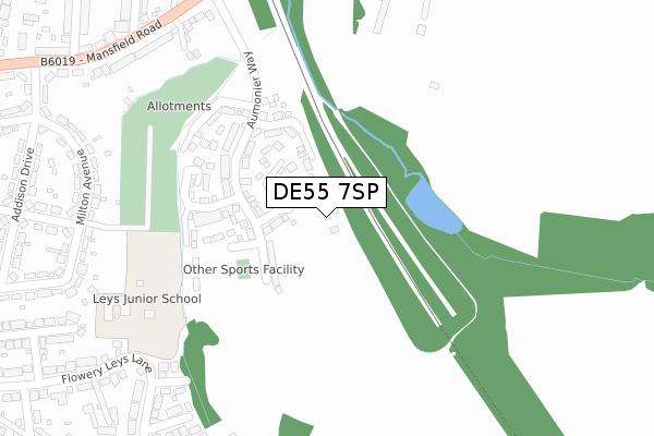
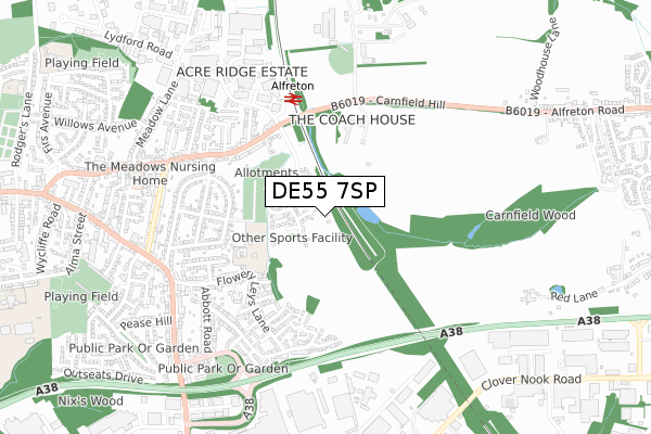
DE55 7SP is located in the Alfreton electoral ward, within the local authority district of Amber Valley and the English Parliamentary constituency of Amber Valley. The Sub Integrated Care Board (ICB) Location is NHS Derby and Derbyshire ICB - 15M and the police force is Derbyshire. This postcode has been in use since April 2020.


GetTheData
Source: OS Open Zoomstack (Ordnance Survey)
Licence: Open Government Licence (requires attribution)
Attribution: Contains OS data © Crown copyright and database right 2024
Source: Open Postcode Geo
Licence: Open Government Licence (requires attribution)
Attribution: Contains OS data © Crown copyright and database right 2024; Contains Royal Mail data © Royal Mail copyright and database right 2024; Source: Office for National Statistics licensed under the Open Government Licence v.3.0
| Easting | 442438 |
| Northing | 355585 |
| Latitude | 53.095809 |
| Longitude | -1.367701 |
GetTheData
Source: Open Postcode Geo
Licence: Open Government Licence
| Country | England |
| Postcode District | DE55 |
| ➜ DE55 open data dashboard ➜ See where DE55 is on a map ➜ Where is Alfreton? | |
GetTheData
Source: Land Registry Price Paid Data
Licence: Open Government Licence
| Ward | Alfreton |
| Constituency | Amber Valley |
GetTheData
Source: ONS Postcode Database
Licence: Open Government Licence
2022 6 OCT £296,000 |
21, HOPKINSON CLOSE, ALFRETON, DE55 7SP 2021 20 DEC £261,950 |
19, HOPKINSON CLOSE, ALFRETON, DE55 7SP 2021 17 DEC £261,900 |
17, HOPKINSON CLOSE, ALFRETON, DE55 7SP 2021 10 DEC £328,950 |
11, HOPKINSON CLOSE, ALFRETON, DE55 7SP 2021 8 DEC £249,950 |
15, HOPKINSON CLOSE, ALFRETON, DE55 7SP 2021 30 NOV £279,950 |
9, HOPKINSON CLOSE, ALFRETON, DE55 7SP 2021 30 NOV £242,950 |
7, HOPKINSON CLOSE, ALFRETON, DE55 7SP 2021 29 NOV £328,950 |
22, HOPKINSON CLOSE, ALFRETON, DE55 7SP 2021 15 SEP £264,950 |
20, HOPKINSON CLOSE, ALFRETON, DE55 7SP 2021 1 SEP £255,000 |
GetTheData
Source: HM Land Registry Price Paid Data
Licence: Contains HM Land Registry data © Crown copyright and database right 2024. This data is licensed under the Open Government Licence v3.0.
| June 2022 | Violence and sexual offences | On or near Normanton Avenue | 352m |
| June 2022 | Violence and sexual offences | On or near Milton Avenue | 401m |
| June 2022 | Violence and sexual offences | On or near Milton Avenue | 401m |
| ➜ Get more crime data in our Crime section | |||
GetTheData
Source: data.police.uk
Licence: Open Government Licence
| Chatham Avenue (Flowery Leys Lane) | Outseats Estate | 410m |
| Ley Avenue (Flowery Leys Lane) | Outseats Estate | 449m |
| Railway Station (Mansfield Road) | Alfreton | 473m |
| Railway Station (Mansfield Road) | Alfreton | 492m |
| Abbott Road (Birchwood Road) | Outseats Estate | 495m |
| Alfreton Station | 0.5km |
GetTheData
Source: NaPTAN
Licence: Open Government Licence
GetTheData
Source: ONS Postcode Database
Licence: Open Government Licence


➜ Get more ratings from the Food Standards Agency
GetTheData
Source: Food Standards Agency
Licence: FSA terms & conditions
| Last Collection | |||
|---|---|---|---|
| Location | Mon-Fri | Sat | Distance |
| Flowery Lees Lane | 17:00 | 09:30 | 443m |
| Notts Road | 17:00 | 09:30 | 579m |
| Leabrooks Post Office | 17:30 | 11:00 | 579m |
GetTheData
Source: Dracos
Licence: Creative Commons Attribution-ShareAlike
| Facility | Distance |
|---|---|
| Leys Junior School Flowery Leys Lane, Alfreton Grass Pitches | 336m |
| Atlas Workout Warehouse (Closed) Salcombe Road, Alfreton Health and Fitness Gym | 762m |
| Impact Arena North Street, Alfreton Grass Pitches | 947m |
GetTheData
Source: Active Places
Licence: Open Government Licence
| School | Phase of Education | Distance |
|---|---|---|
| Leys Junior School Flowery Leys Lane, Leys Junior School, Alfreton, DE55 7HA | Primary | 351m |
| David Nieper Academy Grange Street, Alfreton, DE55 7JA | Secondary | 1.1km |
| Woodbridge Junior School Grange Street, Alfreton, DE55 7JA | Primary | 1.2km |
GetTheData
Source: Edubase
Licence: Open Government Licence
The below table lists the International Territorial Level (ITL) codes (formerly Nomenclature of Territorial Units for Statistics (NUTS) codes) and Local Administrative Units (LAU) codes for DE55 7SP:
| ITL 1 Code | Name |
|---|---|
| TLF | East Midlands (England) |
| ITL 2 Code | Name |
| TLF1 | Derbyshire and Nottinghamshire |
| ITL 3 Code | Name |
| TLF13 | South and West Derbyshire |
| LAU 1 Code | Name |
| E07000032 | Amber Valley |
GetTheData
Source: ONS Postcode Directory
Licence: Open Government Licence
The below table lists the Census Output Area (OA), Lower Layer Super Output Area (LSOA), and Middle Layer Super Output Area (MSOA) for DE55 7SP:
| Code | Name | |
|---|---|---|
| OA | E00098113 | |
| LSOA | E01019402 | Amber Valley 001C |
| MSOA | E02004029 | Amber Valley 001 |
GetTheData
Source: ONS Postcode Directory
Licence: Open Government Licence
| DE55 7JG | Henry Crescent | 292m |
| DE55 7QA | Normanton Avenue | 320m |
| DE55 7QH | Beechdale Road | 325m |
| DE55 7HG | Cowham Close | 327m |
| DE55 7QG | Pinewood Close | 337m |
| DE55 7QL | Ash Court | 374m |
| DE55 7QF | Briar Close | 388m |
| DE55 7QJ | Elmwood Drive | 410m |
| DE55 7HA | Flowery Leys Lane | 411m |
| DE55 7QE | Flowery Leys Lane | 417m |
GetTheData
Source: Open Postcode Geo; Land Registry Price Paid Data
Licence: Open Government Licence