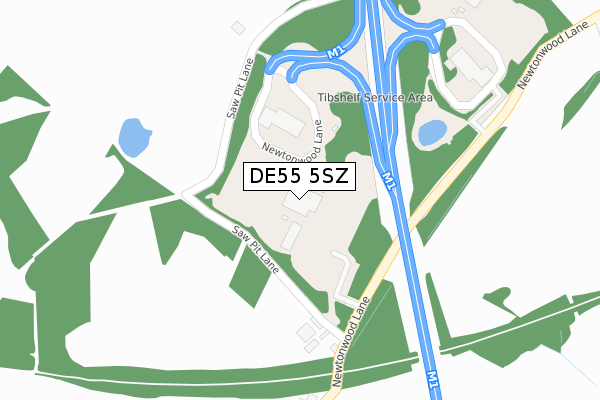
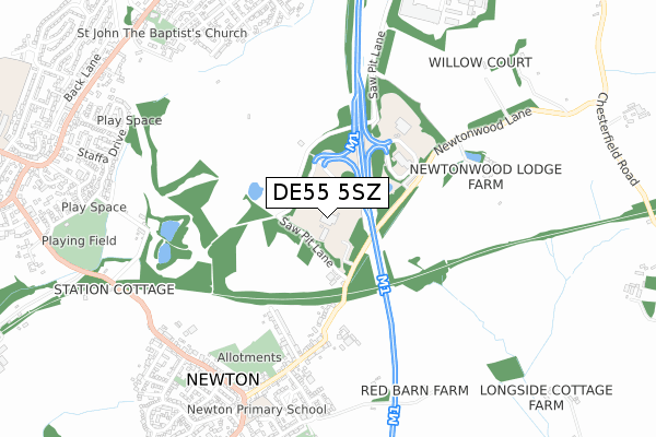
DE55 5SZ is located in the Tibshelf electoral ward, within the local authority district of Bolsover and the English Parliamentary constituency of Bolsover. The Sub Integrated Care Board (ICB) Location is NHS Derby and Derbyshire ICB - 15M and the police force is Derbyshire. This postcode has been in use since December 1999.


GetTheData
Source: OS Open Zoomstack (Ordnance Survey)
Licence: Open Government Licence (requires attribution)
Attribution: Contains OS data © Crown copyright and database right 2025
Source: Open Postcode Geo
Licence: Open Government Licence (requires attribution)
Attribution: Contains OS data © Crown copyright and database right 2025; Contains Royal Mail data © Royal Mail copyright and database right 2025; Source: Office for National Statistics licensed under the Open Government Licence v.3.0
| Easting | 444731 |
| Northing | 360096 |
| Latitude | 53.136150 |
| Longitude | -1.332836 |
GetTheData
Source: Open Postcode Geo
Licence: Open Government Licence
| Country | England |
| Postcode District | DE55 |
➜ See where DE55 is on a map | |
GetTheData
Source: Land Registry Price Paid Data
Licence: Open Government Licence
Elevation or altitude of DE55 5SZ as distance above sea level:
| Metres | Feet | |
|---|---|---|
| Elevation | 170m | 558ft |
Elevation is measured from the approximate centre of the postcode, to the nearest point on an OS contour line from OS Terrain 50, which has contour spacing of ten vertical metres.
➜ How high above sea level am I? Find the elevation of your current position using your device's GPS.
GetTheData
Source: Open Postcode Elevation
Licence: Open Government Licence
| Ward | Tibshelf |
| Constituency | Bolsover |
GetTheData
Source: ONS Postcode Database
Licence: Open Government Licence
| Bridge House Farm (Newtonwood Lane) | Newton | 211m |
| Bridge House Farm (Newtonwood Lane) | Newton | 217m |
| Sherwood Street (Littlemoor Lane) | Newton | 522m |
| Sherwood Street (Littlemoor Lane) | Newton | 527m |
| Newtonwood Lane | Newton | 567m |
| Alfreton Station | 4.7km |
GetTheData
Source: NaPTAN
Licence: Open Government Licence
GetTheData
Source: ONS Postcode Database
Licence: Open Government Licence


➜ Get more ratings from the Food Standards Agency
GetTheData
Source: Food Standards Agency
Licence: FSA terms & conditions
| Last Collection | |||
|---|---|---|---|
| Location | Mon-Fri | Sat | Distance |
| Sherwood Street/Wire Lane | 16:00 | 08:00 | 609m |
| Newton Post Office | 16:00 | 09:30 | 721m |
| Classic Journeys Box | 16:30 | 08:00 | 1,032m |
GetTheData
Source: Dracos
Licence: Creative Commons Attribution-ShareAlike
The below table lists the International Territorial Level (ITL) codes (formerly Nomenclature of Territorial Units for Statistics (NUTS) codes) and Local Administrative Units (LAU) codes for DE55 5SZ:
| ITL 1 Code | Name |
|---|---|
| TLF | East Midlands (England) |
| ITL 2 Code | Name |
| TLF1 | Derbyshire and Nottinghamshire |
| ITL 3 Code | Name |
| TLF12 | East Derbyshire |
| LAU 1 Code | Name |
| E07000033 | Bolsover |
GetTheData
Source: ONS Postcode Directory
Licence: Open Government Licence
The below table lists the Census Output Area (OA), Lower Layer Super Output Area (LSOA), and Middle Layer Super Output Area (MSOA) for DE55 5SZ:
| Code | Name | |
|---|---|---|
| OA | E00098728 | |
| LSOA | E01019521 | Bolsover 008D |
| MSOA | E02004052 | Bolsover 008 |
GetTheData
Source: ONS Postcode Directory
Licence: Open Government Licence
| DE55 5TZ | Newton Wood Lane | 257m |
| DE55 5SE | Sherwood Street | 463m |
| DE55 5TY | Littlemoor Lane | 556m |
| DE55 5SA | Wire Lane | 688m |
| DE55 5SJ | Red Barn Close | 693m |
| DE55 5PG | Elm Tree Row | 709m |
| DE55 5SB | Charnwood Crescent | 735m |
| DE55 5TE | Main Street | 762m |
| DE55 5TJ | Green Close | 779m |
| DE55 5QT | Kedleston Court | 787m |
GetTheData
Source: Open Postcode Geo; Land Registry Price Paid Data
Licence: Open Government Licence