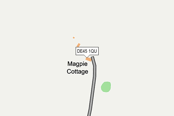
DE45 1QU is located in the Bakewell electoral ward, within the local authority district of Derbyshire Dales and the English Parliamentary constituency of Derbyshire Dales. The Sub Integrated Care Board (ICB) Location is NHS Derby and Derbyshire ICB - 15M and the police force is Derbyshire. This postcode has been in use since May 2007.


GetTheData
Source: OS OpenMap – Local (Ordnance Survey)
Source: OS VectorMap District (Ordnance Survey)
Licence: Open Government Licence (requires attribution)
| Easting | 417266 |
| Northing | 368087 |
| Latitude | 53.209571 |
| Longitude | -1.742933 |
GetTheData
Source: Open Postcode Geo
Licence: Open Government Licence
| Country | England |
| Postcode District | DE45 |
➜ See where DE45 is on a map | |
GetTheData
Source: Land Registry Price Paid Data
Licence: Open Government Licence
Elevation or altitude of DE45 1QU as distance above sea level:
| Metres | Feet | |
|---|---|---|
| Elevation | 320m | 1,050ft |
Elevation is measured from the approximate centre of the postcode, to the nearest point on an OS contour line from OS Terrain 50, which has contour spacing of ten vertical metres.
➜ How high above sea level am I? Find the elevation of your current position using your device's GPS.
GetTheData
Source: Open Postcode Elevation
Licence: Open Government Licence
| Ward | Bakewell |
| Constituency | Derbyshire Dales |
GetTheData
Source: ONS Postcode Database
Licence: Open Government Licence
| Cock And Pullet (Main Street) | Sheldon | 731m |
| Rose Farm (Johnsons Lane) | Sheldon | 737m |
| Cock And Pullet (Main Street) | Sheldon | 738m |
| Wheal Lane (High Low) | Sheldon | 1,499m |
| Wheal Lane (High Low) | Sheldon | 1,542m |
GetTheData
Source: NaPTAN
Licence: Open Government Licence
GetTheData
Source: ONS Postcode Database
Licence: Open Government Licence


➜ Get more ratings from the Food Standards Agency
GetTheData
Source: Food Standards Agency
Licence: FSA terms & conditions
| Last Collection | |||
|---|---|---|---|
| Location | Mon-Fri | Sat | Distance |
| Sheldon | 16:00 | 09:15 | 729m |
| Ashford School | 16:00 | 10:30 | 2,721m |
| Monyash Post Office | 16:00 | 09:30 | 2,751m |
GetTheData
Source: Dracos
Licence: Creative Commons Attribution-ShareAlike
The below table lists the International Territorial Level (ITL) codes (formerly Nomenclature of Territorial Units for Statistics (NUTS) codes) and Local Administrative Units (LAU) codes for DE45 1QU:
| ITL 1 Code | Name |
|---|---|
| TLF | East Midlands (England) |
| ITL 2 Code | Name |
| TLF1 | Derbyshire and Nottinghamshire |
| ITL 3 Code | Name |
| TLF13 | South and West Derbyshire |
| LAU 1 Code | Name |
| E07000035 | Derbyshire Dales |
GetTheData
Source: ONS Postcode Directory
Licence: Open Government Licence
The below table lists the Census Output Area (OA), Lower Layer Super Output Area (LSOA), and Middle Layer Super Output Area (MSOA) for DE45 1QU:
| Code | Name | |
|---|---|---|
| OA | E00099125 | |
| LSOA | E01019600 | Derbyshire Dales 002A |
| MSOA | E02004069 | Derbyshire Dales 002 |
GetTheData
Source: ONS Postcode Directory
Licence: Open Government Licence
| DE45 1QS | 711m | |
| DE45 1JF | Haddon Grove | 2124m |
| DE45 1QW | Bole Hill | 2179m |
| DE45 1QP | Buxton Road | 2600m |
| DE45 1JH | Church Street | 2618m |
| DE45 1JJ | Chapel Street | 2630m |
| DE45 1QF | Fennel Street | 2690m |
| SK17 9UH | 2729m | |
| DE45 1QG | Court Lane | 2780m |
| DE45 1QE | Cherry Close | 2814m |
GetTheData
Source: Open Postcode Geo; Land Registry Price Paid Data
Licence: Open Government Licence