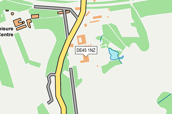
DE45 1NZ is located in the Bakewell electoral ward, within the local authority district of Derbyshire Dales and the English Parliamentary constituency of Derbyshire Dales. The Sub Integrated Care Board (ICB) Location is NHS Derby and Derbyshire ICB - 15M and the police force is Derbyshire. This postcode has been in use since August 1992.


GetTheData
Source: OS OpenMap – Local (Ordnance Survey)
Source: OS VectorMap District (Ordnance Survey)
Licence: Open Government Licence (requires attribution)
| Easting | 419980 |
| Northing | 370377 |
| Latitude | 53.230078 |
| Longitude | -1.702153 |
GetTheData
Source: Open Postcode Geo
Licence: Open Government Licence
| Country | England |
| Postcode District | DE45 |
➜ See where DE45 is on a map ➜ Where is Great Longstone? | |
GetTheData
Source: Land Registry Price Paid Data
Licence: Open Government Licence
Elevation or altitude of DE45 1NZ as distance above sea level:
| Metres | Feet | |
|---|---|---|
| Elevation | 180m | 591ft |
Elevation is measured from the approximate centre of the postcode, to the nearest point on an OS contour line from OS Terrain 50, which has contour spacing of ten vertical metres.
➜ How high above sea level am I? Find the elevation of your current position using your device's GPS.
GetTheData
Source: Open Postcode Elevation
Licence: Open Government Licence
| Ward | Bakewell |
| Constituency | Derbyshire Dales |
GetTheData
Source: ONS Postcode Database
Licence: Open Government Licence
| New Road (Baslow Road) | Ashford-in-the-water | 626m |
| Ashford Arms (Greaves Lane) | Ashford-in-the-water | 685m |
| Ashford Arms (Greaves Lane) | Ashford-in-the-water | 693m |
| New Road (Baslow Road) | Ashford-in-the-water | 733m |
| Fennel Street | Ashford-in-the-water | 836m |
GetTheData
Source: NaPTAN
Licence: Open Government Licence
| Percentage of properties with Next Generation Access | 100.0% |
| Percentage of properties with Superfast Broadband | 0.0% |
| Percentage of properties with Ultrafast Broadband | 0.0% |
| Percentage of properties with Full Fibre Broadband | 0.0% |
Superfast Broadband is between 30Mbps and 300Mbps
Ultrafast Broadband is > 300Mbps
| Percentage of properties unable to receive 2Mbps | 0.0% |
| Percentage of properties unable to receive 5Mbps | 0.0% |
| Percentage of properties unable to receive 10Mbps | 0.0% |
| Percentage of properties unable to receive 30Mbps | 100.0% |
GetTheData
Source: Ofcom
Licence: Ofcom Terms of Use (requires attribution)
GetTheData
Source: ONS Postcode Database
Licence: Open Government Licence


➜ Get more ratings from the Food Standards Agency
GetTheData
Source: Food Standards Agency
Licence: FSA terms & conditions
| Last Collection | |||
|---|---|---|---|
| Location | Mon-Fri | Sat | Distance |
| Ashford In The Water P.o. | 16:00 | 10:00 | 693m |
| Thornbridge Hall | 16:15 | 09:00 | 755m |
| Ashford School | 16:00 | 10:30 | 835m |
GetTheData
Source: Dracos
Licence: Creative Commons Attribution-ShareAlike
The below table lists the International Territorial Level (ITL) codes (formerly Nomenclature of Territorial Units for Statistics (NUTS) codes) and Local Administrative Units (LAU) codes for DE45 1NZ:
| ITL 1 Code | Name |
|---|---|
| TLF | East Midlands (England) |
| ITL 2 Code | Name |
| TLF1 | Derbyshire and Nottinghamshire |
| ITL 3 Code | Name |
| TLF13 | South and West Derbyshire |
| LAU 1 Code | Name |
| E07000035 | Derbyshire Dales |
GetTheData
Source: ONS Postcode Directory
Licence: Open Government Licence
The below table lists the Census Output Area (OA), Lower Layer Super Output Area (LSOA), and Middle Layer Super Output Area (MSOA) for DE45 1NZ:
| Code | Name | |
|---|---|---|
| OA | E00099125 | |
| LSOA | E01019600 | Derbyshire Dales 002A |
| MSOA | E02004069 | Derbyshire Dales 002 |
GetTheData
Source: ONS Postcode Directory
Licence: Open Government Licence
| DE45 1NX | 487m | |
| DE45 1NH | Longstone Lane | 537m |
| DE45 1QA | Baslow Road | 573m |
| DE45 1QJ | Hall End Lane | 621m |
| DE45 1QH | Greaves Lane | 644m |
| DE45 1QL | Hill Cross | 646m |
| DE45 1QN | Highfields | 720m |
| DE45 1NY | 738m | |
| DE45 1PZ | Betty Lane | 743m |
| DE45 1QB | Church Street | 747m |
GetTheData
Source: Open Postcode Geo; Land Registry Price Paid Data
Licence: Open Government Licence