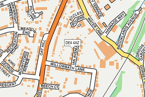
DE4 4AZ lies on Ian Avenue in Wirksworth, Matlock. DE4 4AZ is located in the Wirksworth electoral ward, within the local authority district of Derbyshire Dales and the English Parliamentary constituency of Derbyshire Dales. The Sub Integrated Care Board (ICB) Location is NHS Derby and Derbyshire ICB - 15M and the police force is Derbyshire. This postcode has been in use since January 1980.


GetTheData
Source: OS OpenMap – Local (Ordnance Survey)
Source: OS VectorMap District (Ordnance Survey)
Licence: Open Government Licence (requires attribution)
| Easting | 428641 |
| Northing | 353377 |
| Latitude | 53.076859 |
| Longitude | -1.573929 |
GetTheData
Source: Open Postcode Geo
Licence: Open Government Licence
| Street | Ian Avenue |
| Locality | Wirksworth |
| Town/City | Matlock |
| Country | England |
| Postcode District | DE4 |
➜ See where DE4 is on a map ➜ Where is Wirksworth? | |
GetTheData
Source: Land Registry Price Paid Data
Licence: Open Government Licence
Elevation or altitude of DE4 4AZ as distance above sea level:
| Metres | Feet | |
|---|---|---|
| Elevation | 140m | 459ft |
Elevation is measured from the approximate centre of the postcode, to the nearest point on an OS contour line from OS Terrain 50, which has contour spacing of ten vertical metres.
➜ How high above sea level am I? Find the elevation of your current position using your device's GPS.
GetTheData
Source: Open Postcode Elevation
Licence: Open Government Licence
| Ward | Wirksworth |
| Constituency | Derbyshire Dales |
GetTheData
Source: ONS Postcode Database
Licence: Open Government Licence
| Willowbath Lane | Wirksworth | 84m |
| Summer Lane (Derby Road) | Wirksworth | 156m |
| Oat Hill (Derby Road) | Wirksworth | 157m |
| Oat Hill (Derby Road) | Wirksworth | 163m |
| Health Centre (Hannage Way) | Wirksworth | 169m |
| Wirksworth (Ecclesbourne Valley Railway) | Wirksworth | 732m |
| Cromford Station | 4.3km |
| Whatstandwell Station | 4.7km |
GetTheData
Source: NaPTAN
Licence: Open Government Licence
| Percentage of properties with Next Generation Access | 100.0% |
| Percentage of properties with Superfast Broadband | 100.0% |
| Percentage of properties with Ultrafast Broadband | 0.0% |
| Percentage of properties with Full Fibre Broadband | 0.0% |
Superfast Broadband is between 30Mbps and 300Mbps
Ultrafast Broadband is > 300Mbps
| Median download speed | 38.2Mbps |
| Average download speed | 31.7Mbps |
| Maximum download speed | 59.21Mbps |
| Median upload speed | 9.6Mbps |
| Average upload speed | 7.4Mbps |
| Maximum upload speed | 14.55Mbps |
| Percentage of properties unable to receive 2Mbps | 0.0% |
| Percentage of properties unable to receive 5Mbps | 0.0% |
| Percentage of properties unable to receive 10Mbps | 0.0% |
| Percentage of properties unable to receive 30Mbps | 0.0% |
GetTheData
Source: Ofcom
Licence: Ofcom Terms of Use (requires attribution)
Estimated total energy consumption in DE4 4AZ by fuel type, 2015.
| Consumption (kWh) | 285,949 |
|---|---|
| Meter count | 21 |
| Mean (kWh/meter) | 13,617 |
| Median (kWh/meter) | 14,509 |
| Consumption (kWh) | 79,038 |
|---|---|
| Meter count | 22 |
| Mean (kWh/meter) | 3,593 |
| Median (kWh/meter) | 3,577 |
GetTheData
Source: Postcode level gas estimates: 2015 (experimental)
Source: Postcode level electricity estimates: 2015 (experimental)
Licence: Open Government Licence
GetTheData
Source: ONS Postcode Database
Licence: Open Government Licence


➜ Get more ratings from the Food Standards Agency
GetTheData
Source: Food Standards Agency
Licence: FSA terms & conditions
| Last Collection | |||
|---|---|---|---|
| Location | Mon-Fri | Sat | Distance |
| Derby Road | 17:00 | 09:15 | 132m |
| Wirksworth | 17:00 | 09:15 | 243m |
| Griggs Gardens | 16:00 | 08:00 | 275m |
GetTheData
Source: Dracos
Licence: Creative Commons Attribution-ShareAlike
The below table lists the International Territorial Level (ITL) codes (formerly Nomenclature of Territorial Units for Statistics (NUTS) codes) and Local Administrative Units (LAU) codes for DE4 4AZ:
| ITL 1 Code | Name |
|---|---|
| TLF | East Midlands (England) |
| ITL 2 Code | Name |
| TLF1 | Derbyshire and Nottinghamshire |
| ITL 3 Code | Name |
| TLF13 | South and West Derbyshire |
| LAU 1 Code | Name |
| E07000035 | Derbyshire Dales |
GetTheData
Source: ONS Postcode Directory
Licence: Open Government Licence
The below table lists the Census Output Area (OA), Lower Layer Super Output Area (LSOA), and Middle Layer Super Output Area (MSOA) for DE4 4AZ:
| Code | Name | |
|---|---|---|
| OA | E00099345 | |
| LSOA | E01019636 | Derbyshire Dales 007D |
| MSOA | E02004074 | Derbyshire Dales 007 |
GetTheData
Source: ONS Postcode Directory
Licence: Open Government Licence
| DE4 4AY | Willowbath Lane | 66m |
| DE4 4AR | Derby Road | 85m |
| DE4 4AL | The Hawthorns | 124m |
| DE4 4AA | Mill Yard | 138m |
| DE4 4AQ | Derby Road | 139m |
| DE4 4FX | Beech Court | 158m |
| DE4 4DH | Meadow End | 165m |
| DE4 4DZ | Water Lane | 201m |
| DE4 4DY | Canterbury Terrace | 201m |
| DE4 4AT | Mountford Avenue | 218m |
GetTheData
Source: Open Postcode Geo; Land Registry Price Paid Data
Licence: Open Government Licence