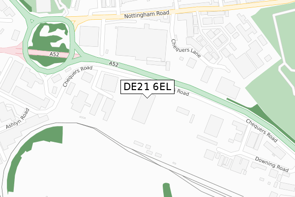
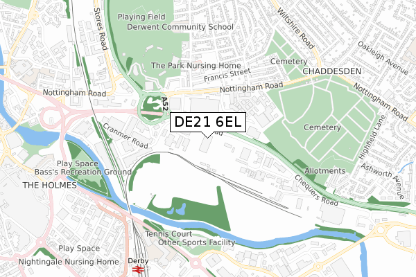
DE21 6EL is located in the Chaddesden West electoral ward, within the unitary authority of Derby and the English Parliamentary constituency of Derby North. The Sub Integrated Care Board (ICB) Location is NHS Derby and Derbyshire ICB - 15M and the police force is Derbyshire. This postcode has been in use since December 2019.


GetTheData
Source: OS Open Zoomstack (Ordnance Survey)
Licence: Open Government Licence (requires attribution)
Attribution: Contains OS data © Crown copyright and database right 2024
Source: Open Postcode Geo
Licence: Open Government Licence (requires attribution)
Attribution: Contains OS data © Crown copyright and database right 2024; Contains Royal Mail data © Royal Mail copyright and database right 2024; Source: Office for National Statistics licensed under the Open Government Licence v.3.0
| Easting | 436616 |
| Northing | 336311 |
| Latitude | 52.922989 |
| Longitude | -1.456816 |
GetTheData
Source: Open Postcode Geo
Licence: Open Government Licence
| Country | England |
| Postcode District | DE21 |
| ➜ DE21 open data dashboard ➜ See where DE21 is on a map ➜ Where is Derby? | |
GetTheData
Source: Land Registry Price Paid Data
Licence: Open Government Licence
| Ward | Chaddesden West |
| Constituency | Derby North |
GetTheData
Source: ONS Postcode Database
Licence: Open Government Licence
| January 2024 | Burglary | On or near Chequers Lane | 256m |
| January 2024 | Other theft | On or near Chequers Lane | 256m |
| December 2023 | Other theft | On or near Chequers Lane | 256m |
| ➜ Get more crime data in our Crime section | |||
GetTheData
Source: data.police.uk
Licence: Open Government Licence
| Wayzgoose Drive (Nottingham Road) | Chaddesden | 313m |
| Wayzgoose Drive (Nottingham Road) | Chaddesden | 341m |
| Cornwall Road (Nottingham Road) | Chaddesden | 384m |
| Cornwall Road (Nottingham Road) | Chaddesden | 396m |
| Francis Street (Beaufort Street) | Chaddesden | 397m |
| Derby Station | 0.8km |
| Peartree Station | 3.1km |
| Spondon Station | 3.3km |
GetTheData
Source: NaPTAN
Licence: Open Government Licence
GetTheData
Source: ONS Postcode Database
Licence: Open Government Licence


➜ Get more ratings from the Food Standards Agency
GetTheData
Source: Food Standards Agency
Licence: FSA terms & conditions
| Last Collection | |||
|---|---|---|---|
| Location | Mon-Fri | Sat | Distance |
| West Meadows Business Box | 18:30 | 318m | |
| Cranmer Road | 18:30 | 12:00 | 319m |
| Cemetery Hill | 17:30 | 12:00 | 444m |
GetTheData
Source: Dracos
Licence: Creative Commons Attribution-ShareAlike
| Facility | Distance |
|---|---|
| Crossfit Deviant Cranmer Road, West Meadows Industrial Estate, Derby Health and Fitness Gym | 439m |
| Nuffield Health (Derby) Nottingham Road, Derby Swimming Pool, Health and Fitness Gym, Studio | 485m |
| The Incora County Ground (Derbyshire Ccc) Nottingham Road, Derby Grass Pitches | 496m |
GetTheData
Source: Active Places
Licence: Open Government Licence
| School | Phase of Education | Distance |
|---|---|---|
| Derby College The Roundhouse, Roundhouse Road, Pride Park, Derby, DE24 8JE | 16 plus | 703m |
| Derwent Primary School St Mark's Road, Derby, DE21 6AL | Primary | 716m |
| Castleward Spencer Academy Canal Street, Derby, DE1 2RJ | Primary | 783m |
GetTheData
Source: Edubase
Licence: Open Government Licence
| Risk of DE21 6EL flooding from rivers and sea | Medium |
| ➜ DE21 6EL flood map | |
GetTheData
Source: Open Flood Risk by Postcode
Licence: Open Government Licence
The below table lists the International Territorial Level (ITL) codes (formerly Nomenclature of Territorial Units for Statistics (NUTS) codes) and Local Administrative Units (LAU) codes for DE21 6EL:
| ITL 1 Code | Name |
|---|---|
| TLF | East Midlands (England) |
| ITL 2 Code | Name |
| TLF1 | Derbyshire and Nottinghamshire |
| ITL 3 Code | Name |
| TLF11 | Derby |
| LAU 1 Code | Name |
| E06000015 | Derby |
GetTheData
Source: ONS Postcode Directory
Licence: Open Government Licence
The below table lists the Census Output Area (OA), Lower Layer Super Output Area (LSOA), and Middle Layer Super Output Area (MSOA) for DE21 6EL:
| Code | Name | |
|---|---|---|
| OA | E00068349 | |
| LSOA | E01013538 | Derby 007E |
| MSOA | E02002802 | Derby 007 |
GetTheData
Source: ONS Postcode Directory
Licence: Open Government Licence
| DE21 6AN | Nottingham Road | 325m |
| DE21 6AS | Sawley Park | 333m |
| DE21 6AW | Chequers Lane | 344m |
| DE21 6AQ | Nottingham Road | 374m |
| DE21 6DB | Francis Street | 377m |
| DE21 6AP | Nottingham Road | 386m |
| DE21 6DD | Francis Street | 400m |
| DE21 6AH | St Marks Road | 421m |
| DE21 6AB | Huntingdon Green | 425m |
| DE21 6YZ | Masons Place Business Park | 432m |
GetTheData
Source: Open Postcode Geo; Land Registry Price Paid Data
Licence: Open Government Licence