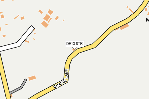
DE13 8TR lies on Chapel Lane in Hanbury, Burton-on-trent. DE13 8TR is located in the Crown electoral ward, within the local authority district of East Staffordshire and the English Parliamentary constituency of Burton. The Sub Integrated Care Board (ICB) Location is NHS Staffordshire and Stoke-on-Trent ICB - 05D and the police force is Staffordshire. This postcode has been in use since January 1980.


GetTheData
Source: OS OpenMap – Local (Ordnance Survey)
Source: OS VectorMap District (Ordnance Survey)
Licence: Open Government Licence (requires attribution)
| Easting | 416850 |
| Northing | 326587 |
| Latitude | 52.836539 |
| Longitude | -1.751314 |
GetTheData
Source: Open Postcode Geo
Licence: Open Government Licence
| Street | Chapel Lane |
| Locality | Hanbury |
| Town/City | Burton-on-trent |
| Country | England |
| Postcode District | DE13 |
➜ See where DE13 is on a map ➜ Where is Hanbury Woodend? | |
GetTheData
Source: Land Registry Price Paid Data
Licence: Open Government Licence
Elevation or altitude of DE13 8TR as distance above sea level:
| Metres | Feet | |
|---|---|---|
| Elevation | 140m | 459ft |
Elevation is measured from the approximate centre of the postcode, to the nearest point on an OS contour line from OS Terrain 50, which has contour spacing of ten vertical metres.
➜ How high above sea level am I? Find the elevation of your current position using your device's GPS.
GetTheData
Source: Open Postcode Elevation
Licence: Open Government Licence
| Ward | Crown |
| Constituency | Burton |
GetTheData
Source: ONS Postcode Database
Licence: Open Government Licence
| The Crown Inn Ph (Chapel Lane) | Hanbury Woodend | 295m |
| Top Farm (Anslow Road) | Woodend | 841m |
| Anslow Road (Martin's Lane) | Hanbury | 1,276m |
| Anslow Road (Martin's Lane) | Hanbury | 1,286m |
| Tutbury & Hatton Station | 5.6km |
GetTheData
Source: NaPTAN
Licence: Open Government Licence
| Percentage of properties with Next Generation Access | 100.0% |
| Percentage of properties with Superfast Broadband | 100.0% |
| Percentage of properties with Ultrafast Broadband | 0.0% |
| Percentage of properties with Full Fibre Broadband | 0.0% |
Superfast Broadband is between 30Mbps and 300Mbps
Ultrafast Broadband is > 300Mbps
| Median download speed | 19.6Mbps |
| Average download speed | 22.9Mbps |
| Maximum download speed | 55.00Mbps |
| Median upload speed | 4.2Mbps |
| Average upload speed | 4.9Mbps |
| Maximum upload speed | 10.00Mbps |
| Percentage of properties unable to receive 2Mbps | 0.0% |
| Percentage of properties unable to receive 5Mbps | 0.0% |
| Percentage of properties unable to receive 10Mbps | 0.0% |
| Percentage of properties unable to receive 30Mbps | 0.0% |
GetTheData
Source: Ofcom
Licence: Ofcom Terms of Use (requires attribution)
GetTheData
Source: ONS Postcode Database
Licence: Open Government Licence


➜ Get more ratings from the Food Standards Agency
GetTheData
Source: Food Standards Agency
Licence: FSA terms & conditions
| Last Collection | |||
|---|---|---|---|
| Location | Mon-Fri | Sat | Distance |
| Hanbury Woodend West | 16:00 | 08:30 | 341m |
| Hanbury Woodend East | 16:00 | 08:45 | 879m |
| Hanbury So | 16:00 | 11:15 | 1,293m |
GetTheData
Source: Dracos
Licence: Creative Commons Attribution-ShareAlike
The below table lists the International Territorial Level (ITL) codes (formerly Nomenclature of Territorial Units for Statistics (NUTS) codes) and Local Administrative Units (LAU) codes for DE13 8TR:
| ITL 1 Code | Name |
|---|---|
| TLG | West Midlands (England) |
| ITL 2 Code | Name |
| TLG2 | Shropshire and Staffordshire |
| ITL 3 Code | Name |
| TLG24 | Staffordshire CC |
| LAU 1 Code | Name |
| E07000193 | East Staffordshire |
GetTheData
Source: ONS Postcode Directory
Licence: Open Government Licence
The below table lists the Census Output Area (OA), Lower Layer Super Output Area (LSOA), and Middle Layer Super Output Area (MSOA) for DE13 8TR:
| Code | Name | |
|---|---|---|
| OA | E00149921 | |
| LSOA | E01029424 | East Staffordshire 006C |
| MSOA | E02006136 | East Staffordshire 006 |
GetTheData
Source: ONS Postcode Directory
Licence: Open Government Licence
| DE13 8TH | Knightsfield Lane | 315m |
| DE13 8TL | Knightsfield Road | 524m |
| DE13 8TJ | Anslow Road | 749m |
| DE13 8TU | Anslow Road | 787m |
| DE13 8TG | Wood Lane | 886m |
| DE13 8TN | Parsons Brake | 1230m |
| DE13 8TE | Martins Lane | 1330m |
| DE13 8TF | Church Lane | 1339m |
| DE13 8TP | Oakfields | 1354m |
| DE13 8TD | Hanbury Hill | 1427m |
GetTheData
Source: Open Postcode Geo; Land Registry Price Paid Data
Licence: Open Government Licence