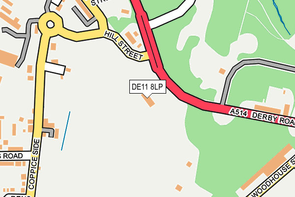
DE11 8LP is located in the Church Gresley electoral ward, within the local authority district of South Derbyshire and the English Parliamentary constituency of South Derbyshire. The Sub Integrated Care Board (ICB) Location is NHS Derby and Derbyshire ICB - 15M and the police force is Derbyshire. This postcode has been in use since April 1987.


GetTheData
Source: OS OpenMap – Local (Ordnance Survey)
Source: OS VectorMap District (Ordnance Survey)
Licence: Open Government Licence (requires attribution)
| Easting | 430395 |
| Northing | 319257 |
| Latitude | 52.770057 |
| Longitude | -1.550931 |
GetTheData
Source: Open Postcode Geo
Licence: Open Government Licence
| Country | England |
| Postcode District | DE11 |
➜ See where DE11 is on a map ➜ Where is Swadlincote? | |
GetTheData
Source: Land Registry Price Paid Data
Licence: Open Government Licence
Elevation or altitude of DE11 8LP as distance above sea level:
| Metres | Feet | |
|---|---|---|
| Elevation | 120m | 394ft |
Elevation is measured from the approximate centre of the postcode, to the nearest point on an OS contour line from OS Terrain 50, which has contour spacing of ten vertical metres.
➜ How high above sea level am I? Find the elevation of your current position using your device's GPS.
GetTheData
Source: Open Postcode Elevation
Licence: Open Government Licence
| Ward | Church Gresley |
| Constituency | South Derbyshire |
GetTheData
Source: ONS Postcode Database
Licence: Open Government Licence
| Ski Centre (Derby Road) | Swadlincote | 65m |
| Sir Herbert Wragg Way | Swadlincote | 178m |
| Sir Herbert Wragg Way | Swadlincote | 181m |
| Coppice Side | Swadlincote | 230m |
| Ski Centre (Derby Road) | Swadlincote | 238m |
GetTheData
Source: NaPTAN
Licence: Open Government Licence
GetTheData
Source: ONS Postcode Database
Licence: Open Government Licence


➜ Get more ratings from the Food Standards Agency
GetTheData
Source: Food Standards Agency
Licence: FSA terms & conditions
| Last Collection | |||
|---|---|---|---|
| Location | Mon-Fri | Sat | Distance |
| Morrisons | 16:00 | 12:15 | 417m |
| Swadlincote Road | 16:00 | 11:30 | 430m |
| Hastings Road | 17:30 | 11:15 | 582m |
GetTheData
Source: Dracos
Licence: Creative Commons Attribution-ShareAlike
The below table lists the International Territorial Level (ITL) codes (formerly Nomenclature of Territorial Units for Statistics (NUTS) codes) and Local Administrative Units (LAU) codes for DE11 8LP:
| ITL 1 Code | Name |
|---|---|
| TLF | East Midlands (England) |
| ITL 2 Code | Name |
| TLF1 | Derbyshire and Nottinghamshire |
| ITL 3 Code | Name |
| TLF13 | South and West Derbyshire |
| LAU 1 Code | Name |
| E07000039 | South Derbyshire |
GetTheData
Source: ONS Postcode Directory
Licence: Open Government Licence
The below table lists the Census Output Area (OA), Lower Layer Super Output Area (LSOA), and Middle Layer Super Output Area (MSOA) for DE11 8LP:
| Code | Name | |
|---|---|---|
| OA | E00100379 | |
| LSOA | E01019837 | South Derbyshire 012A |
| MSOA | E02006919 | South Derbyshire 012 |
GetTheData
Source: ONS Postcode Directory
Licence: Open Government Licence
| DE11 9AA | Coppice Side | 182m |
| DE11 8HL | Hill Street | 234m |
| DE11 8EB | Derby Road | 240m |
| DE11 8HW | Russell Street | 258m |
| DE11 8LZ | Anchor Close | 265m |
| DE11 9AB | Heritage Close | 277m |
| DE11 9AE | Coppice Side | 317m |
| DE11 8LS | Vicarage Gardens | 319m |
| DE11 8LE | Church Street | 333m |
| DE11 9AQ | Ravenwood | 339m |
GetTheData
Source: Open Postcode Geo; Land Registry Price Paid Data
Licence: Open Government Licence