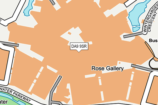
DA9 9SR is located in the Stone Castle electoral ward, within the local authority district of Dartford and the English Parliamentary constituency of Dartford. The Sub Integrated Care Board (ICB) Location is NHS Kent and Medway ICB - 91Q and the police force is Kent. This postcode has been in use since December 1998.


GetTheData
Source: OS OpenMap – Local (Ordnance Survey)
Source: OS VectorMap District (Ordnance Survey)
Licence: Open Government Licence (requires attribution)
| Easting | 557913 |
| Northing | 173481 |
| Latitude | 51.438318 |
| Longitude | 0.270624 |
GetTheData
Source: Open Postcode Geo
Licence: Open Government Licence
| Country | England |
| Postcode District | DA9 |
➜ See where DA9 is on a map | |
GetTheData
Source: Land Registry Price Paid Data
Licence: Open Government Licence
Elevation or altitude of DA9 9SR as distance above sea level:
| Metres | Feet | |
|---|---|---|
| Elevation | 10m | 33ft |
Elevation is measured from the approximate centre of the postcode, to the nearest point on an OS contour line from OS Terrain 50, which has contour spacing of ten vertical metres.
➜ How high above sea level am I? Find the elevation of your current position using your device's GPS.
GetTheData
Source: Open Postcode Elevation
Licence: Open Government Licence
| Ward | Stone Castle |
| Constituency | Dartford |
GetTheData
Source: ONS Postcode Database
Licence: Open Government Licence
| St James' Lane (Watling Street) | Dartford | 727m |
| St James' Lane (Watling Street) | Dartford | 787m |
| Ightham Cottages (Bean Lane) | Bean | 815m |
| Darent Valley Hospital (Hospital Grounds) | Darenth | 828m |
| Darent Valley Hospital (Hospital Grounds) | Darenth | 850m |
| Greenhithe for Bluewater Station | 1.5km |
| Stone Crossing Station | 1.5km |
| Swanscombe Station | 3km |
GetTheData
Source: NaPTAN
Licence: Open Government Licence
| Median download speed | 6.4Mbps |
| Average download speed | 5.6Mbps |
| Maximum download speed | 7.42Mbps |
| Median upload speed | 1.0Mbps |
| Average upload speed | 1.0Mbps |
| Maximum upload speed | 1.05Mbps |
GetTheData
Source: Ofcom
Licence: Ofcom Terms of Use (requires attribution)
GetTheData
Source: ONS Postcode Database
Licence: Open Government Licence

➜ Get more ratings from the Food Standards Agency
GetTheData
Source: Food Standards Agency
Licence: FSA terms & conditions
| Last Collection | |||
|---|---|---|---|
| Location | Mon-Fri | Sat | Distance |
| Elm Road | 17:30 | 11:00 | 746m |
| Horns Cross Post Office | 17:30 | 12:15 | 993m |
| Morgan Drive | 17:30 | 11:00 | 1,084m |
GetTheData
Source: Dracos
Licence: Creative Commons Attribution-ShareAlike
The below table lists the International Territorial Level (ITL) codes (formerly Nomenclature of Territorial Units for Statistics (NUTS) codes) and Local Administrative Units (LAU) codes for DA9 9SR:
| ITL 1 Code | Name |
|---|---|
| TLJ | South East (England) |
| ITL 2 Code | Name |
| TLJ4 | Kent |
| ITL 3 Code | Name |
| TLJ43 | Kent Thames Gateway |
| LAU 1 Code | Name |
| E07000107 | Dartford |
GetTheData
Source: ONS Postcode Directory
Licence: Open Government Licence
The below table lists the Census Output Area (OA), Lower Layer Super Output Area (LSOA), and Middle Layer Super Output Area (MSOA) for DA9 9SR:
| Code | Name | |
|---|---|---|
| OA | E00122699 | |
| LSOA | E01024172 | Dartford 006D |
| MSOA | E02005033 | Dartford 006 |
GetTheData
Source: ONS Postcode Directory
Licence: Open Government Licence
| DA9 9SG | Water Circus | 96m |
| DA9 9JA | Plantation Close | 606m |
| DA9 9UP | Fieldfare Lane | 635m |
| DA9 9UN | Fieldfare Lane | 639m |
| DA9 9EA | St James Lane | 648m |
| DA9 9UA | Woodpecker Drive | 661m |
| DA9 9LD | Hedge Place Road | 666m |
| DA9 9DX | St James Lane | 671m |
| DA9 9UB | Waterstone Way | 673m |
| DA9 9TX | Woodpecker Drive | 689m |
GetTheData
Source: Open Postcode Geo; Land Registry Price Paid Data
Licence: Open Government Licence