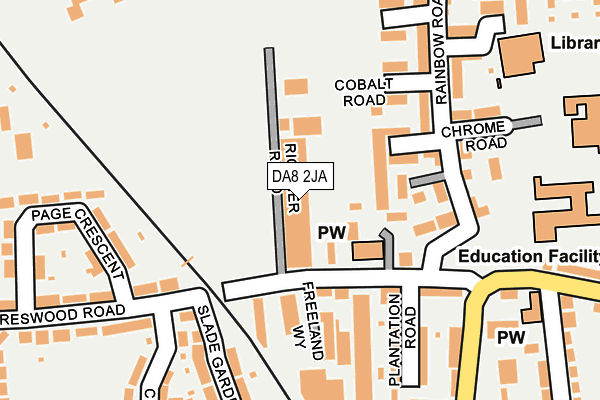
DA8 2JA is located in the Slade Green & Northend electoral ward, within the London borough of Bexley and the English Parliamentary constituency of Bexleyheath and Crayford. The Sub Integrated Care Board (ICB) Location is NHS South East London ICB - 72Q and the police force is Metropolitan Police. This postcode has been in use since July 1995.


GetTheData
Source: OS OpenMap – Local (Ordnance Survey)
Source: OS VectorMap District (Ordnance Survey)
Licence: Open Government Licence (requires attribution)
| Easting | 552053 |
| Northing | 177092 |
| Latitude | 51.472365 |
| Longitude | 0.187930 |
GetTheData
Source: Open Postcode Geo
Licence: Open Government Licence
| Country | England |
| Postcode District | DA8 |
➜ See where DA8 is on a map ➜ Where is London? | |
GetTheData
Source: Land Registry Price Paid Data
Licence: Open Government Licence
Elevation or altitude of DA8 2JA as distance above sea level:
| Metres | Feet | |
|---|---|---|
| Elevation | 10m | 33ft |
Elevation is measured from the approximate centre of the postcode, to the nearest point on an OS contour line from OS Terrain 50, which has contour spacing of ten vertical metres.
➜ How high above sea level am I? Find the elevation of your current position using your device's GPS.
GetTheData
Source: Open Postcode Elevation
Licence: Open Government Licence
| Ward | Slade Green & Northend |
| Constituency | Bexleyheath And Crayford |
GetTheData
Source: ONS Postcode Database
Licence: Open Government Licence
| Bridge Road Slade Green Road (Bridge Road) | Slade Green | 219m |
| Bridge Road Slade Green Road (Bridge Road) | Slade Green | 258m |
| Forest Road Bridge Road (Forest Road) | Slade Green | 306m |
| Forest Road Bridge Road (Forest Road) | Slade Green | 329m |
| Hazel Road | Slade Green | 400m |
| Slade Green Station | 0.5km |
| Erith Station | 1.4km |
| Barnehurst Station | 2.1km |
GetTheData
Source: NaPTAN
Licence: Open Government Licence
GetTheData
Source: ONS Postcode Database
Licence: Open Government Licence


➜ Get more ratings from the Food Standards Agency
GetTheData
Source: Food Standards Agency
Licence: FSA terms & conditions
| Last Collection | |||
|---|---|---|---|
| Location | Mon-Fri | Sat | Distance |
| Slade Green | 17:30 | 11:30 | 74m |
| Northend Road | 17:30 | 11:30 | 464m |
| Forest Road Post Office | 17:30 | 12:15 | 497m |
GetTheData
Source: Dracos
Licence: Creative Commons Attribution-ShareAlike
The below table lists the International Territorial Level (ITL) codes (formerly Nomenclature of Territorial Units for Statistics (NUTS) codes) and Local Administrative Units (LAU) codes for DA8 2JA:
| ITL 1 Code | Name |
|---|---|
| TLI | London |
| ITL 2 Code | Name |
| TLI5 | Outer London - East and North East |
| ITL 3 Code | Name |
| TLI51 | Bexley and Greenwich |
| LAU 1 Code | Name |
| E09000004 | Bexley |
GetTheData
Source: ONS Postcode Directory
Licence: Open Government Licence
The below table lists the Census Output Area (OA), Lower Layer Super Output Area (LSOA), and Middle Layer Super Output Area (MSOA) for DA8 2JA:
| Code | Name | |
|---|---|---|
| OA | E00002122 | |
| LSOA | E01000432 | Bexley 008E |
| MSOA | E02000072 | Bexley 008 |
GetTheData
Source: ONS Postcode Directory
Licence: Open Government Licence
| DA8 2LW | Slade Green Road | 99m |
| DA8 2HU | Slade Green Road | 109m |
| DA8 2LQ | Freeland Way | 129m |
| DA8 2JE | Slade Green Road | 163m |
| DA8 2JB | Plantation Road | 180m |
| DA8 2HT | Slade Gardens | 208m |
| DA8 2EQ | Rainbow Road | 211m |
| DA8 2FF | Crimson Road | 213m |
| DA8 2FE | Scarlet Road | 216m |
| DA8 2HL | Peareswood Road | 219m |
GetTheData
Source: Open Postcode Geo; Land Registry Price Paid Data
Licence: Open Government Licence