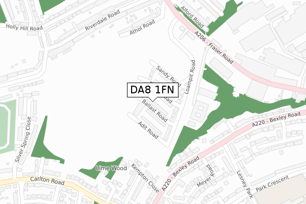
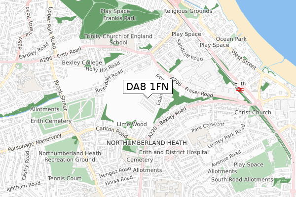
DA8 1FN is located in the Erith electoral ward, within the London borough of Bexley and the English Parliamentary constituency of Erith and Thamesmead. The Sub Integrated Care Board (ICB) Location is NHS South East London ICB - 72Q and the police force is Metropolitan Police. This postcode has been in use since November 2018.


GetTheData
Source: OS Open Zoomstack (Ordnance Survey)
Licence: Open Government Licence (requires attribution)
Attribution: Contains OS data © Crown copyright and database right 2024
Source: Open Postcode Geo
Licence: Open Government Licence (requires attribution)
Attribution: Contains OS data © Crown copyright and database right 2024; Contains Royal Mail data © Royal Mail copyright and database right 2024; Source: Office for National Statistics licensed under the Open Government Licence v.3.0
| Easting | 550347 |
| Northing | 178027 |
| Latitude | 51.481222 |
| Longitude | 0.163784 |
GetTheData
Source: Open Postcode Geo
Licence: Open Government Licence
| Country | England |
| Postcode District | DA8 |
| ➜ DA8 open data dashboard ➜ See where DA8 is on a map ➜ Where is Erith? | |
GetTheData
Source: Land Registry Price Paid Data
Licence: Open Government Licence
| Ward | Erith |
| Constituency | Erith And Thamesmead |
GetTheData
Source: ONS Postcode Database
Licence: Open Government Licence
| January 2024 | Violence and sexual offences | On or near Silver Spring Close | 420m |
| November 2023 | Violence and sexual offences | On or near Silver Spring Close | 420m |
| January 2023 | Violence and sexual offences | On or near Silver Spring Close | 420m |
| ➜ Get more crime data in our Crime section | |||
GetTheData
Source: data.police.uk
Licence: Open Government Licence
| Lesney Park (Bexley Road) | Erith | 276m |
| Carlton Road (Bexley Road) | Northumberland Heath | 283m |
| Birch Walk | Erith | 303m |
| Lesney Park (Bexley Road) | Erith | 314m |
| Alford Road | Hillside | 331m |
| Erith Station | 0.8km |
| Belvedere Station | 1.5km |
| Barnehurst Station | 1.8km |
GetTheData
Source: NaPTAN
Licence: Open Government Licence
| Percentage of properties with Next Generation Access | 100.0% |
| Percentage of properties with Superfast Broadband | 100.0% |
| Percentage of properties with Ultrafast Broadband | 100.0% |
| Percentage of properties with Full Fibre Broadband | 100.0% |
Superfast Broadband is between 30Mbps and 300Mbps
Ultrafast Broadband is > 300Mbps
| Percentage of properties unable to receive 2Mbps | 0.0% |
| Percentage of properties unable to receive 5Mbps | 0.0% |
| Percentage of properties unable to receive 10Mbps | 0.0% |
| Percentage of properties unable to receive 30Mbps | 0.0% |
GetTheData
Source: Ofcom
Licence: Ofcom Terms of Use (requires attribution)
GetTheData
Source: ONS Postcode Database
Licence: Open Government Licence


➜ Get more ratings from the Food Standards Agency
GetTheData
Source: Food Standards Agency
Licence: FSA terms & conditions
| Last Collection | |||
|---|---|---|---|
| Location | Mon-Fri | Sat | Distance |
| Bexley Road | 17:30 | 11:00 | 282m |
| Riverdale Road | 17:30 | 11:45 | 352m |
| Carlton Road | 17:30 | 11:15 | 385m |
GetTheData
Source: Dracos
Licence: Creative Commons Attribution-ShareAlike
| Facility | Distance |
|---|---|
| Trinity School (Belvedere) Erith Road, Belvedere Health and Fitness Gym, Sports Hall, Grass Pitches, Studio, Artificial Grass Pitch | 497m |
| St Fidelis Catholic Primary School Bexley Road, Erith Grass Pitches | 499m |
| Bodyworks (Bexley College) (Closed) Tower Road, Belvedere Health and Fitness Gym | 527m |
GetTheData
Source: Active Places
Licence: Open Government Licence
| School | Phase of Education | Distance |
|---|---|---|
| St Fidelis Catholic Primary School Bexley Road, Erith, DA8 3HQ | Primary | 406m |
| Trinity Church of England School, Belvedere Erith Road, Belvedere, DA17 6HT | Secondary | 573m |
| Christ Church (Erith) CofE Primary School Lesney Park Road, Erith, DA8 3DG | Primary | 716m |
GetTheData
Source: Edubase
Licence: Open Government Licence
The below table lists the International Territorial Level (ITL) codes (formerly Nomenclature of Territorial Units for Statistics (NUTS) codes) and Local Administrative Units (LAU) codes for DA8 1FN:
| ITL 1 Code | Name |
|---|---|
| TLI | London |
| ITL 2 Code | Name |
| TLI5 | Outer London - East and North East |
| ITL 3 Code | Name |
| TLI51 | Bexley and Greenwich |
| LAU 1 Code | Name |
| E09000004 | Bexley |
GetTheData
Source: ONS Postcode Directory
Licence: Open Government Licence
The below table lists the Census Output Area (OA), Lower Layer Super Output Area (LSOA), and Middle Layer Super Output Area (MSOA) for DA8 1FN:
| Code | Name | |
|---|---|---|
| OA | E00001978 | |
| LSOA | E01000407 | Bexley 005D |
| MSOA | E02000069 | Bexley 005 |
GetTheData
Source: ONS Postcode Directory
Licence: Open Government Licence
| DA8 3SR | Kempton Close | 242m |
| DA8 1PT | Athol Road | 246m |
| DA8 1QU | Hawthorn Place | 253m |
| DA8 1QT | Hawthorn Place | 256m |
| DA8 1QS | Atlas Trade Park | 262m |
| DA8 3SP | Bexley Road | 264m |
| DA8 3SN | Bexley Road | 275m |
| DA8 1ET | Vicarage Close | 287m |
| DA8 1PU | Riverdale Road | 289m |
| DA8 1PS | De Luci Road | 289m |
GetTheData
Source: Open Postcode Geo; Land Registry Price Paid Data
Licence: Open Government Licence