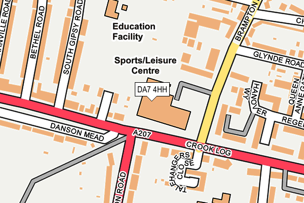
DA7 4HH is located in the Crook Log electoral ward, within the London borough of Bexley and the English Parliamentary constituency of Bexleyheath and Crayford. The Sub Integrated Care Board (ICB) Location is NHS South East London ICB - 72Q and the police force is Metropolitan Police. This postcode has been in use since January 1983.


GetTheData
Source: OS OpenMap – Local (Ordnance Survey)
Source: OS VectorMap District (Ordnance Survey)
Licence: Open Government Licence (requires attribution)
| Easting | 547689 |
| Northing | 175615 |
| Latitude | 51.460249 |
| Longitude | 0.124500 |
GetTheData
Source: Open Postcode Geo
Licence: Open Government Licence
| Country | England |
| Postcode District | DA7 |
➜ See where DA7 is on a map ➜ Where is London? | |
GetTheData
Source: Land Registry Price Paid Data
Licence: Open Government Licence
Elevation or altitude of DA7 4HH as distance above sea level:
| Metres | Feet | |
|---|---|---|
| Elevation | 50m | 164ft |
Elevation is measured from the approximate centre of the postcode, to the nearest point on an OS contour line from OS Terrain 50, which has contour spacing of ten vertical metres.
➜ How high above sea level am I? Find the elevation of your current position using your device's GPS.
GetTheData
Source: Open Postcode Elevation
Licence: Open Government Licence
| Ward | Crook Log |
| Constituency | Bexleyheath And Crayford |
GetTheData
Source: ONS Postcode Database
Licence: Open Government Licence
| Crook Log Leisure Centre (Crook Log) | Bexleyheath | 78m |
| Park View Road Crook Log (Park View Road) | Bexleyheath | 89m |
| Danson Road Crook Log | Bexleyheath | 179m |
| Bethel Road (Park View Road) | East Wickham | 226m |
| Crook Log Dallin Road (Crook Log) | East Wickham | 299m |
| Bexleyheath Station | 0.7km |
| Welling Station | 1.7km |
| Barnehurst Station | 2.5km |
GetTheData
Source: NaPTAN
Licence: Open Government Licence
GetTheData
Source: ONS Postcode Database
Licence: Open Government Licence


➜ Get more ratings from the Food Standards Agency
GetTheData
Source: Food Standards Agency
Licence: FSA terms & conditions
| Last Collection | |||
|---|---|---|---|
| Location | Mon-Fri | Sat | Distance |
| Brampton Road | 17:30 | 11:00 | 180m |
| 41 Bean Road | 18:00 | 11:45 | 574m |
| Bexleyheath Post Office | 17:30 | 11:15 | 793m |
GetTheData
Source: Dracos
Licence: Creative Commons Attribution-ShareAlike
The below table lists the International Territorial Level (ITL) codes (formerly Nomenclature of Territorial Units for Statistics (NUTS) codes) and Local Administrative Units (LAU) codes for DA7 4HH:
| ITL 1 Code | Name |
|---|---|
| TLI | London |
| ITL 2 Code | Name |
| TLI5 | Outer London - East and North East |
| ITL 3 Code | Name |
| TLI51 | Bexley and Greenwich |
| LAU 1 Code | Name |
| E09000004 | Bexley |
GetTheData
Source: ONS Postcode Directory
Licence: Open Government Licence
The below table lists the Census Output Area (OA), Lower Layer Super Output Area (LSOA), and Middle Layer Super Output Area (MSOA) for DA7 4HH:
| Code | Name | |
|---|---|---|
| OA | E00001937 | |
| LSOA | E01000393 | Bexley 020G |
| MSOA | E02000084 | Bexley 020 |
GetTheData
Source: ONS Postcode Directory
Licence: Open Government Licence
| DA16 1RS | Park View Road | 126m |
| DA6 8AE | Talehangers Close | 151m |
| DA6 8BZ | Hanover Way | 161m |
| DA7 4HB | Brampton Road | 169m |
| DA16 1JB | South Gipsy Road | 176m |
| DA6 8HA | Danson Road | 196m |
| DA16 1RT | Park View Road | 210m |
| DA7 4EZ | Brampton Road | 218m |
| DA16 1HP | South Gipsy Road | 219m |
| DA6 8BU | Gainsborough Square | 219m |
GetTheData
Source: Open Postcode Geo; Land Registry Price Paid Data
Licence: Open Government Licence