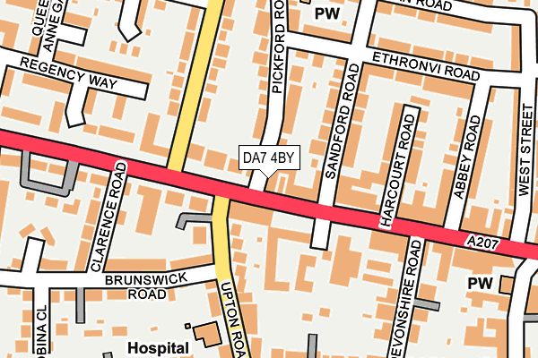
DA7 4BY lies on Pickford Road in Bexleyheath. DA7 4BY is located in the Crook Log electoral ward, within the London borough of Bexley and the English Parliamentary constituency of Bexleyheath and Crayford. The Sub Integrated Care Board (ICB) Location is NHS South East London ICB - 72Q and the police force is Metropolitan Police. This postcode has been in use since July 2007.


GetTheData
Source: OS OpenMap – Local (Ordnance Survey)
Source: OS VectorMap District (Ordnance Survey)
Licence: Open Government Licence (requires attribution)
| Easting | 548223 |
| Northing | 175449 |
| Latitude | 51.458618 |
| Longitude | 0.132111 |
GetTheData
Source: Open Postcode Geo
Licence: Open Government Licence
| Street | Pickford Road |
| Town/City | Bexleyheath |
| Country | England |
| Postcode District | DA7 |
➜ See where DA7 is on a map ➜ Where is London? | |
GetTheData
Source: Land Registry Price Paid Data
Licence: Open Government Licence
Elevation or altitude of DA7 4BY as distance above sea level:
| Metres | Feet | |
|---|---|---|
| Elevation | 50m | 164ft |
Elevation is measured from the approximate centre of the postcode, to the nearest point on an OS contour line from OS Terrain 50, which has contour spacing of ten vertical metres.
➜ How high above sea level am I? Find the elevation of your current position using your device's GPS.
GetTheData
Source: Open Postcode Elevation
Licence: Open Government Licence
| Ward | Crook Log |
| Constituency | Bexleyheath And Crayford |
GetTheData
Source: ONS Postcode Database
Licence: Open Government Licence
| Upton Road Broadway (Broadway) | Bexleyheath | 34m |
| Upton Road Broadway (Broadway) | Bexleyheath | 39m |
| Avenue Road Crook Log (Avenue Road) | East Wickham | 105m |
| Crook Log Dallin Road (Crook Log) | East Wickham | 187m |
| Lion Road | Bexleyheath | 231m |
| Bexleyheath Station | 0.6km |
| Barnehurst Station | 2km |
| Welling Station | 2.2km |
GetTheData
Source: NaPTAN
Licence: Open Government Licence
| Percentage of properties with Next Generation Access | 100.0% |
| Percentage of properties with Superfast Broadband | 100.0% |
| Percentage of properties with Ultrafast Broadband | 0.0% |
| Percentage of properties with Full Fibre Broadband | 0.0% |
Superfast Broadband is between 30Mbps and 300Mbps
Ultrafast Broadband is > 300Mbps
| Percentage of properties unable to receive 2Mbps | 0.0% |
| Percentage of properties unable to receive 5Mbps | 0.0% |
| Percentage of properties unable to receive 10Mbps | 0.0% |
| Percentage of properties unable to receive 30Mbps | 0.0% |
GetTheData
Source: Ofcom
Licence: Ofcom Terms of Use (requires attribution)
GetTheData
Source: ONS Postcode Database
Licence: Open Government Licence


➜ Get more ratings from the Food Standards Agency
GetTheData
Source: Food Standards Agency
Licence: FSA terms & conditions
| Last Collection | |||
|---|---|---|---|
| Location | Mon-Fri | Sat | Distance |
| Ethronvi Road | 18:00 | 11:15 | 288m |
| Broadway | 18:00 | 11:15 | 355m |
| Brampton Road | 17:30 | 11:00 | 457m |
GetTheData
Source: Dracos
Licence: Creative Commons Attribution-ShareAlike
The below table lists the International Territorial Level (ITL) codes (formerly Nomenclature of Territorial Units for Statistics (NUTS) codes) and Local Administrative Units (LAU) codes for DA7 4BY:
| ITL 1 Code | Name |
|---|---|
| TLI | London |
| ITL 2 Code | Name |
| TLI5 | Outer London - East and North East |
| ITL 3 Code | Name |
| TLI51 | Bexley and Greenwich |
| LAU 1 Code | Name |
| E09000004 | Bexley |
GetTheData
Source: ONS Postcode Directory
Licence: Open Government Licence
The below table lists the Census Output Area (OA), Lower Layer Super Output Area (LSOA), and Middle Layer Super Output Area (MSOA) for DA7 4BY:
| Code | Name | |
|---|---|---|
| OA | E00001773 | |
| LSOA | E01000360 | Bexley 015A |
| MSOA | E02000079 | Bexley 015 |
GetTheData
Source: ONS Postcode Directory
Licence: Open Government Licence
| DA6 8AA | Broadway | 25m |
| DA6 8BW | Crook Log | 26m |
| DA7 4AT | Pickford Road | 64m |
| DA6 8DT | Broadway | 79m |
| DA6 8BN | Crook Log | 92m |
| DA6 8LG | Upton Villas | 97m |
| DA7 4AX | Sandford Road | 98m |
| DA6 8LF | Upton Road | 100m |
| DA6 8DZ | Crook Log | 101m |
| DA6 8BP | Crook Log | 115m |
GetTheData
Source: Open Postcode Geo; Land Registry Price Paid Data
Licence: Open Government Licence