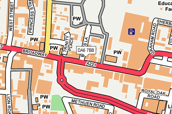
DA6 7BB is located in the Bexleyheath electoral ward, within the London borough of Bexley and the English Parliamentary constituency of Bexleyheath and Crayford. The Sub Integrated Care Board (ICB) Location is NHS South East London ICB - 72Q and the police force is Metropolitan Police. This postcode has been in use since January 1980.


GetTheData
Source: OS OpenMap – Local (Ordnance Survey)
Source: OS VectorMap District (Ordnance Survey)
Licence: Open Government Licence (requires attribution)
| Easting | 548770 |
| Northing | 175339 |
| Latitude | 51.457486 |
| Longitude | 0.139932 |
GetTheData
Source: Open Postcode Geo
Licence: Open Government Licence
| Country | England |
| Postcode District | DA6 |
➜ See where DA6 is on a map ➜ Where is London? | |
GetTheData
Source: Land Registry Price Paid Data
Licence: Open Government Licence
Elevation or altitude of DA6 7BB as distance above sea level:
| Metres | Feet | |
|---|---|---|
| Elevation | 50m | 164ft |
Elevation is measured from the approximate centre of the postcode, to the nearest point on an OS contour line from OS Terrain 50, which has contour spacing of ten vertical metres.
➜ How high above sea level am I? Find the elevation of your current position using your device's GPS.
GetTheData
Source: Open Postcode Elevation
Licence: Open Government Licence
| Ward | Bexleyheath |
| Constituency | Bexleyheath And Crayford |
GetTheData
Source: ONS Postcode Database
Licence: Open Government Licence
| Trinity Place | Bexleyheath | 28m |
| Trinity Place (Broadway) | Bexleyheath | 138m |
| Lion Road | Bexleyheath | 181m |
| Albion Road Bexleyheath | Bexleyheath | 234m |
| Lion Road | Bexleyheath | 329m |
| Bexleyheath Station | 0.8km |
| Barnehurst Station | 1.6km |
| Bexley Station | 2km |
GetTheData
Source: NaPTAN
Licence: Open Government Licence
GetTheData
Source: ONS Postcode Database
Licence: Open Government Licence


➜ Get more ratings from the Food Standards Agency
GetTheData
Source: Food Standards Agency
Licence: FSA terms & conditions
| Last Collection | |||
|---|---|---|---|
| Location | Mon-Fri | Sat | Distance |
| Broadway | 18:00 | 11:15 | 204m |
| Ethronvi Road | 18:00 | 11:15 | 354m |
| Market Place | 18:30 | 12:15 | 449m |
GetTheData
Source: Dracos
Licence: Creative Commons Attribution-ShareAlike
The below table lists the International Territorial Level (ITL) codes (formerly Nomenclature of Territorial Units for Statistics (NUTS) codes) and Local Administrative Units (LAU) codes for DA6 7BB:
| ITL 1 Code | Name |
|---|---|
| TLI | London |
| ITL 2 Code | Name |
| TLI5 | Outer London - East and North East |
| ITL 3 Code | Name |
| TLI51 | Bexley and Greenwich |
| LAU 1 Code | Name |
| E09000004 | Bexley |
GetTheData
Source: ONS Postcode Directory
Licence: Open Government Licence
The below table lists the Census Output Area (OA), Lower Layer Super Output Area (LSOA), and Middle Layer Super Output Area (MSOA) for DA6 7BB:
| Code | Name | |
|---|---|---|
| OA | E00001768 | |
| LSOA | E01000360 | Bexley 015A |
| MSOA | E02000079 | Bexley 015 |
GetTheData
Source: ONS Postcode Directory
Licence: Open Government Licence
| DA6 7BT | Broadway | 44m |
| DA6 7EJ | Broadway | 50m |
| DA6 7ER | Broadway | 50m |
| DA6 7BH | Banks Lane | 75m |
| DA6 7ES | Broadway | 88m |
| DA6 7AY | Trinity Place | 109m |
| DA6 7AU | Broadway | 118m |
| DA7 4DD | Church Road | 165m |
| DA6 7AH | Methuen Road | 178m |
| DA6 8AS | Broadway | 181m |
GetTheData
Source: Open Postcode Geo; Land Registry Price Paid Data
Licence: Open Government Licence