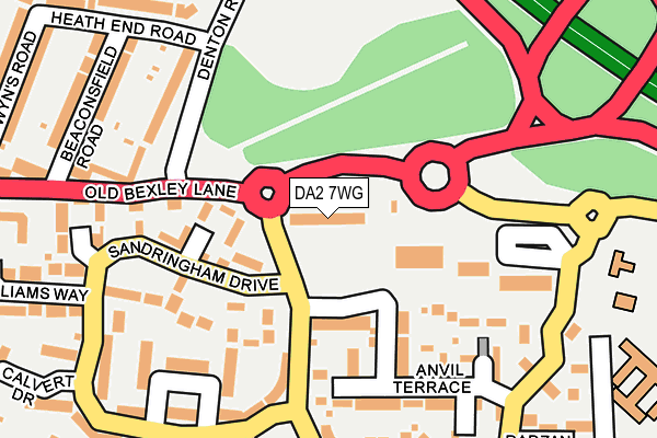
DA2 7WG is located in the Maypole & Leyton Cross electoral ward, within the local authority district of Dartford and the English Parliamentary constituency of Dartford. The Sub Integrated Care Board (ICB) Location is NHS Kent and Medway ICB - 91Q and the police force is Kent. This postcode has been in use since August 2005.


GetTheData
Source: OS OpenMap – Local (Ordnance Survey)
Source: OS VectorMap District (Ordnance Survey)
Licence: Open Government Licence (requires attribution)
| Easting | 551263 |
| Northing | 172887 |
| Latitude | 51.434795 |
| Longitude | 0.174741 |
GetTheData
Source: Open Postcode Geo
Licence: Open Government Licence
| Country | England |
| Postcode District | DA2 |
➜ See where DA2 is on a map ➜ Where is Dartford? | |
GetTheData
Source: Land Registry Price Paid Data
Licence: Open Government Licence
Elevation or altitude of DA2 7WG as distance above sea level:
| Metres | Feet | |
|---|---|---|
| Elevation | 40m | 131ft |
Elevation is measured from the approximate centre of the postcode, to the nearest point on an OS contour line from OS Terrain 50, which has contour spacing of ten vertical metres.
➜ How high above sea level am I? Find the elevation of your current position using your device's GPS.
GetTheData
Source: Open Postcode Elevation
Licence: Open Government Licence
| Ward | Maypole & Leyton Cross |
| Constituency | Dartford |
GetTheData
Source: ONS Postcode Database
Licence: Open Government Licence
| Bexley Park (Old Bexley Lane) | Maypole | 112m |
| Interchange (Old Bexley Lane) | Dartford Heath | 170m |
| Bexley Park (Old Bexley Lane) | Maypole | 213m |
| Baldwyns Park | Coldblow | 577m |
| Old Bexley Lane (Baldwyn's Park) | Coldblow | 596m |
| Crayford Station | 1.5km |
| Bexley Station | 2km |
| Dartford Station | 3.4km |
GetTheData
Source: NaPTAN
Licence: Open Government Licence
GetTheData
Source: ONS Postcode Database
Licence: Open Government Licence


➜ Get more ratings from the Food Standards Agency
GetTheData
Source: Food Standards Agency
Licence: FSA terms & conditions
| Last Collection | |||
|---|---|---|---|
| Location | Mon-Fri | Sat | Distance |
| Maypole Estate Post Office | 18:30 | 12:15 | 262m |
| Leyton Cross Road Post Office | 17:30 | 11:15 | 830m |
| Tile Kiln Lane | 17:30 | 12:00 | 876m |
GetTheData
Source: Dracos
Licence: Creative Commons Attribution-ShareAlike
The below table lists the International Territorial Level (ITL) codes (formerly Nomenclature of Territorial Units for Statistics (NUTS) codes) and Local Administrative Units (LAU) codes for DA2 7WG:
| ITL 1 Code | Name |
|---|---|
| TLJ | South East (England) |
| ITL 2 Code | Name |
| TLJ4 | Kent |
| ITL 3 Code | Name |
| TLJ43 | Kent Thames Gateway |
| LAU 1 Code | Name |
| E07000107 | Dartford |
GetTheData
Source: ONS Postcode Directory
Licence: Open Government Licence
The below table lists the Census Output Area (OA), Lower Layer Super Output Area (LSOA), and Middle Layer Super Output Area (MSOA) for DA2 7WG:
| Code | Name | |
|---|---|---|
| OA | E00122604 | |
| LSOA | E01024152 | Dartford 010C |
| MSOA | E02005037 | Dartford 010 |
GetTheData
Source: ONS Postcode Directory
Licence: Open Government Licence
| DA2 7WD | Andrews Place | 95m |
| DA2 7WA | Sandringham Drive | 153m |
| DA2 7WR | Anvil Terrace | 160m |
| DA2 7WB | Sandringham Drive | 161m |
| DA2 7WW | Chapel Walk | 162m |
| DA2 7WX | Maplehurst Close | 177m |
| DA5 2AF | Denton Terrace | 186m |
| DA2 7WL | Sandringham Drive | 186m |
| DA5 2GA | Beaconsfield Road | 197m |
| DA2 7WQ | Pinewood Place | 210m |
GetTheData
Source: Open Postcode Geo; Land Registry Price Paid Data
Licence: Open Government Licence