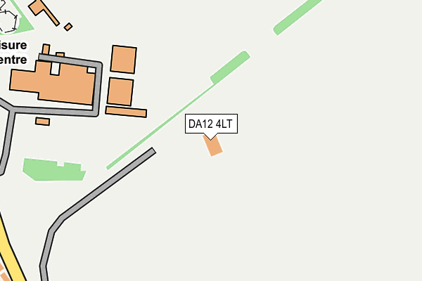
DA12 4LT is located in the Riverview Park electoral ward, within the local authority district of Gravesham and the English Parliamentary constituency of Gravesham. The Sub Integrated Care Board (ICB) Location is NHS Kent and Medway ICB - 91Q and the police force is Kent. This postcode has been in use since December 1998.


GetTheData
Source: OS OpenMap – Local (Ordnance Survey)
Source: OS VectorMap District (Ordnance Survey)
Licence: Open Government Licence (requires attribution)
| Easting | 567288 |
| Northing | 171664 |
| Latitude | 51.419307 |
| Longitude | 0.404498 |
GetTheData
Source: Open Postcode Geo
Licence: Open Government Licence
| Country | England |
| Postcode District | DA12 |
➜ See where DA12 is on a map ➜ Where is Gravesend? | |
GetTheData
Source: Land Registry Price Paid Data
Licence: Open Government Licence
Elevation or altitude of DA12 4LT as distance above sea level:
| Metres | Feet | |
|---|---|---|
| Elevation | 60m | 197ft |
Elevation is measured from the approximate centre of the postcode, to the nearest point on an OS contour line from OS Terrain 50, which has contour spacing of ten vertical metres.
➜ How high above sea level am I? Find the elevation of your current position using your device's GPS.
GetTheData
Source: Open Postcode Elevation
Licence: Open Government Licence
| Ward | Riverview Park |
| Constituency | Gravesham |
GetTheData
Source: ONS Postcode Database
Licence: Open Government Licence
| Cascades Leisure Centre | Riverview Park | 283m |
| Cascades (Thong Lane) | Riverview Park | 429m |
| Imperial Drive (Vigilant Way) | Riverview Park | 444m |
| Cascades (Thong Lane) | Riverview Park | 452m |
| Imperial Drive (Vigilant Way) | Riverview Park | 480m |
| Gravesend Station | 3.6km |
| Higham Station | 4.4km |
| Sole Street Station | 4.4km |
GetTheData
Source: NaPTAN
Licence: Open Government Licence
GetTheData
Source: ONS Postcode Database
Licence: Open Government Licence


➜ Get more ratings from the Food Standards Agency
GetTheData
Source: Food Standards Agency
Licence: FSA terms & conditions
| Last Collection | |||
|---|---|---|---|
| Location | Mon-Fri | Sat | Distance |
| Sapho Park | 17:30 | 11:45 | 526m |
| Vigilante Way | 17:45 | 11:45 | 600m |
| Riverview Park Post Office | 17:45 | 12:00 | 757m |
GetTheData
Source: Dracos
Licence: Creative Commons Attribution-ShareAlike
The below table lists the International Territorial Level (ITL) codes (formerly Nomenclature of Territorial Units for Statistics (NUTS) codes) and Local Administrative Units (LAU) codes for DA12 4LT:
| ITL 1 Code | Name |
|---|---|
| TLJ | South East (England) |
| ITL 2 Code | Name |
| TLJ4 | Kent |
| ITL 3 Code | Name |
| TLJ43 | Kent Thames Gateway |
| LAU 1 Code | Name |
| E07000109 | Gravesham |
GetTheData
Source: ONS Postcode Directory
Licence: Open Government Licence
The below table lists the Census Output Area (OA), Lower Layer Super Output Area (LSOA), and Middle Layer Super Output Area (MSOA) for DA12 4LT:
| Code | Name | |
|---|---|---|
| OA | E00123357 | |
| LSOA | E01024298 | Gravesham 008B |
| MSOA | E02005062 | Gravesham 008 |
GetTheData
Source: ONS Postcode Directory
Licence: Open Government Licence
| DA12 4LQ | Thong Lane | 351m |
| DA12 4LN | Imperial Drive | 401m |
| DA12 4SE | Whinfell Way | 420m |
| DA12 4LG | Thong Lane | 425m |
| DA12 4LL | Imperial Drive | 431m |
| DA12 4LH | Thong Lane | 448m |
| DA12 4LJ | Thelma Close | 477m |
| DA12 4RZ | Whinfell Way | 488m |
| DA12 4PR | Genesta Glade | 499m |
| DA12 4LF | Thong Lane | 519m |
GetTheData
Source: Open Postcode Geo; Land Registry Price Paid Data
Licence: Open Government Licence